![](/images/other/stat-length.png)
![Tocht Te voet Unknown - Od Knina do Brezovca - Photo](https://media.geolcdn.com/t/1900/400/093a6e50-0cba-4ea6-8f57-cdfc99edf942.jpeg&format=pjpeg&maxdim=2)
Od Knina do Brezovca
SityTrail - itinéraires balisés pédestres
Tous les sentiers balisés d’Europe GUIDE+
![Lengte](/images/other/stat-length.png)
![Max. hoogte](https://static1.geolcdn.com/siteimages/upload/files/1508320355ic_sort_altitude_max_24dp.png)
![Positief hoogteverschil](https://static1.geolcdn.com/siteimages/upload/files/1508320355ic_sort_den_pos_24dp.png)
![Km-Effort](/images/other/stat-length.png)
![Min. hoogte](https://static1.geolcdn.com/siteimages/upload/files/1508320355ic_sort_altitude_min_24dp.png)
![Negatief hoogteverschil](https://static1.geolcdn.com/siteimages/upload/files/1508320355ic_sort_den_neg_24dp.png)
![Boucle](https://static1.geolcdn.com/siteimages/upload/files/16400158638029165_repeat_loop_refresh_sync_direction_icon.png)
![Te voet](https://static1.geolcdn.com/sitytour/trail-icons/100.png)
5h59
Moeilijkheid : Medium
![Scan deze QR-code om de tocht te openen in de SityTrail-applicatie](https://capi.geolives.com/qq0zvz2zws4bq2lad0pu/sitytour/trails/4346149/qr.png?size=200)
Gratisgps-wandelapplicatie
Over ons
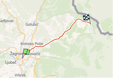
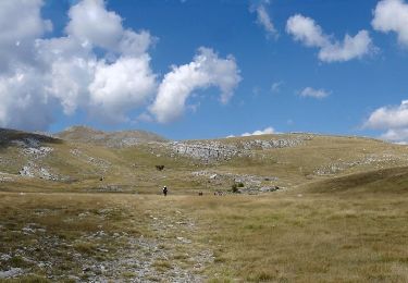
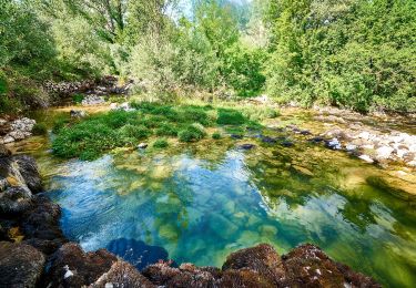
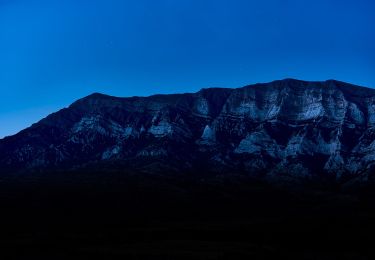
Tocht Te voet van 16,3 km beschikbaar op Onbekend, Šibensko-kninska županija. Deze tocht wordt voorgesteld door SityTrail - itinéraires balisés pédestres.
Beschrijving
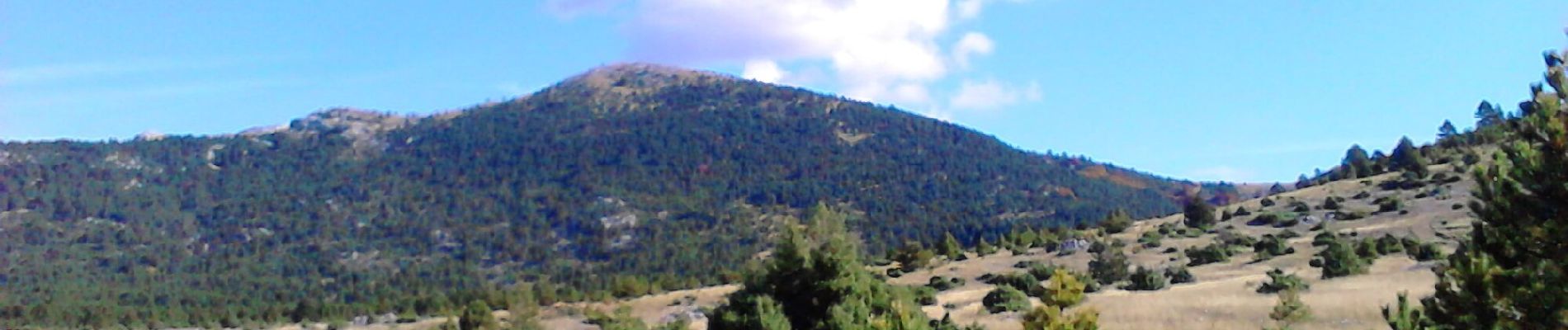
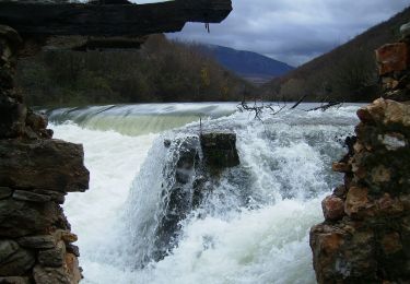
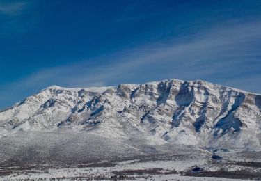
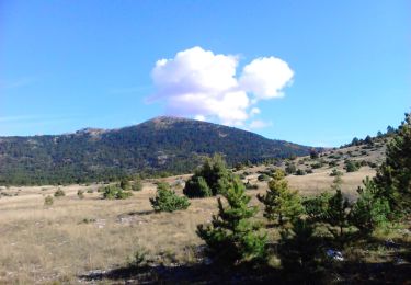
Dinara is the highest mountain in Croatia, and one of the most picturesque mountains in Dalmatia and in the Dalmatian hinterland. Even though it is not particularly high – not even exceeding the 2000-meter mark – it still represents one of the most impressive Croatian mountains with its shape ...
Website: https://trail.viadinarica.com/tour/hiking/15967323/
Plaatsbepaling
Opmerkingen
Wandeltochten in de omgeving
![Tocht Te voet - Poučno-pješačka staza: Stinice – Roški slap – Oziđana pećina - Photo](https://media.geolcdn.com/t/375/260/b6990a43-e1bf-4ef4-a38f-bc0e9b07e7fa.jpeg&format=jpg&maxdim=2)
![Te voet Te voet](https://static1.geolcdn.com/sitytour/trail-icons/100.png)
Te voet
![](/images/other/stat-length.png)
![](https://static1.geolcdn.com/siteimages/upload/files/16400158638029165_repeat_loop_refresh_sync_direction_icon.png)
![Tocht Te voet - Put preko vrha Dinare - Photo](https://media.geolcdn.com/t/375/260/d761895b-49a7-4b3b-8818-06c288ba4289.jpeg&format=jpg&maxdim=2)
![Te voet Te voet](https://static1.geolcdn.com/sitytour/trail-icons/100.png)
Te voet
![](/images/other/stat-length.png)
![](https://static1.geolcdn.com/siteimages/upload/files/16400158638029165_repeat_loop_refresh_sync_direction_icon.png)
![Tocht Te voet - yogurt staza Mirkovići-Dinara - Photo](https://media.geolcdn.com/t/375/260/29a1aecf-36fc-498e-8743-c859be60c896.jpeg&format=jpg&maxdim=2)
![Te voet Te voet](https://static1.geolcdn.com/sitytour/trail-icons/100.png)
Te voet
![](/images/other/stat-length.png)
![](https://static1.geolcdn.com/siteimages/upload/files/16400158638029165_repeat_loop_refresh_sync_direction_icon.png)
![Tocht Te voet - planinarska staza Mirkovići - Brezovac - Photo](https://media.geolcdn.com/t/375/260/6a972028-7138-496c-8b39-a194eaf01a7d.jpeg&format=jpg&maxdim=2)
![Te voet Te voet](https://static1.geolcdn.com/sitytour/trail-icons/100.png)
Te voet
![](/images/other/stat-length.png)
![](https://static1.geolcdn.com/siteimages/upload/files/16400158638029165_repeat_loop_refresh_sync_direction_icon.png)
![Tocht Te voet - Glavaš-Dinara_brezovac - Photo](https://media.geolcdn.com/t/375/260/70028265-24e3-4592-9650-7b9a1d72b553.jpeg&format=jpg&maxdim=2)
![Te voet Te voet](https://static1.geolcdn.com/sitytour/trail-icons/100.png)
Te voet
![](/images/other/stat-length.png)
![](https://static1.geolcdn.com/siteimages/upload/files/16400158638029165_repeat_loop_refresh_sync_direction_icon.png)
![Tocht Te voet - Guge-Brezovac - Photo](https://media.geolcdn.com/t/375/260/093a6e50-0cba-4ea6-8f57-cdfc99edf942.jpeg&format=jpg&maxdim=2)
![Te voet Te voet](https://static1.geolcdn.com/sitytour/trail-icons/100.png)
Te voet
![](/images/other/stat-length.png)
![](https://static1.geolcdn.com/siteimages/upload/files/16400158638029165_repeat_loop_refresh_sync_direction_icon.png)
![Tocht Te voet - Cetina put Oluje - Photo](https://media.geolcdn.com/t/375/260/92a1d8af-a831-4030-94fd-b4e7c791cd61.jpeg&format=jpg&maxdim=2)
![Te voet Te voet](https://static1.geolcdn.com/sitytour/trail-icons/100.png)
Te voet
![](/images/other/stat-length.png)
![](https://static1.geolcdn.com/siteimages/upload/files/16400158638029165_repeat_loop_refresh_sync_direction_icon.png)
![Tocht Te voet - Glavaš-Dinara - Photo](https://media.geolcdn.com/t/375/260/b5ccdf9b-e704-4365-8026-b13b6609237c.jpeg&format=jpg&maxdim=2)
![Te voet Te voet](https://static1.geolcdn.com/sitytour/trail-icons/100.png)
Te voet
![](/images/other/stat-length.png)
![](https://static1.geolcdn.com/siteimages/upload/files/16400158638029165_repeat_loop_refresh_sync_direction_icon.png)
![Tocht Te voet - Martinove košare-Leurdovac-Dinara - Photo](https://media.geolcdn.com/t/375/260/b5ccdf9b-e704-4365-8026-b13b6609237c.jpeg&format=jpg&maxdim=2)
![Te voet Te voet](https://static1.geolcdn.com/sitytour/trail-icons/100.png)
Te voet
![](/images/other/stat-length.png)
![](https://static1.geolcdn.com/siteimages/upload/files/16400158638029165_repeat_loop_refresh_sync_direction_icon.png)