![](/images/other/stat-length.png)
![Tocht Te voet Unknown - Nacionalni park Paklenica - Photo](https://media.geolcdn.com/t/1900/400/afedae5b-4209-4d66-bdba-6cfba3f997ff.jpeg&format=pjpeg&maxdim=2)
Nacionalni park Paklenica
SityTrail - itinéraires balisés pédestres
Tous les sentiers balisés d’Europe GUIDE+
![Lengte](/images/other/stat-length.png)
![Max. hoogte](https://static1.geolcdn.com/siteimages/upload/files/1508320355ic_sort_altitude_max_24dp.png)
![Positief hoogteverschil](https://static1.geolcdn.com/siteimages/upload/files/1508320355ic_sort_den_pos_24dp.png)
![Km-Effort](/images/other/stat-length.png)
![Min. hoogte](https://static1.geolcdn.com/siteimages/upload/files/1508320355ic_sort_altitude_min_24dp.png)
![Negatief hoogteverschil](https://static1.geolcdn.com/siteimages/upload/files/1508320355ic_sort_den_neg_24dp.png)
![Boucle](https://static1.geolcdn.com/siteimages/upload/files/16400158638029165_repeat_loop_refresh_sync_direction_icon.png)
![Te voet](https://static1.geolcdn.com/sitytour/trail-icons/100.png)
4h46
Moeilijkheid : Medium
![Scan deze QR-code om de tocht te openen in de SityTrail-applicatie](https://capi.geolives.com/qq0zvz2zws4bq2lad0pu/sitytour/trails/4346147/qr.png?size=200)
Gratisgps-wandelapplicatie
Over ons
Tocht Te voet van 11,7 km beschikbaar op Onbekend, Ličko-senjska županija. Deze tocht wordt voorgesteld door SityTrail - itinéraires balisés pédestres.
Beschrijving
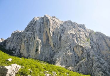
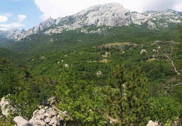
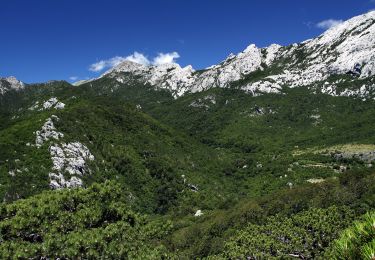
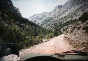
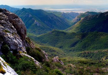
The area of Paklenica is one of the most interesting karst areas of Velebit and Croatia. At the base of the series of the highest peaks of Velebit, torrents have created two deep canyons representing a combination of longitudinal and deeply cut valleys in geomorphological terms. The most ...
Website: https://trail.viadinarica.com/tour/hiking/15966852/
Plaatsbepaling
Opmerkingen
Wandeltochten in de omgeving
![Tocht Te voet - Bukova staza - Photo](https://media.geolcdn.com/t/375/260/0293162d-3a5f-4b15-b737-440dbc2c1183.jpeg&format=jpg&maxdim=2)
![Te voet Te voet](https://static1.geolcdn.com/sitytour/trail-icons/100.png)
Te voet
![](/images/other/stat-length.png)
![](https://static1.geolcdn.com/siteimages/upload/files/16400158638029165_repeat_loop_refresh_sync_direction_icon.png)
![Tocht Te voet - Dom u Velikoj Paklenici - Krajni brig - Photo](https://media.geolcdn.com/t/375/260/9b12ad8e-78b9-402d-9026-622d8b2790f2.jpeg&format=jpg&maxdim=2)
![Te voet Te voet](https://static1.geolcdn.com/sitytour/trail-icons/100.png)
Te voet
![](/images/other/stat-length.png)
![](https://static1.geolcdn.com/siteimages/upload/files/16400158638029165_repeat_loop_refresh_sync_direction_icon.png)
![Tocht Te voet - Golić - Stražbenica - Photo](https://media.geolcdn.com/t/375/260/1fb005e9-31bf-41ad-b0c1-91bb8d8fb8c4.jpeg&format=jpg&maxdim=2)
![Te voet Te voet](https://static1.geolcdn.com/sitytour/trail-icons/100.png)
Te voet
![](/images/other/stat-length.png)
![](https://static1.geolcdn.com/siteimages/upload/files/16400158638029165_repeat_loop_refresh_sync_direction_icon.png)
![Tocht Te voet - Dom u Velikoj Paklenici - Stražbenica - Photo](https://media.geolcdn.com/t/375/260/74943b82-bfa9-49f1-8ba4-6b0b9dfe9937.jpeg&format=jpg&maxdim=2)
![Te voet Te voet](https://static1.geolcdn.com/sitytour/trail-icons/100.png)
Te voet
![](/images/other/stat-length.png)
![](https://static1.geolcdn.com/siteimages/upload/files/16400158638029165_repeat_loop_refresh_sync_direction_icon.png)
![Tocht Te voet - Lipa staza - Photo](https://media.geolcdn.com/t/375/260/cd3917a8-4228-43c8-9d12-c2fc6fd497bd.jpeg&format=jpg&maxdim=2)
![Te voet Te voet](https://static1.geolcdn.com/sitytour/trail-icons/100.png)
Te voet
![](/images/other/stat-length.png)
![](https://static1.geolcdn.com/siteimages/upload/files/16400158638029165_repeat_loop_refresh_sync_direction_icon.png)
![Tocht Te voet - Struge - Vaganski vrh - Photo](https://media.geolcdn.com/t/375/260/3896feef-29ff-4652-b14a-a616281106d1.jpeg&format=jpg&maxdim=2)
![Te voet Te voet](https://static1.geolcdn.com/sitytour/trail-icons/100.png)
Te voet
![](/images/other/stat-length.png)
![](https://static1.geolcdn.com/siteimages/upload/files/16400158638029165_repeat_loop_refresh_sync_direction_icon.png)
![Tocht Te voet - Vaganski vrh - Sveto Brdo - Photo](https://media.geolcdn.com/t/375/260/afedae5b-4209-4d66-bdba-6cfba3f997ff.jpeg&format=jpg&maxdim=2)
![Te voet Te voet](https://static1.geolcdn.com/sitytour/trail-icons/100.png)
Te voet
![](/images/other/stat-length.png)
![](https://static1.geolcdn.com/siteimages/upload/files/16400158638029165_repeat_loop_refresh_sync_direction_icon.png)
![Tocht Te voet - Dom u Velikoj Paklenici - Vlaški grad - Photo](https://media.geolcdn.com/t/375/260/afedae5b-4209-4d66-bdba-6cfba3f997ff.jpeg&format=jpg&maxdim=2)
![Te voet Te voet](https://static1.geolcdn.com/sitytour/trail-icons/100.png)
Te voet
![](/images/other/stat-length.png)
![](https://static1.geolcdn.com/siteimages/upload/files/16400158638029165_repeat_loop_refresh_sync_direction_icon.png)
![Tocht Te voet - Dom Paklenica - Jurline - Photo](https://media.geolcdn.com/t/375/260/74943b82-bfa9-49f1-8ba4-6b0b9dfe9937.jpeg&format=jpg&maxdim=2)
![Te voet Te voet](https://static1.geolcdn.com/sitytour/trail-icons/100.png)
Te voet
![](/images/other/stat-length.png)
![](https://static1.geolcdn.com/siteimages/upload/files/16400158638029165_repeat_loop_refresh_sync_direction_icon.png)