


5,3 km | 5,9 km-effort
![Tocht Te voet Milý - [Ž] Mšec - Milý - Photo](https://media.geolcdn.com/t/1900/400/dca1caca-11bd-48f5-a342-341234bf00ce.jpeg&format=pjpeg&maxdim=2)

Tous les sentiers balisés d’Europe GUIDE+


Gratisgps-wandelapplicatie
 SityTrail
IGN / Geografische instituten
SityTrail World
De wereld gaat voor u open
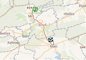
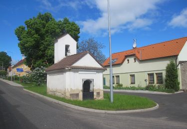
Tocht Te voet van 4,5 km beschikbaar op Centraal-Bohemen, Onbekend, Milý. Deze tocht wordt voorgesteld door SityTrail - itinéraires balisés pédestres.
Tocht aangemaakt door cz:KČT.
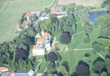
![Tocht Te voet Milý - [Ž] Mšec - Milý - Photo 1](https://media.geolcdn.com/t/2048/auto/c1b7b056-ee96-4390-be6e-8ca0e3b4dee5.jpeg&format=jpg&maxdim=0 "Tocht Te voet Milý - [Ž] Mšec - Milý - Photo 1")
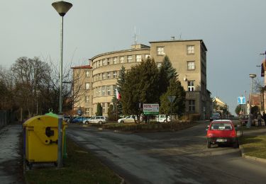
![Tocht Te voet Milý - [Ž] Mšec - Milý - Photo 2](https://media.geolcdn.com/t/2048/auto/140c5135-cfcc-4079-ae31-0b321a9b5b6d.jpeg&format=jpg&maxdim=0 "Tocht Te voet Milý - [Ž] Mšec - Milý - Photo 2")
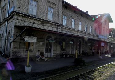
![Tocht Te voet Milý - [Ž] Mšec - Milý - Photo 3](https://media.geolcdn.com/t/2048/auto/c82ee6d4-d96d-4cf0-8fe2-2197bfafa829.jpeg&format=jpg&maxdim=0 "Tocht Te voet Milý - [Ž] Mšec - Milý - Photo 3")
![Tocht Te voet Milý - [Ž] Mšec - Milý - Photo 4](https://media.geolcdn.com/t/2048/auto/32fefaa7-f6d8-4fc0-8392-f5418ea71409.jpeg&format=jpg&maxdim=0 "Tocht Te voet Milý - [Ž] Mšec - Milý - Photo 4")
![Tocht Te voet Milý - [Ž] Mšec - Milý - Photo 5](https://media.geolcdn.com/t/2048/auto/4484877c-a2e2-4cd7-a8bb-300b77df0768.jpeg&format=jpg&maxdim=0 "Tocht Te voet Milý - [Ž] Mšec - Milý - Photo 5")
![Tocht Te voet Milý - [Ž] Mšec - Milý - Photo 6](https://media.geolcdn.com/t/2048/auto/14a6e021-d1bb-445c-8f15-1ee3930a0cc7.jpeg&format=jpg&maxdim=0 "Tocht Te voet Milý - [Ž] Mšec - Milý - Photo 6")
![Tocht Te voet Milý - [Ž] Mšec - Milý - Photo 7](https://media.geolcdn.com/t/2048/auto/f78449af-e684-4e10-9948-79741efcde89.jpeg&format=jpg&maxdim=0 "Tocht Te voet Milý - [Ž] Mšec - Milý - Photo 7")
![Tocht Te voet Milý - [Ž] Mšec - Milý - Photo 8](https://media.geolcdn.com/t/2048/auto/dfc7099f-2e62-4cce-af51-ce8353939e6b.jpeg&format=jpg&maxdim=0 "Tocht Te voet Milý - [Ž] Mšec - Milý - Photo 8")
![Tocht Te voet Milý - [Ž] Mšec - Milý - Photo 9](https://media.geolcdn.com/t/2048/auto/432ededa-dffb-4931-b465-1cf90d53f3cc.jpeg&format=jpg&maxdim=0 "Tocht Te voet Milý - [Ž] Mšec - Milý - Photo 9")
![Tocht Te voet Milý - [Ž] Mšec - Milý - Photo 10](https://media.geolcdn.com/t/2048/auto/dca1caca-11bd-48f5-a342-341234bf00ce.jpeg&format=jpg&maxdim=0 "Tocht Te voet Milý - [Ž] Mšec - Milý - Photo 10")
![Tocht Te voet Evaň - [Z] Poplze - Horka - Photo](https://media.geolcdn.com/t/375/260/58b6020a-01a4-4926-b083-ab4b33d6a3be.jpeg&format=jpg&maxdim=2)
Te voet
Te voet
Te voet
![Tocht Te voet Nové Strašecí - [Ž] Nové Strašecí - Punčocha, rybník - Photo](https://media.geolcdn.com/t/375/260/44bfaf8e-a472-4cd5-9fd6-cf12bbe0e639.jpeg&format=jpg&maxdim=2)
Te voet
Te voet
![Tocht Te voet Lubná - [Ž] Rakovník - Senecká hora - Photo](https://media.geolcdn.com/t/375/260/dff3753f-98a3-47a5-8521-cd2a1a4dd151.jpeg&format=jpg&maxdim=2)
Te voet
![Tocht Te voet Rakovník - [Ž] Měststský okruh IVV - Photo](https://media.geolcdn.com/t/375/260/eff4da05-f915-4356-8fee-71a257493d98.jpeg&format=jpg&maxdim=2)
Te voet
![Tocht Te voet Rakovník - [NS] - Photo](https://media.geolcdn.com/t/375/260/d95d36bc-5631-423e-8ea4-68c19af5ca11.jpeg&format=jpg&maxdim=2)
Te voet
Te voet