


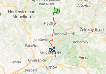

3,2 km | 5,2 km-effort

Tous les sentiers balisés d’Europe GUIDE+


Gratisgps-wandelapplicatie
 SityTrail
IGN / Geografische instituten
SityTrail World
De wereld gaat voor u open
Tocht Te voet van 8,6 km beschikbaar op Noordoost, Liberecký kraj, Frýdštejn. Deze tocht wordt voorgesteld door SityTrail - itinéraires balisés pédestres.
Tocht aangemaakt door cz:KČT.


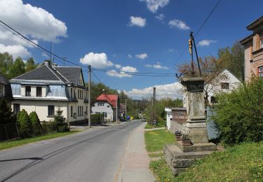
![Tocht Te voet Rychnov u Jablonce nad Nisou - [Ž] Rychnov u Jablonce n. N. - Dobrá Voda - Photo](https://media.geolcdn.com/t/375/260/6d19918f-d3e9-4534-a7af-5e0a5166a0c2.jpeg&format=jpg&maxdim=2)
Te voet
![Tocht Te voet Hodkovice nad Mohelkou - [Ž] Hodkovice nad Mohelkou - Vrchovina - Photo](https://media.geolcdn.com/t/375/260/c8a4d6e6-c436-4c58-854e-1aa3f07f7648.jpeg&format=jpg&maxdim=2)
Te voet
![Tocht Te voet Pulečný - [Z] Jablonec n. N. - Pulečný - Photo](https://media.geolcdn.com/t/375/260/b17bcafe-ad71-4f5a-9387-b5078f702632.jpeg&format=jpg&maxdim=2)
Te voet
Te voet
Te voet
Te voet
Te voet