


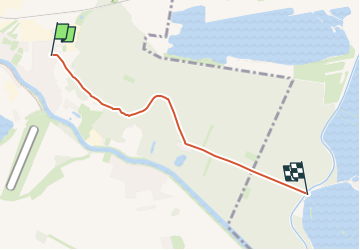

3,7 km | 6 km-effort


Tous les sentiers balisés d’Europe GUIDE+


Gratisgps-wandelapplicatie
 SityTrail
IGN / Geografische instituten
SityTrail World
De wereld gaat voor u open
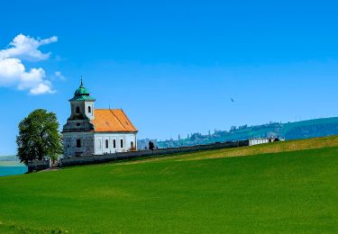
Tocht Te voet van 4,1 km beschikbaar op Centraal-Moravië, Zlínský kraj, Kroměříž. Deze tocht wordt voorgesteld door SityTrail - itinéraires balisés pédestres.
Tocht aangemaakt door cz:KČT.


Te voet

Te voet
Te voet
Te voet
![Tocht Te voet Pačlavice - [Ž] Nad Kozojedskem - Lhota u Pačlavic - Photo](https://media.geolcdn.com/t/375/260/2ea20ab0-bb88-4be4-8f66-358c0e08b97e.jpeg&format=jpg&maxdim=2)
Te voet
![Tocht Te voet Fryšták - [Z] Andrýskova stezka NS - Photo](https://media.geolcdn.com/t/375/260/c5864c9f-8818-48e6-a17b-627485842b23.jpeg&format=jpg&maxdim=2)
Te voet
Te voet
Te voet
Te voet