![](/images/other/stat-length.png)
![Tocht Te voet Unknown - Grdanjci - Noršić selo - Photo](https://media.geolcdn.com/t/1900/400/360e921b-97d3-4b67-9f69-dac3c02b0938.jpeg&format=pjpeg&maxdim=2)
Grdanjci - Noršić selo
SityTrail - itinéraires balisés pédestres
Tous les sentiers balisés d’Europe GUIDE+
![Lengte](/images/other/stat-length.png)
Lengte
7,1 km
![Max. hoogte](https://static1.geolcdn.com/siteimages/upload/files/1508320355ic_sort_altitude_max_24dp.png)
Max. hoogte
680 m
![Positief hoogteverschil](https://static1.geolcdn.com/siteimages/upload/files/1508320355ic_sort_den_pos_24dp.png)
Positief hoogteverschil
88 m
![Km-Effort](/images/other/stat-length.png)
Km-Effort
9,8 km
![Min. hoogte](https://static1.geolcdn.com/siteimages/upload/files/1508320355ic_sort_altitude_min_24dp.png)
Min. hoogte
191 m
![Negatief hoogteverschil](https://static1.geolcdn.com/siteimages/upload/files/1508320355ic_sort_den_neg_24dp.png)
Negatief hoogteverschil
554 m
![Boucle](https://static1.geolcdn.com/siteimages/upload/files/16400158638029165_repeat_loop_refresh_sync_direction_icon.png)
Boucle
Neen
Markering
Datum van aanmaak :
2025-02-07 10:53:58.145
Laatste wijziging :
2025-02-07 10:53:58.145
![Te voet](https://static1.geolcdn.com/sitytour/trail-icons/100.png)
2h13
Moeilijkheid : Gemakkelijk
![Scan deze QR-code om de tocht te openen in de SityTrail-applicatie](https://capi.geolives.com/qq0zvz2zws4bq2lad0pu/sitytour/trails/4345372/qr.png?size=200)
Gratisgps-wandelapplicatie
Over ons
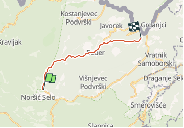
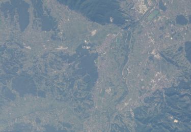
Tocht Te voet van 7,1 km beschikbaar op Onbekend, Zagrebačka županija. Deze tocht wordt voorgesteld door SityTrail - itinéraires balisés pédestres.
Beschrijving
Tocht aangemaakt door HPD Zanatlija, Zagreb.
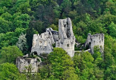
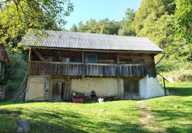
Grdanjci (a.p.) - Beder - Brnjice - Noršić Selo(Kapelišće)
Plaatsbepaling
Land:
Croatia
Regio :
Onbekend
Departement/Provincie :
Zagrebačka županija
Gemeente :
Unknown
Locatie:
Unknown
Vertrek:(Dec)
Vertrek:(UTM)
544638 ; 5071360 (33T) N.
Opmerkingen
Wandeltochten in de omgeving
![Tocht Te voet - Osredek - Beder - Photo](https://media.geolcdn.com/t/375/260/02f74ee7-f7a8-4cd6-a4f4-99b06a677f3c.jpeg&format=jpg&maxdim=2)
![Te voet Te voet](https://static1.geolcdn.com/sitytour/trail-icons/100.png)
Osredek - Beder
Te voet
Gemakkelijk
,
Onbekend,
Zagrebačka županija,
Croatia
![](/images/other/stat-length.png)
6,4 km | 10,9 km-effort
2h 28min
![](https://static1.geolcdn.com/siteimages/upload/files/16400158638029165_repeat_loop_refresh_sync_direction_icon.png)
Neen
![Tocht Te voet - Koretići - Poklek - Photo](https://media.geolcdn.com/t/375/260/d7fc09e4-b763-4816-8be1-38bb077973f8.jpeg&format=jpg&maxdim=2)
![Te voet Te voet](https://static1.geolcdn.com/sitytour/trail-icons/100.png)
Koretići - Poklek
Te voet
Gemakkelijk
,
Onbekend,
Zagrebačka županija,
Croatia
![](/images/other/stat-length.png)
6,9 km | 12,1 km-effort
2h 44min
![](https://static1.geolcdn.com/siteimages/upload/files/16400158638029165_repeat_loop_refresh_sync_direction_icon.png)
Neen
![Tocht Te voet - Koretići - Kravljak - Photo](https://media.geolcdn.com/t/375/260/d7fc09e4-b763-4816-8be1-38bb077973f8.jpeg&format=jpg&maxdim=2)
![Te voet Te voet](https://static1.geolcdn.com/sitytour/trail-icons/100.png)
Koretići - Kravljak
Te voet
Gemakkelijk
,
Onbekend,
Zagrebačka županija,
Croatia
![](/images/other/stat-length.png)
3,8 km | 5,1 km-effort
1h 9min
![](https://static1.geolcdn.com/siteimages/upload/files/16400158638029165_repeat_loop_refresh_sync_direction_icon.png)
Neen
![Tocht Te voet - Gabrovica - Kravljak - Photo](https://media.geolcdn.com/t/375/260/052fddf2-4498-409b-a8ab-f02cb8a90db8.jpeg&format=jpg&maxdim=2)
![Te voet Te voet](https://static1.geolcdn.com/sitytour/trail-icons/100.png)
Gabrovica - Kravljak
Te voet
Gemakkelijk
,
Onbekend,
Zagrebačka županija,
Croatia
![](/images/other/stat-length.png)
5 km | 8,6 km-effort
1h 57min
![](https://static1.geolcdn.com/siteimages/upload/files/16400158638029165_repeat_loop_refresh_sync_direction_icon.png)
Neen
![Tocht Te voet - Noršić Selo - Katin krč - Photo](https://media.geolcdn.com/t/375/260/b167355c-57af-49c1-ae87-931613543d0f.jpeg&format=jpg&maxdim=2)
![Te voet Te voet](https://static1.geolcdn.com/sitytour/trail-icons/100.png)
Noršić Selo - Katin krč
Te voet
Gemakkelijk
,
Onbekend,
Zagrebačka županija,
Croatia
![](/images/other/stat-length.png)
5,9 km | 9,5 km-effort
2h 9min
![](https://static1.geolcdn.com/siteimages/upload/files/16400158638029165_repeat_loop_refresh_sync_direction_icon.png)
Neen
![Tocht Te voet - Slani dol - Noršić Selo - Photo](https://media.geolcdn.com/t/375/260/360e921b-97d3-4b67-9f69-dac3c02b0938.jpeg&format=jpg&maxdim=2)
![Te voet Te voet](https://static1.geolcdn.com/sitytour/trail-icons/100.png)
Slani dol - Noršić Selo
Te voet
Gemakkelijk
,
Onbekend,
Zagrebačka županija,
Croatia
![](/images/other/stat-length.png)
6,6 km | 10,4 km-effort
2h 22min
![](https://static1.geolcdn.com/siteimages/upload/files/16400158638029165_repeat_loop_refresh_sync_direction_icon.png)
Neen
![Tocht Te voet - Slani dol - Gostinjac Sv. Bernard - Photo](https://media.geolcdn.com/t/375/260/c97b8dc0-0e3a-4e26-bef6-8556ac70acf5.jpeg&format=jpg&maxdim=2)
![Te voet Te voet](https://static1.geolcdn.com/sitytour/trail-icons/100.png)
Slani dol - Gostinjac Sv. Bernard
Te voet
Gemakkelijk
,
Onbekend,
Zagrebačka županija,
Croatia
![](/images/other/stat-length.png)
4,3 km | 6,2 km-effort
1h 24min
![](https://static1.geolcdn.com/siteimages/upload/files/16400158638029165_repeat_loop_refresh_sync_direction_icon.png)
Neen
![Tocht Te voet - Grgosova špilja - Slani dol - Photo](https://media.geolcdn.com/t/375/260/e1d74823-4105-4a56-acd7-4a4d2d506da5.jpeg&format=jpg&maxdim=2)
![Te voet Te voet](https://static1.geolcdn.com/sitytour/trail-icons/100.png)
Grgosova špilja - Slani dol
Te voet
Gemakkelijk
,
Onbekend,
Zagrebačka županija,
Croatia
![](/images/other/stat-length.png)
6,9 km | 9,4 km-effort
2h 7min
![](https://static1.geolcdn.com/siteimages/upload/files/16400158638029165_repeat_loop_refresh_sync_direction_icon.png)
Neen
![Tocht Te voet - Koretići - Gornja Vas - Photo](https://media.geolcdn.com/t/375/260/ee1b2247-18e5-488b-8e88-33333aefa699.jpeg&format=jpg&maxdim=2)
![Te voet Te voet](https://static1.geolcdn.com/sitytour/trail-icons/100.png)
Koretići - Gornja Vas
Te voet
Gemakkelijk
,
Onbekend,
Zagrebačka županija,
Croatia
![](/images/other/stat-length.png)
6,9 km | 10,2 km-effort
2h 19min
![](https://static1.geolcdn.com/siteimages/upload/files/16400158638029165_repeat_loop_refresh_sync_direction_icon.png)
Neen