![](/images/other/stat-length.png)
![Tocht Te voet Poříčí u Litomyšle - NS Kolem Štimberka - Photo](https://media.geolcdn.com/t/1900/400/378eff71-455a-4a01-b8c1-2c2900bfac3e.jpeg&format=pjpeg&maxdim=2)
NS Kolem Štimberka
SityTrail - itinéraires balisés pédestres
Tous les sentiers balisés d’Europe GUIDE+
![Lengte](/images/other/stat-length.png)
Lengte
4,3 km
![Max. hoogte](https://static1.geolcdn.com/siteimages/upload/files/1508320355ic_sort_altitude_max_24dp.png)
Max. hoogte
554 m
![Positief hoogteverschil](https://static1.geolcdn.com/siteimages/upload/files/1508320355ic_sort_den_pos_24dp.png)
Positief hoogteverschil
104 m
![Km-Effort](/images/other/stat-length.png)
Km-Effort
5,7 km
![Min. hoogte](https://static1.geolcdn.com/siteimages/upload/files/1508320355ic_sort_altitude_min_24dp.png)
Min. hoogte
434 m
![Negatief hoogteverschil](https://static1.geolcdn.com/siteimages/upload/files/1508320355ic_sort_den_neg_24dp.png)
Negatief hoogteverschil
125 m
![Boucle](https://static1.geolcdn.com/siteimages/upload/files/16400158638029165_repeat_loop_refresh_sync_direction_icon.png)
Boucle
Neen
Markering
Datum van aanmaak :
2025-02-07 10:16:12.947
Laatste wijziging :
2025-02-07 10:16:12.947
![Te voet](https://static1.geolcdn.com/sitytour/trail-icons/100.png)
1h17
Moeilijkheid : Gemakkelijk
![Scan deze QR-code om de tocht te openen in de SityTrail-applicatie](https://capi.geolives.com/qq0zvz2zws4bq2lad0pu/sitytour/trails/4345200/qr.png?size=200)
Gratisgps-wandelapplicatie
Over ons
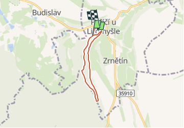
Tocht Te voet van 4,3 km beschikbaar op Noordoost, Pardubický kraj, Poříčí u Litomyšle. Deze tocht wordt voorgesteld door SityTrail - itinéraires balisés pédestres.
Beschrijving
Tocht aangemaakt door cz:KČT.
Plaatsbepaling
Land:
Czech Republic
Regio :
Noordoost
Departement/Provincie :
Pardubický kraj
Gemeente :
Poříčí u Litomyšle
Locatie:
Unknown
Vertrek:(Dec)
Vertrek:(UTM)
585646 ; 5516642 (33U) N.
Opmerkingen
Wandeltochten in de omgeving
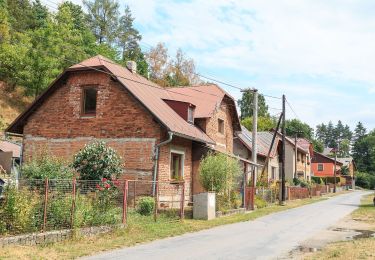
![Tocht Te voet Pustá Kamenice - [M] Pustá Kamenice - Pustá Rybná - Photo](https://media.geolcdn.com/t/375/260/b3405cc6-7ad6-46df-8907-c57a73873ec8.jpeg&format=jpg&maxdim=2)
![Te voet Te voet](https://static1.geolcdn.com/sitytour/trail-icons/100.png)
[M] Pustá Kamenice - Pustá Rybná
Te voet
Gemakkelijk
Pustá Kamenice,
Noordoost,
Pardubický kraj,
Czech Republic
![](/images/other/stat-length.png)
6,3 km | 7,7 km-effort
1h 45min
![](https://static1.geolcdn.com/siteimages/upload/files/16400158638029165_repeat_loop_refresh_sync_direction_icon.png)
Neen
![Tocht Te voet Rybník - NS Údolím Skuhrovského potoka - Photo](https://media.geolcdn.com/t/375/260/981a0e31-bd99-4924-ad4c-fb3778b5ba20.jpeg&format=jpg&maxdim=2)
![Te voet Te voet](https://static1.geolcdn.com/sitytour/trail-icons/100.png)
NS Údolím Skuhrovského potoka
Te voet
Gemakkelijk
Rybník,
Noordoost,
Pardubický kraj,
Czech Republic
![](/images/other/stat-length.png)
8 km | 11,2 km-effort
2h 32min
![](https://static1.geolcdn.com/siteimages/upload/files/16400158638029165_repeat_loop_refresh_sync_direction_icon.png)
Neen
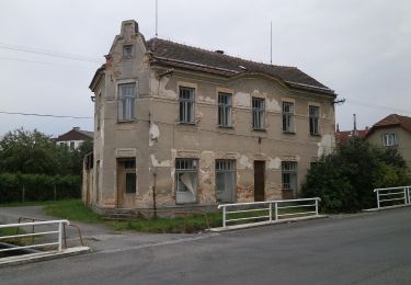
![Tocht Te voet Kukle - [Č] Vozíčkářský okruh nad Rosničkou - Photo](https://media.geolcdn.com/t/375/260/a09e8f9b-db43-4592-b8eb-0648f5280109.jpeg&format=jpg&maxdim=2)
![Te voet Te voet](https://static1.geolcdn.com/sitytour/trail-icons/100.png)
[Č] Vozíčkářský okruh nad Rosničkou
Te voet
Gemakkelijk
Kukle,
Noordoost,
Pardubický kraj,
Czech Republic
![](/images/other/stat-length.png)
12 km | 14,5 km-effort
3h 17min
![](https://static1.geolcdn.com/siteimages/upload/files/16400158638029165_repeat_loop_refresh_sync_direction_icon.png)
Neen
![Tocht Te voet Řetová - NS Okolo Řetové - Photo](https://media.geolcdn.com/t/375/260/e9cbc577-d7db-4570-967f-fbb8bd2a6e49.jpeg&format=jpg&maxdim=2)
![Te voet Te voet](https://static1.geolcdn.com/sitytour/trail-icons/100.png)
NS Okolo Řetové
Te voet
Gemakkelijk
Řetová,
Noordoost,
Pardubický kraj,
Czech Republic
![](/images/other/stat-length.png)
9,6 km | 14,1 km-effort
3h 12min
![](https://static1.geolcdn.com/siteimages/upload/files/16400158638029165_repeat_loop_refresh_sync_direction_icon.png)
Ja
![Tocht Te voet Skuteč - NS Žulová stezka - Photo](https://media.geolcdn.com/t/375/260/b8cc7ccb-a493-49ff-bf12-71443882b9a4.jpeg&format=jpg&maxdim=2)
![Te voet Te voet](https://static1.geolcdn.com/sitytour/trail-icons/100.png)
NS Žulová stezka
Te voet
Gemakkelijk
Skuteč,
Noordoost,
Pardubický kraj,
Czech Republic
![](/images/other/stat-length.png)
3,6 km | 4,7 km-effort
1h 4min
![](https://static1.geolcdn.com/siteimages/upload/files/16400158638029165_repeat_loop_refresh_sync_direction_icon.png)
Ja
![Tocht Te voet Vysoké Mýto - NS Knířov - Vánice - Photo](https://media.geolcdn.com/t/375/260/0cd8f36a-2cc8-45ab-8d9e-fb179da62e5a.jpeg&format=jpg&maxdim=2)
![Te voet Te voet](https://static1.geolcdn.com/sitytour/trail-icons/100.png)
NS Knířov - Vánice
Te voet
Gemakkelijk
Vysoké Mýto,
Noordoost,
Pardubický kraj,
Czech Republic
![](/images/other/stat-length.png)
7,9 km | 9,2 km-effort
2h 5min
![](https://static1.geolcdn.com/siteimages/upload/files/16400158638029165_repeat_loop_refresh_sync_direction_icon.png)
Ja
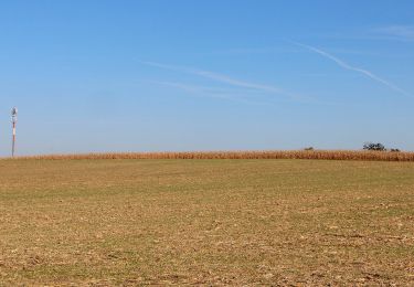
![Tocht Te voet Česká Třebová - [Ž] Serpentýny - Hory - Photo](https://media.geolcdn.com/t/375/260/bd44ac32-e646-4cc9-8783-18dc2e4b84e1.jpeg&format=jpg&maxdim=2)
![Te voet Te voet](https://static1.geolcdn.com/sitytour/trail-icons/100.png)
[Ž] Serpentýny - Hory
Te voet
Gemakkelijk
Česká Třebová,
Noordoost,
Pardubický kraj,
Czech Republic
![](/images/other/stat-length.png)
5,2 km | 8,2 km-effort
1h 51min
![](https://static1.geolcdn.com/siteimages/upload/files/16400158638029165_repeat_loop_refresh_sync_direction_icon.png)
Ja
![Tocht Te voet Proseč - Planetární stezka - Photo](https://media.geolcdn.com/t/375/260/33d4a852-bac6-4ff0-8b9d-a5d212f7f261.jpeg&format=jpg&maxdim=2)
![Te voet Te voet](https://static1.geolcdn.com/sitytour/trail-icons/100.png)
Planetární stezka
Te voet
Gemakkelijk
Proseč,
Noordoost,
Pardubický kraj,
Czech Republic
![](/images/other/stat-length.png)
5,9 km | 7,2 km-effort
1h 38min
![](https://static1.geolcdn.com/siteimages/upload/files/16400158638029165_repeat_loop_refresh_sync_direction_icon.png)
Neen
![Tocht Te voet Vysoké Mýto - NS Vraclav - Photo](https://media.geolcdn.com/t/375/260/1791c917-5d79-4fbd-ae8f-a8a4290f074f.jpeg&format=jpg&maxdim=2)
![Te voet Te voet](https://static1.geolcdn.com/sitytour/trail-icons/100.png)
NS Vraclav
Te voet
Gemakkelijk
Vysoké Mýto,
Noordoost,
Pardubický kraj,
Czech Republic
![](/images/other/stat-length.png)
7,7 km | 9,2 km-effort
2h 6min
![](https://static1.geolcdn.com/siteimages/upload/files/16400158638029165_repeat_loop_refresh_sync_direction_icon.png)
Neen