![](/images/other/stat-length.png)
![Tocht Te voet Netřebice - naučná stezka Po stopách víly Netřebky - Photo](https://media.geolcdn.com/t/1900/400/5999e30b-2a9d-4a4f-abeb-19d760f34452.jpeg&format=pjpeg&maxdim=2)
naučná stezka Po stopách víly Netřebky
SityTrail - itinéraires balisés pédestres
Tous les sentiers balisés d’Europe GUIDE+
![Lengte](/images/other/stat-length.png)
Lengte
3,5 km
![Max. hoogte](https://static1.geolcdn.com/siteimages/upload/files/1508320355ic_sort_altitude_max_24dp.png)
Max. hoogte
193 m
![Positief hoogteverschil](https://static1.geolcdn.com/siteimages/upload/files/1508320355ic_sort_den_pos_24dp.png)
Positief hoogteverschil
9 m
![Km-Effort](/images/other/stat-length.png)
Km-Effort
3,7 km
![Min. hoogte](https://static1.geolcdn.com/siteimages/upload/files/1508320355ic_sort_altitude_min_24dp.png)
Min. hoogte
187 m
![Negatief hoogteverschil](https://static1.geolcdn.com/siteimages/upload/files/1508320355ic_sort_den_neg_24dp.png)
Negatief hoogteverschil
11 m
![Boucle](https://static1.geolcdn.com/siteimages/upload/files/16400158638029165_repeat_loop_refresh_sync_direction_icon.png)
Boucle
Neen
Markering
Datum van aanmaak :
2025-02-07 09:26:25.305
Laatste wijziging :
2025-02-07 09:26:25.305
![Te voet](https://static1.geolcdn.com/sitytour/trail-icons/100.png)
50m
Moeilijkheid : Gemakkelijk
![Scan deze QR-code om de tocht te openen in de SityTrail-applicatie](https://capi.geolives.com/qq0zvz2zws4bq2lad0pu/sitytour/trails/4345088/qr.png?size=200)
Gratisgps-wandelapplicatie
Over ons
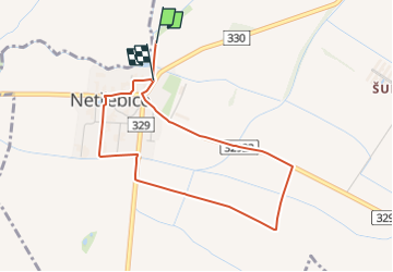
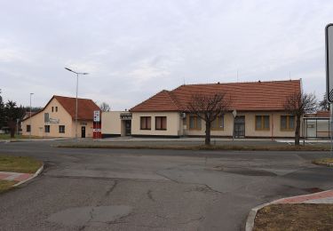
Tocht Te voet van 3,5 km beschikbaar op Centraal-Bohemen, Onbekend, Netřebice. Deze tocht wordt voorgesteld door SityTrail - itinéraires balisés pédestres.
Beschrijving
Tocht aangemaakt door cz:KČT.
Plaatsbepaling
Land:
Czech Republic
Regio :
Centraal-Bohemen
Departement/Provincie :
Onbekend
Gemeente :
Netřebice
Locatie:
Unknown
Vertrek:(Dec)
Vertrek:(UTM)
510474 ; 5562783 (33U) N.
Opmerkingen
Wandeltochten in de omgeving
![Tocht Te voet Nepřevázka - NS PP Chlum - Photo](https://media.geolcdn.com/t/375/260/d4c5be34-3834-4ac2-829f-9a826c7dc87a.jpeg&format=jpg&maxdim=2)
![Te voet Te voet](https://static1.geolcdn.com/sitytour/trail-icons/100.png)
NS PP Chlum
Te voet
Gemakkelijk
Nepřevázka,
Centraal-Bohemen,
Onbekend,
Czech Republic
![](/images/other/stat-length.png)
7,3 km | 9,7 km-effort
2h 12min
![](https://static1.geolcdn.com/siteimages/upload/files/16400158638029165_repeat_loop_refresh_sync_direction_icon.png)
Neen
![Tocht Te voet Dětenice - naučná stezka Viničky - Photo](https://media.geolcdn.com/t/375/260/3874deca-99d1-4f06-9f23-9e8216e8e98e.jpeg&format=jpg&maxdim=2)
![Te voet Te voet](https://static1.geolcdn.com/sitytour/trail-icons/100.png)
naučná stezka Viničky
Te voet
Gemakkelijk
Dětenice,
Noordoost,
Královéhradecký kraj,
Czech Republic
![](/images/other/stat-length.png)
3,4 km | 4,8 km-effort
1h 5min
![](https://static1.geolcdn.com/siteimages/upload/files/16400158638029165_repeat_loop_refresh_sync_direction_icon.png)
Neen
![Tocht Te voet Kolín - NS Za historií řepařské drážky a okolí - Photo](https://media.geolcdn.com/t/375/260/a9c7b755-011b-4959-bdee-5b4cf1210685.jpeg&format=jpg&maxdim=2)
![Te voet Te voet](https://static1.geolcdn.com/sitytour/trail-icons/100.png)
NS Za historií řepařské drážky a okolí
Te voet
Gemakkelijk
Kolín,
Centraal-Bohemen,
Onbekend,
Czech Republic
![](/images/other/stat-length.png)
4,6 km | 5 km-effort
1h 8min
![](https://static1.geolcdn.com/siteimages/upload/files/16400158638029165_repeat_loop_refresh_sync_direction_icon.png)
Neen
![Tocht Te voet Kolín - naučná stezka Borky - Photo](https://media.geolcdn.com/t/375/260/1402bf35-5dd9-4344-85e2-d344a7b53cfa.jpeg&format=jpg&maxdim=2)
![Te voet Te voet](https://static1.geolcdn.com/sitytour/trail-icons/100.png)
naučná stezka Borky
Te voet
Gemakkelijk
Kolín,
Centraal-Bohemen,
Onbekend,
Czech Republic
![](/images/other/stat-length.png)
4,5 km | 5,1 km-effort
1h 9min
![](https://static1.geolcdn.com/siteimages/upload/files/16400158638029165_repeat_loop_refresh_sync_direction_icon.png)
Ja
![Tocht Te voet Jabkenice - [M] Smetanova procházka - okruh 3,5 Km - Photo](https://media.geolcdn.com/t/375/260/ad5da183-bff2-4fd7-ae6a-7c04cd8cd51f.jpeg&format=jpg&maxdim=2)
![Te voet Te voet](https://static1.geolcdn.com/sitytour/trail-icons/100.png)
[M] Smetanova procházka - okruh 3,5 Km
Te voet
Gemakkelijk
Jabkenice,
Centraal-Bohemen,
Onbekend,
Czech Republic
![](/images/other/stat-length.png)
3,7 km | 4,3 km-effort
58min
![](https://static1.geolcdn.com/siteimages/upload/files/16400158638029165_repeat_loop_refresh_sync_direction_icon.png)
Ja
![Tocht Te voet Loučeň - [Ž] Seletice - Loučeň - Photo](https://media.geolcdn.com/t/375/260/a84d29ee-41cb-4460-8be9-f5a462964972.jpeg&format=jpg&maxdim=2)
![Te voet Te voet](https://static1.geolcdn.com/sitytour/trail-icons/100.png)
[Ž] Seletice - Loučeň
Te voet
Gemakkelijk
Loučeň,
Centraal-Bohemen,
Onbekend,
Czech Republic
![](/images/other/stat-length.png)
9,6 km | 11,6 km-effort
2h 37min
![](https://static1.geolcdn.com/siteimages/upload/files/16400158638029165_repeat_loop_refresh_sync_direction_icon.png)
Neen
![Tocht Te voet Kostomlaty nad Labem - [Ž] Kostomlaty nad Labem - ústí Vlkavy - Photo](https://media.geolcdn.com/t/375/260/8043a1fa-bd2d-496a-9ca7-505e6aaabd52.jpeg&format=jpg&maxdim=2)
![Te voet Te voet](https://static1.geolcdn.com/sitytour/trail-icons/100.png)
[Ž] Kostomlaty nad Labem - ústí Vlkavy
Te voet
Gemakkelijk
Kostomlaty nad Labem,
Centraal-Bohemen,
Onbekend,
Czech Republic
![](/images/other/stat-length.png)
3,3 km | 3,6 km-effort
49min
![](https://static1.geolcdn.com/siteimages/upload/files/16400158638029165_repeat_loop_refresh_sync_direction_icon.png)
Neen
![Tocht Te voet Kopidlno - [Ž] Mlýnec - Bučický mlýn - Photo](https://media.geolcdn.com/t/375/260/794a806b-547e-4857-a7af-cdf445bfb5e2.jpeg&format=jpg&maxdim=2)
![Te voet Te voet](https://static1.geolcdn.com/sitytour/trail-icons/100.png)
[Ž] Mlýnec - Bučický mlýn
Te voet
Gemakkelijk
Kopidlno,
Noordoost,
Královéhradecký kraj,
Czech Republic
![](/images/other/stat-length.png)
3,2 km | 3,8 km-effort
51min
![](https://static1.geolcdn.com/siteimages/upload/files/16400158638029165_repeat_loop_refresh_sync_direction_icon.png)
Neen
![Tocht Te voet Libáň - [Z] Rožďalovice - Křešice - Photo](https://media.geolcdn.com/t/375/260/cf6f4b33-7a79-43f1-85e0-975eec0c5661.jpeg&format=jpg&maxdim=2)
![Te voet Te voet](https://static1.geolcdn.com/sitytour/trail-icons/100.png)
[Z] Rožďalovice - Křešice
Te voet
Gemakkelijk
Libáň,
Noordoost,
Královéhradecký kraj,
Czech Republic
![](/images/other/stat-length.png)
7,2 km | 8,4 km-effort
1h 54min
![](https://static1.geolcdn.com/siteimages/upload/files/16400158638029165_repeat_loop_refresh_sync_direction_icon.png)
Neen