


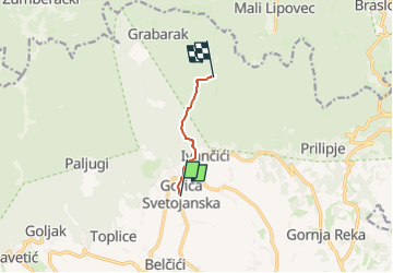

3,7 km | 4,7 km-effort


Tous les sentiers balisés d’Europe GUIDE+


Gratisgps-wandelapplicatie
 SityTrail
IGN / Geografische instituten
SityTrail World
De wereld gaat voor u open
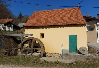
Tocht Te voet van 3,8 km beschikbaar op Onbekend, Zagrebačka županija. Deze tocht wordt voorgesteld door SityTrail - itinéraires balisés pédestres.
Tocht aangemaakt door HPD Jastrebarsko, Jastrebarsko.
Gorica Svetojanska (autobusno stajalište) - Ivančići (Šumski dvor) - Mačkov jarak - Okretaljka - Pl. dom Žitnica
Te voet

Te voet

Te voet
Te voet
Te voet
Te voet
Te voet

Te voet
Te voet