![](/images/other/stat-length.png)
![Tocht Te voet Přestanov - [Ž] Přestanov - Varvažov - Photo](https://media.geolcdn.com/t/1900/400/f60f5d9c-aa80-479b-8ef0-ce6e71c017b2.jpeg&format=pjpeg&maxdim=2)
[Ž] Přestanov - Varvažov
SityTrail - itinéraires balisés pédestres
Tous les sentiers balisés d’Europe GUIDE+
![Lengte](/images/other/stat-length.png)
Lengte
6,7 km
![Max. hoogte](https://static1.geolcdn.com/siteimages/upload/files/1508320355ic_sort_altitude_max_24dp.png)
Max. hoogte
349 m
![Positief hoogteverschil](https://static1.geolcdn.com/siteimages/upload/files/1508320355ic_sort_den_pos_24dp.png)
Positief hoogteverschil
181 m
![Km-Effort](/images/other/stat-length.png)
Km-Effort
8,9 km
![Min. hoogte](https://static1.geolcdn.com/siteimages/upload/files/1508320355ic_sort_altitude_min_24dp.png)
Min. hoogte
215 m
![Negatief hoogteverschil](https://static1.geolcdn.com/siteimages/upload/files/1508320355ic_sort_den_neg_24dp.png)
Negatief hoogteverschil
104 m
![Boucle](https://static1.geolcdn.com/siteimages/upload/files/16400158638029165_repeat_loop_refresh_sync_direction_icon.png)
Boucle
Neen
Markering
Datum van aanmaak :
2025-02-07 05:22:06.533
Laatste wijziging :
2025-02-07 05:22:06.533
![Te voet](https://static1.geolcdn.com/sitytour/trail-icons/100.png)
2h00
Moeilijkheid : Gemakkelijk
![Scan deze QR-code om de tocht te openen in de SityTrail-applicatie](https://capi.geolives.com/qq0zvz2zws4bq2lad0pu/sitytour/trails/4344674/qr.png?size=200)
Gratisgps-wandelapplicatie
Over ons
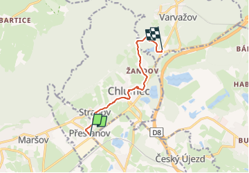
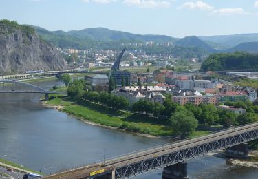
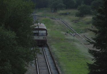
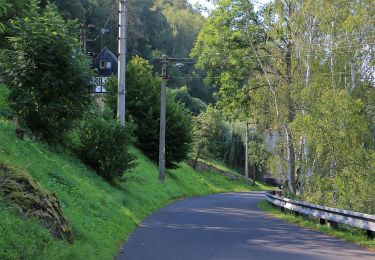
Tocht Te voet van 6,7 km beschikbaar op Noordwest, Ústecký kraj, Přestanov. Deze tocht wordt voorgesteld door SityTrail - itinéraires balisés pédestres.
Beschrijving
Tocht aangemaakt door cz:KČT.
Plaatsbepaling
Land:
Czech Republic
Regio :
Noordwest
Departement/Provincie :
Ústecký kraj
Gemeente :
Přestanov
Locatie:
Unknown
Vertrek:(Dec)
Vertrek:(UTM)
423762 ; 5615457 (33U) N.
Opmerkingen
Wandeltochten in de omgeving
![Tocht Te voet Tisá - [Z] Tisá (bus) – Ostrov - Photo](https://media.geolcdn.com/t/375/260/78f4b062-24a7-4483-95d6-be239bd66196.jpeg&format=jpg&maxdim=2)
![Te voet Te voet](https://static1.geolcdn.com/sitytour/trail-icons/100.png)
[Z] Tisá (bus) – Ostrov
Te voet
Gemakkelijk
Tisá,
Noordwest,
Ústecký kraj,
Czech Republic
![](/images/other/stat-length.png)
3,5 km | 5,3 km-effort
1h 12min
![](https://static1.geolcdn.com/siteimages/upload/files/16400158638029165_repeat_loop_refresh_sync_direction_icon.png)
Neen
![Tocht Te voet Ústí nad Labem - [Z] Sebuzín - Litoměřice - Photo](https://media.geolcdn.com/t/375/260/167dfb07-9404-4e35-a708-f0ca52d05b8b.jpeg&format=jpg&maxdim=2)
![Te voet Te voet](https://static1.geolcdn.com/sitytour/trail-icons/100.png)
[Z] Sebuzín - Litoměřice
Te voet
Gemakkelijk
Ústí nad Labem,
Noordwest,
Ústecký kraj,
Czech Republic
![](/images/other/stat-length.png)
11 km | 16,6 km-effort
3h 46min
![](https://static1.geolcdn.com/siteimages/upload/files/16400158638029165_repeat_loop_refresh_sync_direction_icon.png)
Neen
![Tocht Te voet Ústí nad Labem - NS Větruše - Vrkoč - Photo](https://media.geolcdn.com/t/375/260/250088a6-b70f-4cc7-991c-bc5c16d5177e.jpeg&format=jpg&maxdim=2)
![Te voet Te voet](https://static1.geolcdn.com/sitytour/trail-icons/100.png)
NS Větruše - Vrkoč
Te voet
Gemakkelijk
Ústí nad Labem,
Noordwest,
Ústecký kraj,
Czech Republic
![](/images/other/stat-length.png)
3,7 km | 5,6 km-effort
1h 16min
![](https://static1.geolcdn.com/siteimages/upload/files/16400158638029165_repeat_loop_refresh_sync_direction_icon.png)
Neen
![Tocht Te voet Mikulov - Sklářská NS - Photo](https://media.geolcdn.com/t/375/260/b7c25c96-f53a-4e8a-b4e4-c4dbddd64bdc.jpeg&format=jpg&maxdim=2)
![Te voet Te voet](https://static1.geolcdn.com/sitytour/trail-icons/100.png)
Sklářská NS
Te voet
Medium
Mikulov,
Noordwest,
Ústecký kraj,
Czech Republic
![](/images/other/stat-length.png)
17,4 km | 21 km-effort
4h 51min
![](https://static1.geolcdn.com/siteimages/upload/files/16400158638029165_repeat_loop_refresh_sync_direction_icon.png)
Ja
![Tocht Te voet Povrly - CZ-7044 - Photo](https://media.geolcdn.com/t/375/260/f0d5583d-de2b-4558-b8cc-423fe7624603.jpeg&format=jpg&maxdim=2)
![Te voet Te voet](https://static1.geolcdn.com/sitytour/trail-icons/100.png)
CZ-7044
Te voet
Gemakkelijk
Povrly,
Noordwest,
Ústecký kraj,
Czech Republic
![](/images/other/stat-length.png)
5,5 km | 7 km-effort
1h 35min
![](https://static1.geolcdn.com/siteimages/upload/files/16400158638029165_repeat_loop_refresh_sync_direction_icon.png)
Neen
![Tocht Te voet Malé Žernoseky - NS Brána Čech - Photo](https://media.geolcdn.com/t/375/260/01ba7aae-79f0-4028-9750-4bcd786203bb.jpeg&format=jpg&maxdim=2)
![Te voet Te voet](https://static1.geolcdn.com/sitytour/trail-icons/100.png)
NS Brána Čech
Te voet
Gemakkelijk
Malé Žernoseky,
Noordwest,
Ústecký kraj,
Czech Republic
![](/images/other/stat-length.png)
3,7 km | 5,4 km-effort
1h 13min
![](https://static1.geolcdn.com/siteimages/upload/files/16400158638029165_repeat_loop_refresh_sync_direction_icon.png)
Neen
![Tocht Te voet Ústí nad Labem - [Z] Dobětice - Velké Chvojno - Photo](https://media.geolcdn.com/t/375/260/92f062a0-9eab-432b-8d79-33bfa2de2d0d.jpeg&format=jpg&maxdim=2)
![Te voet Te voet](https://static1.geolcdn.com/sitytour/trail-icons/100.png)
[Z] Dobětice - Velké Chvojno
Te voet
Gemakkelijk
Ústí nad Labem,
Noordwest,
Ústecký kraj,
Czech Republic
![](/images/other/stat-length.png)
9,4 km | 13,7 km-effort
3h 6min
![](https://static1.geolcdn.com/siteimages/upload/files/16400158638029165_repeat_loop_refresh_sync_direction_icon.png)
Neen
![Tocht Te voet Malečov - [Z] Nová Ves - Malečov - Photo](https://media.geolcdn.com/t/375/260/688e9a7f-c1c6-48e7-b04c-0f1bf5f8973f.jpeg&format=jpg&maxdim=2)
![Te voet Te voet](https://static1.geolcdn.com/sitytour/trail-icons/100.png)
[Z] Nová Ves - Malečov
Te voet
Gemakkelijk
Malečov,
Noordwest,
Ústecký kraj,
Czech Republic
![](/images/other/stat-length.png)
4,5 km | 5,8 km-effort
1h 19min
![](https://static1.geolcdn.com/siteimages/upload/files/16400158638029165_repeat_loop_refresh_sync_direction_icon.png)
Neen
![Tocht Te voet Bad Gottleuba-Berggießhübel - [Z] okruh Oelsen - Špičák - Oelsen - Photo](https://media.geolcdn.com/t/375/260/84446251-a0ec-4b89-b1b1-9407074742c9.jpeg&format=jpg&maxdim=2)
![Te voet Te voet](https://static1.geolcdn.com/sitytour/trail-icons/100.png)
[Z] okruh Oelsen - Špičák - Oelsen
Te voet
Gemakkelijk
Bad Gottleuba-Berggießhübel,
Saksen,
Sächsische Schweiz-Osterzgebirge,
Germany
![](/images/other/stat-length.png)
10,5 km | 13,6 km-effort
3h 5min
![](https://static1.geolcdn.com/siteimages/upload/files/16400158638029165_repeat_loop_refresh_sync_direction_icon.png)
Ja