![](/images/other/stat-length.png)
![Tocht Te voet Ralsko - NS Hamry u Jezera - Photo](https://media.geolcdn.com/t/1900/400/8fe2496e-dddb-49e6-978b-0b81795dd600.jpeg&format=pjpeg&maxdim=2)
NS Hamry u Jezera
SityTrail - itinéraires balisés pédestres
Tous les sentiers balisés d’Europe GUIDE+
![Lengte](/images/other/stat-length.png)
Lengte
9,4 km
![Max. hoogte](https://static1.geolcdn.com/siteimages/upload/files/1508320355ic_sort_altitude_max_24dp.png)
Max. hoogte
389 m
![Positief hoogteverschil](https://static1.geolcdn.com/siteimages/upload/files/1508320355ic_sort_den_pos_24dp.png)
Positief hoogteverschil
165 m
![Km-Effort](/images/other/stat-length.png)
Km-Effort
11,6 km
![Min. hoogte](https://static1.geolcdn.com/siteimages/upload/files/1508320355ic_sort_altitude_min_24dp.png)
Min. hoogte
315 m
![Negatief hoogteverschil](https://static1.geolcdn.com/siteimages/upload/files/1508320355ic_sort_den_neg_24dp.png)
Negatief hoogteverschil
167 m
![Boucle](https://static1.geolcdn.com/siteimages/upload/files/16400158638029165_repeat_loop_refresh_sync_direction_icon.png)
Boucle
Ja
Markering
Datum van aanmaak :
2025-02-07 04:08:34.923
Laatste wijziging :
2025-02-07 04:08:34.923
![Te voet](https://static1.geolcdn.com/sitytour/trail-icons/100.png)
2h37
Moeilijkheid : Gemakkelijk
![Scan deze QR-code om de tocht te openen in de SityTrail-applicatie](https://capi.geolives.com/qq0zvz2zws4bq2lad0pu/sitytour/trails/4344572/qr.png?size=200)
Gratisgps-wandelapplicatie
Over ons
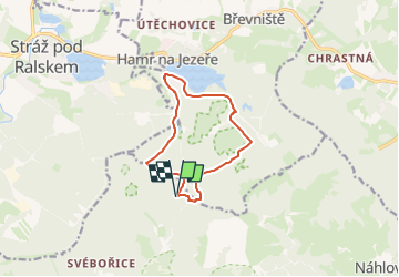
Tocht Te voet van 9,4 km beschikbaar op Noordoost, Liberecký kraj, Ralsko. Deze tocht wordt voorgesteld door SityTrail - itinéraires balisés pédestres.
Beschrijving
Tocht aangemaakt door cz:KČT.
Plaatsbepaling
Land:
Czech Republic
Regio :
Noordoost
Departement/Provincie :
Liberecký kraj
Gemeente :
Ralsko
Locatie:
Unknown
Vertrek:(Dec)
Vertrek:(UTM)
488795 ; 5613747 (33U) N.
Opmerkingen
Wandeltochten in de omgeving
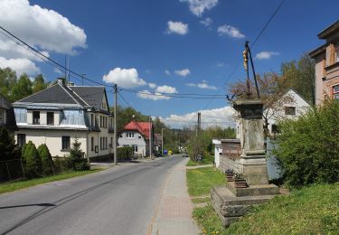
![Tocht Te voet Dubá - [Z] Dubá - místní okruh - Photo](https://media.geolcdn.com/t/375/260/34bbea99-b172-428f-985b-ab1f4428ddc7.jpeg&format=jpg&maxdim=2)
![Te voet Te voet](https://static1.geolcdn.com/sitytour/trail-icons/100.png)
[Z] Dubá - místní okruh
Te voet
Gemakkelijk
Dubá,
Noordoost,
Liberecký kraj,
Czech Republic
![](/images/other/stat-length.png)
6 km | 7,8 km-effort
1h 46min
![](https://static1.geolcdn.com/siteimages/upload/files/16400158638029165_repeat_loop_refresh_sync_direction_icon.png)
Ja
![Tocht Te voet Okna - CZ-3955 - Photo](https://media.geolcdn.com/t/375/260/ef3f6ad6-5c16-42c0-a05d-38e66d8df5a6.jpeg&format=jpg&maxdim=2)
![Te voet Te voet](https://static1.geolcdn.com/sitytour/trail-icons/100.png)
CZ-3955
Te voet
Gemakkelijk
Okna,
Noordoost,
Liberecký kraj,
Czech Republic
![](/images/other/stat-length.png)
4,2 km | 5,7 km-effort
1h 17min
![](https://static1.geolcdn.com/siteimages/upload/files/16400158638029165_repeat_loop_refresh_sync_direction_icon.png)
Neen
![Tocht Te voet Bakov nad Jizerou - Bělá p. Bezdězem (žst., rozc.) - Klokočka - Photo](https://media.geolcdn.com/t/375/260/21932d23-f317-41e3-970d-a5fa4f1651af.jpeg&format=jpg&maxdim=2)
![Te voet Te voet](https://static1.geolcdn.com/sitytour/trail-icons/100.png)
Bělá p. Bezdězem (žst., rozc.) - Klokočka
Te voet
Gemakkelijk
Bakov nad Jizerou,
Centraal-Bohemen,
Onbekend,
Czech Republic
![](/images/other/stat-length.png)
9,3 km | 11,3 km-effort
2h 34min
![](https://static1.geolcdn.com/siteimages/upload/files/16400158638029165_repeat_loop_refresh_sync_direction_icon.png)
Neen
![Tocht Te voet Zákupy - NS Zákupy - Photo](https://media.geolcdn.com/t/375/260/73c27391-a204-4590-805c-e915504c9179.jpeg&format=jpg&maxdim=2)
![Te voet Te voet](https://static1.geolcdn.com/sitytour/trail-icons/100.png)
NS Zákupy
Te voet
Gemakkelijk
Zákupy,
Noordoost,
Liberecký kraj,
Czech Republic
![](/images/other/stat-length.png)
5,8 km | 8,4 km-effort
1h 54min
![](https://static1.geolcdn.com/siteimages/upload/files/16400158638029165_repeat_loop_refresh_sync_direction_icon.png)
Neen
![Tocht Te voet Rychnov u Jablonce nad Nisou - NS manželů Scheybalových 1. část - Photo](https://media.geolcdn.com/t/375/260/20c24816-e22e-43ee-bd40-11c6a6522ec7.jpeg&format=jpg&maxdim=2)
![Te voet Te voet](https://static1.geolcdn.com/sitytour/trail-icons/100.png)
NS manželů Scheybalových 1. část
Te voet
Gemakkelijk
Rychnov u Jablonce nad Nisou,
Noordoost,
Liberecký kraj,
Czech Republic
![](/images/other/stat-length.png)
6,8 km | 9 km-effort
2h 2min
![](https://static1.geolcdn.com/siteimages/upload/files/16400158638029165_repeat_loop_refresh_sync_direction_icon.png)
Neen
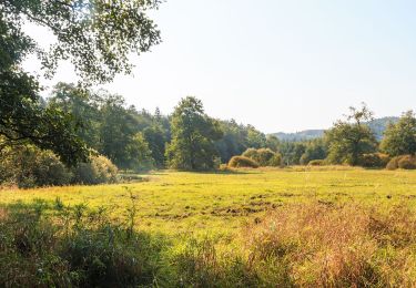
![Tocht Te voet Dlouhý Most - [Ž] Jeřmanice - Vesecký rybník - Photo](https://media.geolcdn.com/t/375/260/ff65f4ef-fc4b-4afc-94c8-b3aecddcea25.jpeg&format=jpg&maxdim=2)
![Te voet Te voet](https://static1.geolcdn.com/sitytour/trail-icons/100.png)
[Ž] Jeřmanice - Vesecký rybník
Te voet
Gemakkelijk
Dlouhý Most,
Noordoost,
Liberecký kraj,
Czech Republic
![](/images/other/stat-length.png)
3,4 km | 4 km-effort
54min
![](https://static1.geolcdn.com/siteimages/upload/files/16400158638029165_repeat_loop_refresh_sync_direction_icon.png)
Neen
![Tocht Te voet Hrádek nad Nisou - NS Pašerácká stezka - Photo](https://media.geolcdn.com/t/375/260/33e0b3d7-a061-4075-ad06-68f770b3455c.jpeg&format=jpg&maxdim=2)
![Te voet Te voet](https://static1.geolcdn.com/sitytour/trail-icons/100.png)
NS Pašerácká stezka
Te voet
Zeer moeilijk
Hrádek nad Nisou,
Noordoost,
Liberecký kraj,
Czech Republic
![](/images/other/stat-length.png)
41 km | 49 km-effort
11h 9min
![](https://static1.geolcdn.com/siteimages/upload/files/16400158638029165_repeat_loop_refresh_sync_direction_icon.png)
Neen
![Tocht Te voet Ralsko - naučná stezka Jeřáb - Photo](https://media.geolcdn.com/t/375/260/117fe431-d1ec-4e00-89fe-5287e3f96880.jpeg&format=jpg&maxdim=2)
![Te voet Te voet](https://static1.geolcdn.com/sitytour/trail-icons/100.png)
naučná stezka Jeřáb
Te voet
Gemakkelijk
Ralsko,
Noordoost,
Liberecký kraj,
Czech Republic
![](/images/other/stat-length.png)
4,1 km | 5,2 km-effort
1h 10min
![](https://static1.geolcdn.com/siteimages/upload/files/16400158638029165_repeat_loop_refresh_sync_direction_icon.png)
Ja
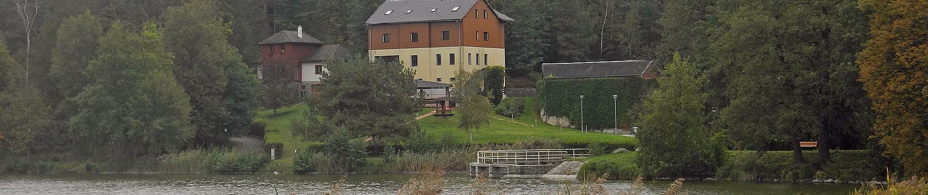
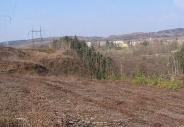
![Tocht Te voet Ralsko - [Ž] Jelení Vrch - Brennský mlýn - Photo](https://media.geolcdn.com/t/375/260/b538ad50-9c11-4eae-ab49-904257cb9a55.jpeg&format=jpg&maxdim=2)
![Te voet Te voet](https://static1.geolcdn.com/sitytour/trail-icons/100.png)
[Ž] Jelení Vrch - Brennský mlýn
Te voet
Gemakkelijk
Ralsko,
Noordoost,
Liberecký kraj,
Czech Republic
![](/images/other/stat-length.png)
4,3 km | 4,8 km-effort
1h 5min
![](https://static1.geolcdn.com/siteimages/upload/files/16400158638029165_repeat_loop_refresh_sync_direction_icon.png)
Neen