![](/images/other/stat-length.png)
![Tocht Te voet Branice - NS Vejrovského zemanství - Photo](https://media.geolcdn.com/t/1900/400/c9857817-7111-4ef9-8729-20b716f6138c.jpeg&format=pjpeg&maxdim=2)
NS Vejrovského zemanství
SityTrail - itinéraires balisés pédestres
Tous les sentiers balisés d’Europe GUIDE+
![Lengte](/images/other/stat-length.png)
Lengte
13,1 km
![Max. hoogte](https://static1.geolcdn.com/siteimages/upload/files/1508320355ic_sort_altitude_max_24dp.png)
Max. hoogte
541 m
![Positief hoogteverschil](https://static1.geolcdn.com/siteimages/upload/files/1508320355ic_sort_den_pos_24dp.png)
Positief hoogteverschil
190 m
![Km-Effort](/images/other/stat-length.png)
Km-Effort
15,6 km
![Min. hoogte](https://static1.geolcdn.com/siteimages/upload/files/1508320355ic_sort_altitude_min_24dp.png)
Min. hoogte
454 m
![Negatief hoogteverschil](https://static1.geolcdn.com/siteimages/upload/files/1508320355ic_sort_den_neg_24dp.png)
Negatief hoogteverschil
190 m
![Boucle](https://static1.geolcdn.com/siteimages/upload/files/16400158638029165_repeat_loop_refresh_sync_direction_icon.png)
Boucle
Ja
Markering
Datum van aanmaak :
2025-02-07 01:40:10.223
Laatste wijziging :
2025-02-07 01:40:10.223
![Te voet](https://static1.geolcdn.com/sitytour/trail-icons/100.png)
3h32
Moeilijkheid : Gemakkelijk
![Scan deze QR-code om de tocht te openen in de SityTrail-applicatie](https://capi.geolives.com/qq0zvz2zws4bq2lad0pu/sitytour/trails/4344414/qr.png?size=200)
Gratisgps-wandelapplicatie
Over ons
Tocht Te voet van 13,1 km beschikbaar op Zuidwest, Zuid-Bohemen, Branice. Deze tocht wordt voorgesteld door SityTrail - itinéraires balisés pédestres.
Beschrijving
Tocht aangemaakt door cz:KČT.
Plaatsbepaling
Land:
Czech Republic
Regio :
Zuidwest
Departement/Provincie :
Zuid-Bohemen
Gemeente :
Branice
Locatie:
Unknown
Vertrek:(Dec)
Vertrek:(UTM)
452407 ; 5472322 (33U) N.
Opmerkingen
Wandeltochten in de omgeving
![Tocht Te voet Albrechtice nad Vltavou - Historická stezka Albrechtickem - Photo](https://media.geolcdn.com/t/375/260/4ec0b7ff-0c97-4fba-b42c-637cce5f02aa.jpeg&format=jpg&maxdim=2)
![Te voet Te voet](https://static1.geolcdn.com/sitytour/trail-icons/100.png)
Historická stezka Albrechtickem
Te voet
Gemakkelijk
Albrechtice nad Vltavou,
Zuidwest,
Zuid-Bohemen,
Czech Republic
![](/images/other/stat-length.png)
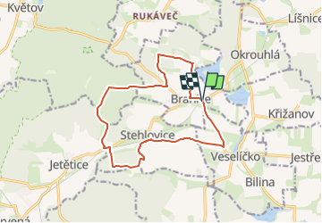
13,5 km | 16,3 km-effort
3h 42min
![](https://static1.geolcdn.com/siteimages/upload/files/16400158638029165_repeat_loop_refresh_sync_direction_icon.png)
Neen
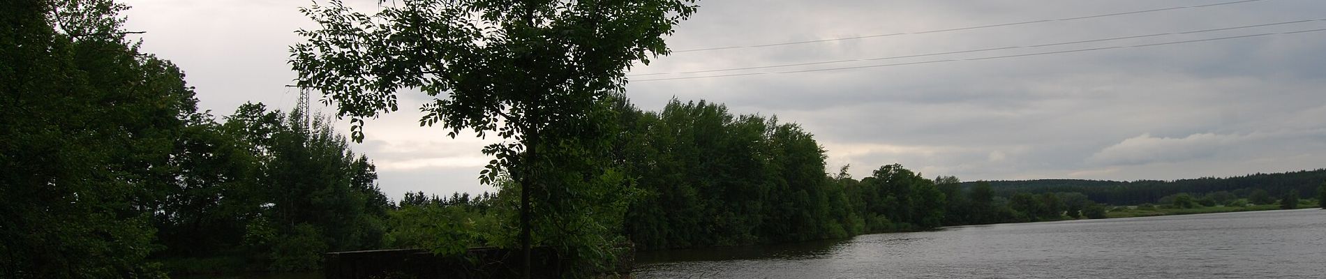
![Tocht Te voet Písek - [Č] Písek - Velká Brašna - Photo](https://media.geolcdn.com/t/375/260/bfca88cd-0504-44c2-9a66-8e406f087387.jpeg&format=jpg&maxdim=2)
![Te voet Te voet](https://static1.geolcdn.com/sitytour/trail-icons/100.png)
[Č] Písek - Velká Brašna
Te voet
Gemakkelijk
Písek,
Zuidwest,
Zuid-Bohemen,
Czech Republic
![](/images/other/stat-length.png)
6,3 km | 8,9 km-effort
2h 1min
![](https://static1.geolcdn.com/siteimages/upload/files/16400158638029165_repeat_loop_refresh_sync_direction_icon.png)
Neen
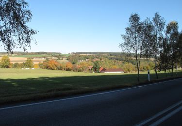
![Tocht Te voet Týn nad Vltavou - [Ž] Nad Překvapením - Semenec (rozhl.) - Photo](https://media.geolcdn.com/t/375/260/5b43c739-7905-4a0c-8a8b-63468991b1a9.jpeg&format=jpg&maxdim=2)
![Te voet Te voet](https://static1.geolcdn.com/sitytour/trail-icons/100.png)
[Ž] Nad Překvapením - Semenec (rozhl.)
Te voet
Gemakkelijk
Týn nad Vltavou,
Zuidwest,
Zuid-Bohemen,
Czech Republic
![](/images/other/stat-length.png)
3,1 km | 4,1 km-effort
55min
![](https://static1.geolcdn.com/siteimages/upload/files/16400158638029165_repeat_loop_refresh_sync_direction_icon.png)
Neen
![Tocht Te voet Všemyslice - naučná stezka Za Neznašovským kohoutem - Photo](https://media.geolcdn.com/t/375/260/d0ca1351-ea77-4047-a33d-45b3a503a3ef.jpeg&format=jpg&maxdim=2)
![Te voet Te voet](https://static1.geolcdn.com/sitytour/trail-icons/100.png)
naučná stezka Za Neznašovským kohoutem
Te voet
Gemakkelijk
Všemyslice,
Zuidwest,
Zuid-Bohemen,
Czech Republic
![](/images/other/stat-length.png)
4,7 km | 6,4 km-effort
1h 27min
![](https://static1.geolcdn.com/siteimages/upload/files/16400158638029165_repeat_loop_refresh_sync_direction_icon.png)
Ja
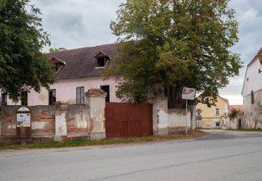
![Tocht Te voet Milevsko - [Č] Milevsko - Jetětice - Photo](https://media.geolcdn.com/t/375/260/19b73443-10f3-4ee2-b906-2593e9794aea.jpeg&format=jpg&maxdim=2)
![Te voet Te voet](https://static1.geolcdn.com/sitytour/trail-icons/100.png)
[Č] Milevsko - Jetětice
Te voet
Gemakkelijk
Milevsko,
Zuidwest,
Zuid-Bohemen,
Czech Republic
![](/images/other/stat-length.png)
11,8 km | 14,8 km-effort
3h 21min
![](https://static1.geolcdn.com/siteimages/upload/files/16400158638029165_repeat_loop_refresh_sync_direction_icon.png)
Neen
![Tocht Te voet Písek - NS Od Ptáčkovny k Živci - Photo](https://media.geolcdn.com/t/375/260/cb7dd3a0-b882-4d93-a910-805045955afa.jpeg&format=jpg&maxdim=2)
![Te voet Te voet](https://static1.geolcdn.com/sitytour/trail-icons/100.png)
NS Od Ptáčkovny k Živci
Te voet
Gemakkelijk
Písek,
Zuidwest,
Zuid-Bohemen,
Czech Republic
![](/images/other/stat-length.png)
3,4 km | 5,5 km-effort
1h 15min
![](https://static1.geolcdn.com/siteimages/upload/files/16400158638029165_repeat_loop_refresh_sync_direction_icon.png)
Neen
![Tocht Te voet Milevsko - [Ž] Budák rybník - Karlov - Photo](https://media.geolcdn.com/t/375/260/6a7dbc34-5b93-44a1-bcc9-52d789012a05.jpeg&format=jpg&maxdim=2)
![Te voet Te voet](https://static1.geolcdn.com/sitytour/trail-icons/100.png)
[Ž] Budák rybník - Karlov
Te voet
Gemakkelijk
Milevsko,
Zuidwest,
Zuid-Bohemen,
Czech Republic
![](/images/other/stat-length.png)
3,6 km | 4,3 km-effort
58min
![](https://static1.geolcdn.com/siteimages/upload/files/16400158638029165_repeat_loop_refresh_sync_direction_icon.png)
Neen
![Tocht Te voet Lety - NS Lety - Photo](https://media.geolcdn.com/t/375/260/d835afd1-38cc-4ff7-be4f-069fcf082a0b.jpeg&format=jpg&maxdim=2)
![Te voet Te voet](https://static1.geolcdn.com/sitytour/trail-icons/100.png)
NS Lety
Te voet
Gemakkelijk
Lety,
Zuidwest,
Zuid-Bohemen,
Czech Republic
![](/images/other/stat-length.png)
3,4 km | 4 km-effort
54min
![](https://static1.geolcdn.com/siteimages/upload/files/16400158638029165_repeat_loop_refresh_sync_direction_icon.png)
Neen
![Tocht Te voet Písek - NS Školní polesí - Hůrka - Photo](https://media.geolcdn.com/t/375/260/7133faff-b21d-41b6-9f51-c54858ab31a0.jpeg&format=jpg&maxdim=2)
![Te voet Te voet](https://static1.geolcdn.com/sitytour/trail-icons/100.png)
NS Školní polesí - Hůrka
Te voet
Gemakkelijk
Písek,
Zuidwest,
Zuid-Bohemen,
Czech Republic
![](/images/other/stat-length.png)
9,5 km | 12 km-effort
2h 43min
![](https://static1.geolcdn.com/siteimages/upload/files/16400158638029165_repeat_loop_refresh_sync_direction_icon.png)
Ja