![](/images/other/stat-length.png)
![Tocht Te voet Milevsko - Vlastivědná NS Milevsko - Photo](https://media.geolcdn.com/t/1900/400/2720f680-a16a-4afc-9976-9a0d8a10a81b.jpeg&format=pjpeg&maxdim=2)
Vlastivědná NS Milevsko
SityTrail - itinéraires balisés pédestres
Tous les sentiers balisés d’Europe GUIDE+
![Lengte](/images/other/stat-length.png)
Lengte
18,5 km
![Max. hoogte](https://static1.geolcdn.com/siteimages/upload/files/1508320355ic_sort_altitude_max_24dp.png)
Max. hoogte
546 m
![Positief hoogteverschil](https://static1.geolcdn.com/siteimages/upload/files/1508320355ic_sort_den_pos_24dp.png)
Positief hoogteverschil
327 m
![Km-Effort](/images/other/stat-length.png)
Km-Effort
23 km
![Min. hoogte](https://static1.geolcdn.com/siteimages/upload/files/1508320355ic_sort_altitude_min_24dp.png)
Min. hoogte
429 m
![Negatief hoogteverschil](https://static1.geolcdn.com/siteimages/upload/files/1508320355ic_sort_den_neg_24dp.png)
Negatief hoogteverschil
324 m
![Boucle](https://static1.geolcdn.com/siteimages/upload/files/16400158638029165_repeat_loop_refresh_sync_direction_icon.png)
Boucle
Ja
Markering
Datum van aanmaak :
2025-02-06 19:52:11.464
Laatste wijziging :
2025-02-06 19:52:11.464
![Te voet](https://static1.geolcdn.com/sitytour/trail-icons/100.png)
5h10
Moeilijkheid : Medium
![Scan deze QR-code om de tocht te openen in de SityTrail-applicatie](https://capi.geolives.com/qq0zvz2zws4bq2lad0pu/sitytour/trails/4343986/qr.png?size=200)
Gratisgps-wandelapplicatie
Over ons
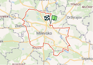
Tocht Te voet van 18,5 km beschikbaar op Zuidwest, Zuid-Bohemen, Milevsko. Deze tocht wordt voorgesteld door SityTrail - itinéraires balisés pédestres.
Beschrijving
Tocht aangemaakt door cz:KČT.
Plaatsbepaling
Land:
Czech Republic
Regio :
Zuidwest
Departement/Provincie :
Zuid-Bohemen
Gemeente :
Milevsko
Locatie:
Unknown
Vertrek:(Dec)
Vertrek:(UTM)
454248 ; 5478590 (33U) N.
Opmerkingen
Wandeltochten in de omgeving
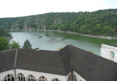
![Tocht Te voet Krásná Hora nad Vltavou - [Ž] U Slupné strouhy - Krásná Hora - Photo](https://media.geolcdn.com/t/375/260/a05476e2-d42f-4e1a-8934-678ca86e1888.jpeg&format=jpg&maxdim=2)
![Te voet Te voet](https://static1.geolcdn.com/sitytour/trail-icons/100.png)
[Ž] U Slupné strouhy - Krásná Hora
Te voet
Gemakkelijk
Krásná Hora nad Vltavou,
Centraal-Bohemen,
Onbekend,
Czech Republic
![](/images/other/stat-length.png)
3,7 km | 4,5 km-effort
1h 1min
![](https://static1.geolcdn.com/siteimages/upload/files/16400158638029165_repeat_loop_refresh_sync_direction_icon.png)
Neen
![Tocht Te voet Orlík nad Vltavou - naučná stezka Zvíkov – Orlík - Photo](https://media.geolcdn.com/t/375/260/6135ff18-8c62-44fc-9d21-185c751ed74e.jpeg&format=jpg&maxdim=2)
![Te voet Te voet](https://static1.geolcdn.com/sitytour/trail-icons/100.png)
naučná stezka Zvíkov – Orlík
Te voet
Moeilijk
Orlík nad Vltavou,
Zuidwest,
Zuid-Bohemen,
Czech Republic
![](/images/other/stat-length.png)
24 km | 31 km-effort
7h 6min
![](https://static1.geolcdn.com/siteimages/upload/files/16400158638029165_repeat_loop_refresh_sync_direction_icon.png)
Neen
![Tocht Te voet Písek - [Z] Zátavský most - Písek, koupaliště - Photo](https://media.geolcdn.com/t/375/260/42c7e9c9-a795-4149-acf3-650d5b8ac140.jpeg&format=jpg&maxdim=2)
![Te voet Te voet](https://static1.geolcdn.com/sitytour/trail-icons/100.png)
[Z] Zátavský most - Písek, koupaliště
Te voet
Gemakkelijk
Písek,
Zuidwest,
Zuid-Bohemen,
Czech Republic
![](/images/other/stat-length.png)
4,4 km | 5,2 km-effort
1h 10min
![](https://static1.geolcdn.com/siteimages/upload/files/16400158638029165_repeat_loop_refresh_sync_direction_icon.png)
Neen
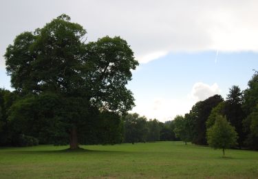
![Tocht Te voet Varvažov - [Ž] Varvažov - U mostu - Photo](https://media.geolcdn.com/t/375/260/a4e04a71-baf8-4e14-ba58-e9217997d189.jpeg&format=jpg&maxdim=2)
![Te voet Te voet](https://static1.geolcdn.com/sitytour/trail-icons/100.png)
[Ž] Varvažov - U mostu
Te voet
Gemakkelijk
Varvažov,
Zuidwest,
Zuid-Bohemen,
Czech Republic
![](/images/other/stat-length.png)
6,6 km | 8,3 km-effort
1h 52min
![](https://static1.geolcdn.com/siteimages/upload/files/16400158638029165_repeat_loop_refresh_sync_direction_icon.png)
Neen
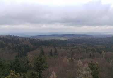
![Tocht Te voet Čížová - [M] Okružní trasa: Vráž - Photo](https://media.geolcdn.com/t/375/260/7488c712-f024-48f1-a9f9-6eb4c1952648.jpeg&format=jpg&maxdim=2)
![Te voet Te voet](https://static1.geolcdn.com/sitytour/trail-icons/100.png)
[M] Okružní trasa: Vráž
Te voet
Gemakkelijk
Čížová,
Zuidwest,
Zuid-Bohemen,
Czech Republic
![](/images/other/stat-length.png)
5 km | 6,6 km-effort
1h 29min
![](https://static1.geolcdn.com/siteimages/upload/files/16400158638029165_repeat_loop_refresh_sync_direction_icon.png)
Ja
![Tocht Te voet Orlík nad Vltavou - Okružní trasa - park - Photo](https://media.geolcdn.com/t/375/260/5c4d4c1d-4a43-47eb-a637-684378c5c2e3.jpeg&format=jpg&maxdim=2)
![Te voet Te voet](https://static1.geolcdn.com/sitytour/trail-icons/100.png)
Okružní trasa - park
Te voet
Gemakkelijk
Orlík nad Vltavou,
Zuidwest,
Zuid-Bohemen,
Czech Republic
![](/images/other/stat-length.png)
4,2 km | 5,1 km-effort
1h 9min
![](https://static1.geolcdn.com/siteimages/upload/files/16400158638029165_repeat_loop_refresh_sync_direction_icon.png)
Neen
![Tocht Te voet Písek - Cesta drahokamů - Photo](https://media.geolcdn.com/t/375/260/c272ea0a-0350-4540-a394-87960286de9a.jpeg&format=jpg&maxdim=2)
![Te voet Te voet](https://static1.geolcdn.com/sitytour/trail-icons/100.png)
Cesta drahokamů
Te voet
Gemakkelijk
Písek,
Zuidwest,
Zuid-Bohemen,
Czech Republic
![](/images/other/stat-length.png)
6,1 km | 9 km-effort
2h 3min
![](https://static1.geolcdn.com/siteimages/upload/files/16400158638029165_repeat_loop_refresh_sync_direction_icon.png)
Neen
![Tocht Te voet Písek - [M] Smrkovice - Protivín - Photo](https://media.geolcdn.com/t/375/260/0e1a79da-d78d-470d-ae1f-52194443f13d.jpeg&format=jpg&maxdim=2)
![Te voet Te voet](https://static1.geolcdn.com/sitytour/trail-icons/100.png)
[M] Smrkovice - Protivín
Te voet
Gemakkelijk
Písek,
Zuidwest,
Zuid-Bohemen,
Czech Republic
![](/images/other/stat-length.png)
9,5 km | 11,3 km-effort
2h 34min
![](https://static1.geolcdn.com/siteimages/upload/files/16400158638029165_repeat_loop_refresh_sync_direction_icon.png)
Neen
![Tocht Te voet Kovářov - [Č] Radava-Onen svět - Photo](https://media.geolcdn.com/t/375/260/6d59da1a-8e91-45bb-b42f-3bc1987e91aa.jpeg&format=jpg&maxdim=2)
![Te voet Te voet](https://static1.geolcdn.com/sitytour/trail-icons/100.png)
[Č] Radava-Onen svět
Te voet
Gemakkelijk
Kovářov,
Zuidwest,
Zuid-Bohemen,
Czech Republic
![](/images/other/stat-length.png)
10 km | 12 km-effort
2h 44min
![](https://static1.geolcdn.com/siteimages/upload/files/16400158638029165_repeat_loop_refresh_sync_direction_icon.png)
Neen