![](/images/other/stat-length.png)
![Tocht Te voet Dubá - Dubský okruh - Photo](https://media.geolcdn.com/t/1900/400/aa163c54-ff80-49d3-bffe-c3b99126a99c.jpeg&format=pjpeg&maxdim=2)
Dubský okruh
SityTrail - itinéraires balisés pédestres
Tous les sentiers balisés d’Europe GUIDE+
![Lengte](/images/other/stat-length.png)
Lengte
12,5 km
![Max. hoogte](https://static1.geolcdn.com/siteimages/upload/files/1508320355ic_sort_altitude_max_24dp.png)
Max. hoogte
360 m
![Positief hoogteverschil](https://static1.geolcdn.com/siteimages/upload/files/1508320355ic_sort_den_pos_24dp.png)
Positief hoogteverschil
276 m
![Km-Effort](/images/other/stat-length.png)
Km-Effort
16,2 km
![Min. hoogte](https://static1.geolcdn.com/siteimages/upload/files/1508320355ic_sort_altitude_min_24dp.png)
Min. hoogte
247 m
![Negatief hoogteverschil](https://static1.geolcdn.com/siteimages/upload/files/1508320355ic_sort_den_neg_24dp.png)
Negatief hoogteverschil
276 m
![Boucle](https://static1.geolcdn.com/siteimages/upload/files/16400158638029165_repeat_loop_refresh_sync_direction_icon.png)
Boucle
Ja
Markering
Datum van aanmaak :
2025-02-06 18:29:47.088
Laatste wijziging :
2025-02-06 18:29:47.088
![Te voet](https://static1.geolcdn.com/sitytour/trail-icons/100.png)
3h40
Moeilijkheid : Gemakkelijk
![Scan deze QR-code om de tocht te openen in de SityTrail-applicatie](https://capi.geolives.com/qq0zvz2zws4bq2lad0pu/sitytour/trails/4343873/qr.png?size=200)
Gratisgps-wandelapplicatie
Over ons
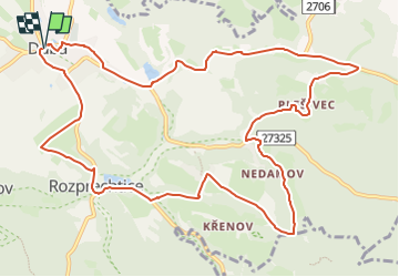
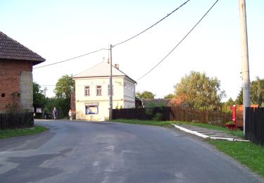
Tocht Te voet van 12,5 km beschikbaar op Noordoost, Liberecký kraj, Dubá. Deze tocht wordt voorgesteld door SityTrail - itinéraires balisés pédestres.
Beschrijving
Tocht aangemaakt door cz:KČT.
Plaatsbepaling
Land:
Czech Republic
Regio :
Noordoost
Departement/Provincie :
Liberecký kraj
Gemeente :
Dubá
Locatie:
Unknown
Vertrek:(Dec)
Vertrek:(UTM)
467394 ; 5598815 (33U) N.
Opmerkingen
Wandeltochten in de omgeving
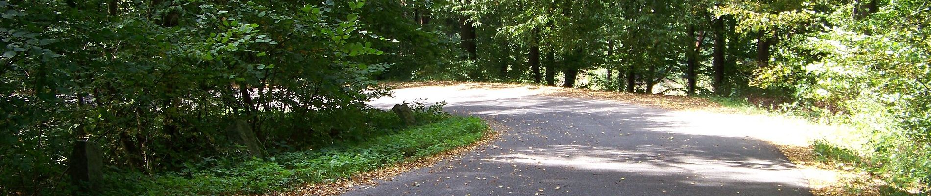
![Tocht Te voet Liběšice - [Ž] Liběšice - Sedlo (pod vrcholem) - Photo](https://media.geolcdn.com/t/375/260/e30fd15b-188b-44c1-93c2-4da6babe0937.jpeg&format=jpg&maxdim=2)
![Te voet Te voet](https://static1.geolcdn.com/sitytour/trail-icons/100.png)
[Ž] Liběšice - Sedlo (pod vrcholem)
Te voet
Gemakkelijk
Liběšice,
Noordwest,
Ústecký kraj,
Czech Republic
![](/images/other/stat-length.png)
4,1 km | 7,4 km-effort
1h 40min
![](https://static1.geolcdn.com/siteimages/upload/files/16400158638029165_repeat_loop_refresh_sync_direction_icon.png)
Neen
![Tocht Te voet Úštěk - Hrádecký okruh - Photo](https://media.geolcdn.com/t/375/260/fb7ec991-2df8-40ba-9a3a-b00ab90a3004.jpeg&format=jpg&maxdim=2)
![Te voet Te voet](https://static1.geolcdn.com/sitytour/trail-icons/100.png)
Hrádecký okruh
Te voet
Gemakkelijk
Úštěk,
Noordwest,
Ústecký kraj,
Czech Republic
![](/images/other/stat-length.png)
5,8 km | 8,1 km-effort
1h 50min
![](https://static1.geolcdn.com/siteimages/upload/files/16400158638029165_repeat_loop_refresh_sync_direction_icon.png)
Ja
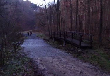
![Tocht Te voet Vysoká - [Ž] Harasov - Chloumek - Photo](https://media.geolcdn.com/t/375/260/bc275f67-78cb-4ea7-af7b-1cfdb0fea829.jpeg&format=jpg&maxdim=2)
![Te voet Te voet](https://static1.geolcdn.com/sitytour/trail-icons/100.png)
[Ž] Harasov - Chloumek
Te voet
Gemakkelijk
Vysoká,
Centraal-Bohemen,
Onbekend,
Czech Republic
![](/images/other/stat-length.png)
8,4 km | 10,4 km-effort
2h 22min
![](https://static1.geolcdn.com/siteimages/upload/files/16400158638029165_repeat_loop_refresh_sync_direction_icon.png)
Neen
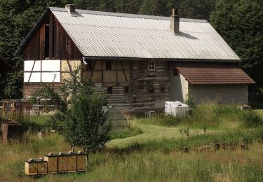
![Tocht Te voet Štětí - [M] Štětí - Ledčice - Photo](https://media.geolcdn.com/t/375/260/bec04fab-17ef-4ed8-9aa1-9f79da79c802.jpeg&format=jpg&maxdim=2)
![Te voet Te voet](https://static1.geolcdn.com/sitytour/trail-icons/100.png)
[M] Štětí - Ledčice
Te voet
Moeilijk
Štětí,
Noordwest,
Ústecký kraj,
Czech Republic
![](/images/other/stat-length.png)
28 km | 35 km-effort
8h 2min
![](https://static1.geolcdn.com/siteimages/upload/files/16400158638029165_repeat_loop_refresh_sync_direction_icon.png)
Neen
![Tocht Te voet Bělá pod Bezdězem - Okružní Bělá p. B. - Valdštejnsko - Photo](https://media.geolcdn.com/t/375/260/2dbc0189-a80e-49e5-b256-7dee5247b0c6.jpeg&format=jpg&maxdim=2)
![Te voet Te voet](https://static1.geolcdn.com/sitytour/trail-icons/100.png)
Okružní Bělá p. B. - Valdštejnsko
Te voet
Gemakkelijk
Bělá pod Bezdězem,
Centraal-Bohemen,
Onbekend,
Czech Republic
![](/images/other/stat-length.png)
9,1 km | 10,8 km-effort
2h 26min
![](https://static1.geolcdn.com/siteimages/upload/files/16400158638029165_repeat_loop_refresh_sync_direction_icon.png)
Neen
![Tocht Te voet Ralsko - [M] místní okruh - Photo](https://media.geolcdn.com/t/375/260/9d0bc935-9f2f-4659-bde0-51fc83ef0549.jpeg&format=jpg&maxdim=2)
![Te voet Te voet](https://static1.geolcdn.com/sitytour/trail-icons/100.png)
[M] místní okruh
Te voet
Gemakkelijk
Ralsko,
Noordoost,
Liberecký kraj,
Czech Republic
![](/images/other/stat-length.png)
16,5 km | 19,6 km-effort
4h 27min
![](https://static1.geolcdn.com/siteimages/upload/files/16400158638029165_repeat_loop_refresh_sync_direction_icon.png)
Ja
![Tocht Te voet Kokořín - CZ-6085 - Photo](https://media.geolcdn.com/t/375/260/072acdae-ecee-46f8-9db4-3714e691d52d.jpeg&format=jpg&maxdim=2)
![Te voet Te voet](https://static1.geolcdn.com/sitytour/trail-icons/100.png)
CZ-6085
Te voet
Gemakkelijk
Kokořín,
Centraal-Bohemen,
Onbekend,
Czech Republic
![](/images/other/stat-length.png)
4,9 km | 6,3 km-effort
1h 25min
![](https://static1.geolcdn.com/siteimages/upload/files/16400158638029165_repeat_loop_refresh_sync_direction_icon.png)
Neen
![Tocht Te voet Kokořín - [Č] Jestřebice - Klemperka - Photo](https://media.geolcdn.com/t/375/260/072acdae-ecee-46f8-9db4-3714e691d52d.jpeg&format=jpg&maxdim=2)
![Te voet Te voet](https://static1.geolcdn.com/sitytour/trail-icons/100.png)
[Č] Jestřebice - Klemperka
Te voet
Gemakkelijk
Kokořín,
Centraal-Bohemen,
Onbekend,
Czech Republic
![](/images/other/stat-length.png)
6,2 km | 8,1 km-effort
1h 50min
![](https://static1.geolcdn.com/siteimages/upload/files/16400158638029165_repeat_loop_refresh_sync_direction_icon.png)
Neen
![Tocht Te voet Mělník - [Z] Mělník - okružní trasa - Photo](https://media.geolcdn.com/t/375/260/e6c96ca9-333e-4cf1-8b0e-018ae508ba3d.jpeg&format=jpg&maxdim=2)
![Te voet Te voet](https://static1.geolcdn.com/sitytour/trail-icons/100.png)
[Z] Mělník - okružní trasa
Te voet
Moeilijk
Mělník,
Centraal-Bohemen,
Onbekend,
Czech Republic
![](/images/other/stat-length.png)
27 km | 32 km-effort
7h 20min
![](https://static1.geolcdn.com/siteimages/upload/files/16400158638029165_repeat_loop_refresh_sync_direction_icon.png)
Ja