


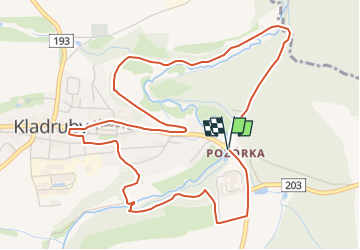

11,8 km | 15,7 km-effort

Tous les sentiers balisés d’Europe GUIDE+


Gratisgps-wandelapplicatie
 SityTrail
IGN / Geografische instituten
SityTrail World
De wereld gaat voor u open
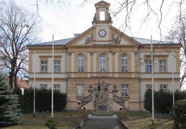
Tocht Te voet van 5,8 km beschikbaar op Zuidwest, Regio Pilsen, Kladruby. Deze tocht wordt voorgesteld door SityTrail - itinéraires balisés pédestres.
Tocht aangemaakt door cz:KČT.


![Tocht Te voet Hradec - [Z] Hradec - Vytůň - Photo](https://media.geolcdn.com/t/375/260/36372a90-b81a-4a71-9876-a3bf9f884ffe.jpeg&format=jpg&maxdim=2)
Te voet
![Tocht Te voet Stod - [Ž] Stod - Vytůň - Photo](https://media.geolcdn.com/t/375/260/5f465939-ef20-4d07-aeae-d7b7b507e19b.jpeg&format=jpg&maxdim=2)
Te voet
Te voet
Te voet
![Tocht Te voet Chotěšov - [Z] Chotěšov - Chudenice - Photo](https://media.geolcdn.com/t/375/260/db6e0667-71ef-4d53-8b64-8b347f6d468d.jpeg&format=jpg&maxdim=2)
Te voet
![Tocht Te voet Holýšov - [Č] Stod - Holýšov - Photo](https://media.geolcdn.com/t/375/260/90aeb2c9-5fc5-41c2-ad60-4fffca584599.jpeg&format=jpg&maxdim=2)
Te voet
![Tocht Te voet Stráž - [Ž] Okružní trasa Sycherák - Photo](https://media.geolcdn.com/t/375/260/86edae86-c7c1-4be9-b771-38fd9cce5c41.jpeg&format=jpg&maxdim=2)
Te voet
Te voet
Te voet