


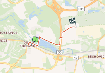

11,2 km | 13 km-effort
![Tocht Te voet Unknown - [Ž] Dolní Počernice - V Ořešinách - Photo](https://media.geolcdn.com/t/1900/400/c6bb931a-a816-4d79-956b-22847f87c90f.jpeg&format=pjpeg&maxdim=2)

Tous les sentiers balisés d’Europe GUIDE+


Gratisgps-wandelapplicatie
 SityTrail
IGN / Geografische instituten
SityTrail World
De wereld gaat voor u open
Tocht Te voet van 3,2 km beschikbaar op Praha, Praag. Deze tocht wordt voorgesteld door SityTrail - itinéraires balisés pédestres.
Tocht aangemaakt door cz:KČT.
![Tocht Te voet Unknown - [Ž] Dolní Počernice - V Ořešinách - Photo 1](https://media.geolcdn.com/t/2048/auto/0bc2c922-3fb8-4fad-bf36-6628b50e8210.jpeg&format=jpg&maxdim=0 "Tocht Te voet Unknown - [Ž] Dolní Počernice - V Ořešinách - Photo 1")
![Tocht Te voet Unknown - [Ž] Dolní Počernice - V Ořešinách - Photo 2](https://media.geolcdn.com/t/2048/auto/527b6b62-0349-4e3d-b6ef-d98b5ce8fd9c.jpeg&format=jpg&maxdim=0 "Tocht Te voet Unknown - [Ž] Dolní Počernice - V Ořešinách - Photo 2")
![Tocht Te voet Unknown - [Ž] Dolní Počernice - V Ořešinách - Photo 3](https://media.geolcdn.com/t/2048/auto/e24293cb-5e60-4131-bd06-a4c6029aee65.jpeg&format=jpg&maxdim=0 "Tocht Te voet Unknown - [Ž] Dolní Počernice - V Ořešinách - Photo 3")
![Tocht Te voet Unknown - [Ž] Dolní Počernice - V Ořešinách - Photo 4](https://media.geolcdn.com/t/2048/auto/03a67f3b-c3e8-40bf-9178-ebec2105d9a2.jpeg&format=jpg&maxdim=0 "Tocht Te voet Unknown - [Ž] Dolní Počernice - V Ořešinách - Photo 4")
![Tocht Te voet Unknown - [Ž] Dolní Počernice - V Ořešinách - Photo 5](https://media.geolcdn.com/t/2048/auto/c2f4ec94-773b-4406-9f68-7c54edaed0b4.jpeg&format=jpg&maxdim=0 "Tocht Te voet Unknown - [Ž] Dolní Počernice - V Ořešinách - Photo 5")
![Tocht Te voet Unknown - [Ž] Dolní Počernice - V Ořešinách - Photo 6](https://media.geolcdn.com/t/2048/auto/78aded78-e4db-4d0c-a467-4dc17c6d970b.jpeg&format=jpg&maxdim=0 "Tocht Te voet Unknown - [Ž] Dolní Počernice - V Ořešinách - Photo 6")
![Tocht Te voet Unknown - [Ž] Dolní Počernice - V Ořešinách - Photo 7](https://media.geolcdn.com/t/2048/auto/8b0535f1-d483-4b0f-8b50-2e8a2aa89e8f.jpeg&format=jpg&maxdim=0 "Tocht Te voet Unknown - [Ž] Dolní Počernice - V Ořešinách - Photo 7")
![Tocht Te voet Unknown - [Ž] Dolní Počernice - V Ořešinách - Photo 8](https://media.geolcdn.com/t/2048/auto/743e3736-984a-46fa-9475-2c6dc597470f.jpeg&format=jpg&maxdim=0 "Tocht Te voet Unknown - [Ž] Dolní Počernice - V Ořešinách - Photo 8")
![Tocht Te voet Unknown - [Ž] Dolní Počernice - V Ořešinách - Photo 9](https://media.geolcdn.com/t/2048/auto/8d0a211a-c6b7-4e1d-9085-087c62df1b2e.jpeg&format=jpg&maxdim=0 "Tocht Te voet Unknown - [Ž] Dolní Počernice - V Ořešinách - Photo 9")
![Tocht Te voet Unknown - [Ž] Dolní Počernice - V Ořešinách - Photo 10](https://media.geolcdn.com/t/2048/auto/c6bb931a-a816-4d79-956b-22847f87c90f.jpeg&format=jpg&maxdim=0 "Tocht Te voet Unknown - [Ž] Dolní Počernice - V Ořešinách - Photo 10")
![Tocht Te voet - [Č] Uhříněves-Běchovice - Photo](https://media.geolcdn.com/t/375/260/625eae54-70bc-435a-bd59-da7017d51f0c.jpeg&format=jpg&maxdim=2)
Te voet
![Tocht Te voet - [Č] Běchovice-Úvaly - Photo](https://media.geolcdn.com/t/375/260/1e5c4a6d-a086-48d0-985d-e933c545c471.jpeg&format=jpg&maxdim=2)
Te voet
![Tocht Te voet - [Z] Klánovice - okružní trasa - Photo](https://media.geolcdn.com/t/375/260/9c6d29df-bba0-4cdc-ad39-46418b50c165.jpeg&format=jpg&maxdim=2)
Te voet