


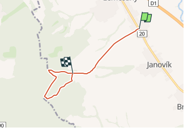

5,5 km | 8,3 km-effort


Tous les sentiers balisés d’Europe GUIDE+


Gratisgps-wandelapplicatie
 SityTrail
IGN / Geografische instituten
SityTrail World
De wereld gaat voor u open
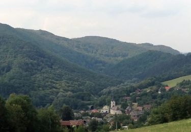
Tocht Te voet van 4,6 km beschikbaar op Prešovský kraj, Onbekend, okres Prešov. Deze tocht wordt voorgesteld door SityTrail - itinéraires balisés pédestres.
Tocht aangemaakt door Záhrada pohybu.
symbol for all 4 routes is actually green backslash but routes have separate colors on guideposts


Te voet
Te voet
Te voet