![](/images/other/stat-length.png)
![Tocht Te voet okres Prešov - Náučný chodník Kamenná Baba - Lačnov - Photo](https://media.geolcdn.com/t/1900/400/782489b6-50e9-4f49-a126-15da6e05cffe.jpeg&format=pjpeg&maxdim=2)
Náučný chodník Kamenná Baba - Lačnov
SityTrail - itinéraires balisés pédestres
Tous les sentiers balisés d’Europe GUIDE+
![Lengte](/images/other/stat-length.png)
Lengte
4,9 km
![Max. hoogte](https://static1.geolcdn.com/siteimages/upload/files/1508320355ic_sort_altitude_max_24dp.png)
Max. hoogte
809 m
![Positief hoogteverschil](https://static1.geolcdn.com/siteimages/upload/files/1508320355ic_sort_den_pos_24dp.png)
Positief hoogteverschil
349 m
![Km-Effort](/images/other/stat-length.png)
Km-Effort
8,7 km
![Min. hoogte](https://static1.geolcdn.com/siteimages/upload/files/1508320355ic_sort_altitude_min_24dp.png)
Min. hoogte
543 m
![Negatief hoogteverschil](https://static1.geolcdn.com/siteimages/upload/files/1508320355ic_sort_den_neg_24dp.png)
Negatief hoogteverschil
111 m
![Boucle](https://static1.geolcdn.com/siteimages/upload/files/16400158638029165_repeat_loop_refresh_sync_direction_icon.png)
Boucle
Neen
Markering
Datum van aanmaak :
2025-02-06 14:09:46.113
Laatste wijziging :
2025-02-06 14:09:46.113
![Te voet](https://static1.geolcdn.com/sitytour/trail-icons/100.png)
1h59
Moeilijkheid : Gemakkelijk
![Scan deze QR-code om de tocht te openen in de SityTrail-applicatie](https://capi.geolives.com/qq0zvz2zws4bq2lad0pu/sitytour/trails/4343092/qr.png?size=200)
Gratisgps-wandelapplicatie
Over ons
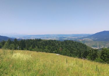
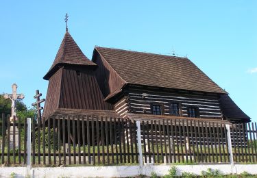
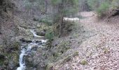
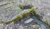
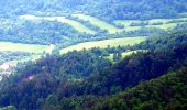
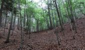
Tocht Te voet van 4,9 km beschikbaar op Prešovský kraj, Onbekend, okres Prešov. Deze tocht wordt voorgesteld door SityTrail - itinéraires balisés pédestres.
Beschrijving
Symbool: education
Plaatsbepaling
Land:
Slovakia
Regio :
Prešovský kraj
Departement/Provincie :
Onbekend
Gemeente :
okres Prešov
Locatie:
Šindliar
Vertrek:(Dec)
Vertrek:(UTM)
494660 ; 5432480 (34U) N.
Opmerkingen
Wandeltochten in de omgeving
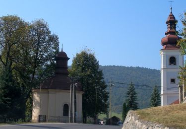
![Tocht Te voet okres Gelnica - Osobnosti a história Kluknavy - Photo](https://media.geolcdn.com/t/375/260/40c82b25-0612-417c-8166-72612fb849c5.jpeg&format=jpg&maxdim=2)
![Te voet Te voet](https://static1.geolcdn.com/sitytour/trail-icons/100.png)
Osobnosti a história Kluknavy
Te voet
Gemakkelijk
okres Gelnica,
Košický kraj,
Onbekend,
Slovakia
![](/images/other/stat-length.png)
7,1 km | 8,9 km-effort
2h 1min
![](https://static1.geolcdn.com/siteimages/upload/files/16400158638029165_repeat_loop_refresh_sync_direction_icon.png)
Neen
![Tocht Te voet okres Gelnica - Vyhliadková trasa - Photo](https://media.geolcdn.com/t/375/260/3fcfe349-9039-4e79-91ca-95f8e8192ed5.jpeg&format=jpg&maxdim=2)
![Te voet Te voet](https://static1.geolcdn.com/sitytour/trail-icons/100.png)
Vyhliadková trasa
Te voet
Gemakkelijk
okres Gelnica,
Košický kraj,
Onbekend,
Slovakia
![](/images/other/stat-length.png)
5,3 km | 7,1 km-effort
1h 36min
![](https://static1.geolcdn.com/siteimages/upload/files/16400158638029165_repeat_loop_refresh_sync_direction_icon.png)
Neen
![Tocht Te voet okres Prešov - Minerálny chodník - Photo](https://media.geolcdn.com/t/375/260/60a95c2b-2f7c-46c6-bc98-4bf5a10353d2.jpeg&format=jpg&maxdim=2)
![Te voet Te voet](https://static1.geolcdn.com/sitytour/trail-icons/100.png)
Minerálny chodník
Te voet
Gemakkelijk
okres Prešov,
Prešovský kraj,
Onbekend,
Slovakia
![](/images/other/stat-length.png)
12,5 km | 17,1 km-effort
3h 53min
![](https://static1.geolcdn.com/siteimages/upload/files/16400158638029165_repeat_loop_refresh_sync_direction_icon.png)
Neen
![Tocht Te voet okres Prešov - Historický chodník - Photo](https://media.geolcdn.com/t/375/260/d0e18a43-07dc-46ca-b801-d229b9b584f5.jpeg&format=jpg&maxdim=2)
![Te voet Te voet](https://static1.geolcdn.com/sitytour/trail-icons/100.png)
Historický chodník
Te voet
Gemakkelijk
okres Prešov,
Prešovský kraj,
Onbekend,
Slovakia
![](/images/other/stat-length.png)
9,3 km | 13,3 km-effort
3h 1min
![](https://static1.geolcdn.com/siteimages/upload/files/16400158638029165_repeat_loop_refresh_sync_direction_icon.png)
Ja
![Tocht Te voet okres Gelnica - Kamenný chodník - Photo](https://media.geolcdn.com/t/375/260/d383e93e-be11-471e-82b1-2fee2efb6dc4.jpeg&format=jpg&maxdim=2)
![Te voet Te voet](https://static1.geolcdn.com/sitytour/trail-icons/100.png)
Kamenný chodník
Te voet
Gemakkelijk
okres Gelnica,
Košický kraj,
Onbekend,
Slovakia
![](/images/other/stat-length.png)
8,3 km | 10,8 km-effort
2h 27min
![](https://static1.geolcdn.com/siteimages/upload/files/16400158638029165_repeat_loop_refresh_sync_direction_icon.png)
Ja
![Tocht Te voet okres Prešov - Hubársky chodník - Photo](https://media.geolcdn.com/t/375/260/6582feb8-1178-4889-a18b-60cea1a07ab4.jpeg&format=jpg&maxdim=2)
![Te voet Te voet](https://static1.geolcdn.com/sitytour/trail-icons/100.png)
Hubársky chodník
Te voet
Gemakkelijk
okres Prešov,
Prešovský kraj,
Onbekend,
Slovakia
![](/images/other/stat-length.png)
12,4 km | 17 km-effort
3h 51min
![](https://static1.geolcdn.com/siteimages/upload/files/16400158638029165_repeat_loop_refresh_sync_direction_icon.png)
Ja
![Tocht Te voet okres Prešov - Letecký chodník - Photo](https://media.geolcdn.com/t/375/260/707a8872-f3b2-4f47-90dc-ff592f682572.jpeg&format=jpg&maxdim=2)
![Te voet Te voet](https://static1.geolcdn.com/sitytour/trail-icons/100.png)
Letecký chodník
Te voet
Gemakkelijk
okres Prešov,
Prešovský kraj,
Onbekend,
Slovakia
![](/images/other/stat-length.png)
6,8 km | 9,2 km-effort
2h 4min
![](https://static1.geolcdn.com/siteimages/upload/files/16400158638029165_repeat_loop_refresh_sync_direction_icon.png)
Ja
![Tocht Te voet okres Prešov - Čiernohorský chodník - Photo](https://media.geolcdn.com/t/375/260/7590084e-6287-443a-85a6-c39aa00d952c.jpeg&format=jpg&maxdim=2)
![Te voet Te voet](https://static1.geolcdn.com/sitytour/trail-icons/100.png)
Čiernohorský chodník
Te voet
Gemakkelijk
okres Prešov,
Prešovský kraj,
Onbekend,
Slovakia
![](/images/other/stat-length.png)
10,5 km | 14,8 km-effort
3h 21min
![](https://static1.geolcdn.com/siteimages/upload/files/16400158638029165_repeat_loop_refresh_sync_direction_icon.png)
Ja
![Tocht Te voet okres Prešov - Krajinný chodník - Photo](https://media.geolcdn.com/t/375/260/3969334c-4ccc-4970-b226-62ef45ac02e2.jpeg&format=jpg&maxdim=2)
![Te voet Te voet](https://static1.geolcdn.com/sitytour/trail-icons/100.png)
Krajinný chodník
Te voet
Medium
okres Prešov,
Prešovský kraj,
Onbekend,
Slovakia
![](/images/other/stat-length.png)
20 km | 30 km-effort
6h 47min
![](https://static1.geolcdn.com/siteimages/upload/files/16400158638029165_repeat_loop_refresh_sync_direction_icon.png)
Ja