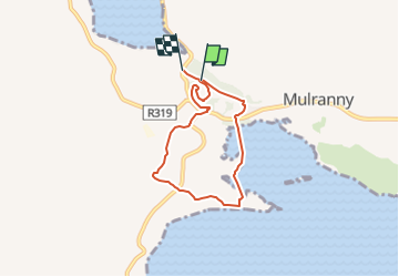
![](/images/other/stat-length.png)
![Tocht Te voet Westport-Belmullet Municipal District - Causeway Loop Walk - Photo](https://media.geolcdn.com/t/1900/400/1c76fb76-10fa-4a2e-9183-8a80e5bcbc5c.jpeg&format=pjpeg&maxdim=2)
Causeway Loop Walk
SityTrail - itinéraires balisés pédestres
Tous les sentiers balisés d’Europe GUIDE+
![Lengte](/images/other/stat-length.png)
![Max. hoogte](https://static1.geolcdn.com/siteimages/upload/files/1508320355ic_sort_altitude_max_24dp.png)
![Positief hoogteverschil](https://static1.geolcdn.com/siteimages/upload/files/1508320355ic_sort_den_pos_24dp.png)
![Km-Effort](/images/other/stat-length.png)
![Min. hoogte](https://static1.geolcdn.com/siteimages/upload/files/1508320355ic_sort_altitude_min_24dp.png)
![Negatief hoogteverschil](https://static1.geolcdn.com/siteimages/upload/files/1508320355ic_sort_den_neg_24dp.png)
![Boucle](https://static1.geolcdn.com/siteimages/upload/files/16400158638029165_repeat_loop_refresh_sync_direction_icon.png)
![Te voet](https://static1.geolcdn.com/sitytour/trail-icons/100.png)
1h22
Moeilijkheid : Gemakkelijk
![Scan deze QR-code om de tocht te openen in de SityTrail-applicatie](https://capi.geolives.com/qq0zvz2zws4bq2lad0pu/sitytour/trails/4342895/qr.png?size=200)
Gratisgps-wandelapplicatie
Over ons
Tocht Te voet van 4,8 km beschikbaar op Onbekend, County Mayo, Westport-Belmullet Municipal District. Deze tocht wordt voorgesteld door SityTrail - itinéraires balisés pédestres.
Beschrijving
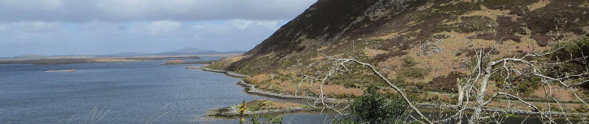
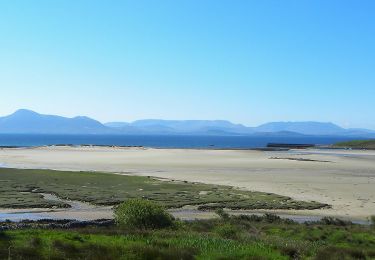
Mayo offers most types of walking to include mountain and hill walks, coastal and island, rural and urban. The variety of these walks combine to give you an unrivalled and unforgettable experience.
Website: http://www.mayowalks.ie/
Plaatsbepaling
Opmerkingen
Wandeltochten in de omgeving
![Tocht Te voet Westport-Belmullet Municipal District - Lookout Hill Loop Walk - Photo](https://media.geolcdn.com/t/375/260/bb48f8ac-ba9d-4302-b827-301974dc309f.jpeg&format=jpg&maxdim=2)
![Te voet Te voet](https://static1.geolcdn.com/sitytour/trail-icons/100.png)
Te voet
![](/images/other/stat-length.png)
![](https://static1.geolcdn.com/siteimages/upload/files/16400158638029165_repeat_loop_refresh_sync_direction_icon.png)