![](/images/other/stat-length.png)
![Tocht Te voet Harrogate - Aislabie Walk - Photo](https://media.geolcdn.com/t/1900/400/cc8602af-0f57-4366-82e5-461295d1977e.jpeg&format=pjpeg&maxdim=2)
Aislabie Walk
SityTrail - itinéraires balisés pédestres
Tous les sentiers balisés d’Europe GUIDE+
![Lengte](/images/other/stat-length.png)
Lengte
29 km
![Max. hoogte](https://static1.geolcdn.com/siteimages/upload/files/1508320355ic_sort_altitude_max_24dp.png)
Max. hoogte
161 m
![Positief hoogteverschil](https://static1.geolcdn.com/siteimages/upload/files/1508320355ic_sort_den_pos_24dp.png)
Positief hoogteverschil
408 m
![Km-Effort](/images/other/stat-length.png)
Km-Effort
34 km
![Min. hoogte](https://static1.geolcdn.com/siteimages/upload/files/1508320355ic_sort_altitude_min_24dp.png)
Min. hoogte
71 m
![Negatief hoogteverschil](https://static1.geolcdn.com/siteimages/upload/files/1508320355ic_sort_den_neg_24dp.png)
Negatief hoogteverschil
406 m
![Boucle](https://static1.geolcdn.com/siteimages/upload/files/16400158638029165_repeat_loop_refresh_sync_direction_icon.png)
Boucle
Ja
Markering
Datum van aanmaak :
2025-02-05 15:05:51.728
Laatste wijziging :
2025-02-05 15:05:51.728
![Te voet](https://static1.geolcdn.com/sitytour/trail-icons/100.png)
7h42
Moeilijkheid : Moeilijk
![Scan deze QR-code om de tocht te openen in de SityTrail-applicatie](https://capi.geolives.com/qq0zvz2zws4bq2lad0pu/sitytour/trails/4341831/qr.png?size=200)
Gratisgps-wandelapplicatie
Over ons
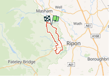
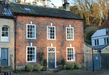
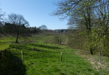
Tocht Te voet van 29 km beschikbaar op Engeland, North Yorkshire, Harrogate. Deze tocht wordt voorgesteld door SityTrail - itinéraires balisés pédestres.
Beschrijving
LDWA Long Distance Paths - Aislabie Walk - N Yorkshire
Website: https://www.ldwa.org.uk/ldp/members/show_path.php?path_name=Aislabie Walk
Plaatsbepaling
Land:
United Kingdom
Regio :
Engeland
Departement/Provincie :
North Yorkshire
Gemeente :
Harrogate
Locatie:
Unknown
Vertrek:(Dec)
Vertrek:(UTM)
589840 ; 6004818 (30U) N.
Opmerkingen
Wandeltochten in de omgeving
![Tocht Te voet Harrogate - Six Dales Trail - Photo](https://media.geolcdn.com/t/375/260/c24952fa-cd3c-40fd-bf63-0aad0a498128.jpeg&format=jpg&maxdim=2)
![Te voet Te voet](https://static1.geolcdn.com/sitytour/trail-icons/100.png)
Six Dales Trail
Te voet
Gemakkelijk
Harrogate,
Engeland,
North Yorkshire,
United Kingdom
![](/images/other/stat-length.png)
3,9 km | 5,1 km-effort
1h 9min
![](https://static1.geolcdn.com/siteimages/upload/files/16400158638029165_repeat_loop_refresh_sync_direction_icon.png)
Neen
![Tocht Te voet Harrogate - Ripon Sanctuary Way - Photo](https://media.geolcdn.com/t/375/260/c64649a2-90fa-4410-92cf-1e4b64c8f700.jpeg&format=jpg&maxdim=2)
![Te voet Te voet](https://static1.geolcdn.com/sitytour/trail-icons/100.png)
Ripon Sanctuary Way
Te voet
Gemakkelijk
Harrogate,
Engeland,
North Yorkshire,
United Kingdom
![](/images/other/stat-length.png)
13,3 km | 14,6 km-effort
3h 18min
![](https://static1.geolcdn.com/siteimages/upload/files/16400158638029165_repeat_loop_refresh_sync_direction_icon.png)
Neen
![Tocht Te voet Harrogate - Knaresborough Round - Photo](https://media.geolcdn.com/t/375/260/485c2170-4cc6-45ba-8068-8597002c2102.jpeg&format=jpg&maxdim=2)
![Te voet Te voet](https://static1.geolcdn.com/sitytour/trail-icons/100.png)
Knaresborough Round
Te voet
Moeilijk
Harrogate,
Engeland,
North Yorkshire,
United Kingdom
![](/images/other/stat-length.png)
34 km | 38 km-effort
8h 37min
![](https://static1.geolcdn.com/siteimages/upload/files/16400158638029165_repeat_loop_refresh_sync_direction_icon.png)
Neen
![Tocht Te voet Harrogate - Harrogate Ringway - Photo](https://media.geolcdn.com/t/375/260/06575157-9ed4-446d-9bdc-3654188bcf5d.jpeg&format=jpg&maxdim=2)
![Te voet Te voet](https://static1.geolcdn.com/sitytour/trail-icons/100.png)
Harrogate Ringway
Te voet
Moeilijk
Harrogate,
Engeland,
North Yorkshire,
United Kingdom
![](/images/other/stat-length.png)
32 km | 39 km-effort
8h 49min
![](https://static1.geolcdn.com/siteimages/upload/files/16400158638029165_repeat_loop_refresh_sync_direction_icon.png)
Ja