![](/images/other/stat-length.png)
![Tocht Te voet Unknown - Out-and-back walk to Harris from Kinloch - Photo](https://media.geolcdn.com/t/1900/400/99c331cb-7ed5-4e99-8161-e3a673d5f1a7.jpeg&format=pjpeg&maxdim=2)
Out-and-back walk to Harris from Kinloch
SityTrail - itinéraires balisés pédestres
Tous les sentiers balisés d’Europe GUIDE+
![Lengte](/images/other/stat-length.png)
![Max. hoogte](https://static1.geolcdn.com/siteimages/upload/files/1508320355ic_sort_altitude_max_24dp.png)
![Positief hoogteverschil](https://static1.geolcdn.com/siteimages/upload/files/1508320355ic_sort_den_pos_24dp.png)
![Km-Effort](/images/other/stat-length.png)
![Min. hoogte](https://static1.geolcdn.com/siteimages/upload/files/1508320355ic_sort_altitude_min_24dp.png)
![Negatief hoogteverschil](https://static1.geolcdn.com/siteimages/upload/files/1508320355ic_sort_den_neg_24dp.png)
![Boucle](https://static1.geolcdn.com/siteimages/upload/files/16400158638029165_repeat_loop_refresh_sync_direction_icon.png)
![Te voet](https://static1.geolcdn.com/sitytour/trail-icons/100.png)
3h34
Moeilijkheid : Gemakkelijk
![Scan deze QR-code om de tocht te openen in de SityTrail-applicatie](https://capi.geolives.com/qq0zvz2zws4bq2lad0pu/sitytour/trails/4341811/qr.png?size=200)
Gratisgps-wandelapplicatie
Over ons
Tocht Te voet van 12,2 km beschikbaar op Schotland, Highland. Deze tocht wordt voorgesteld door SityTrail - itinéraires balisés pédestres.
Beschrijving
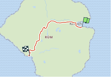
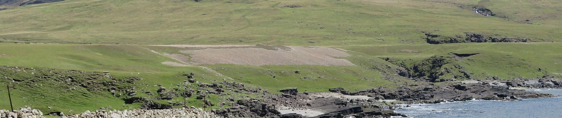
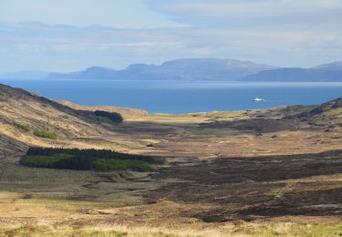
This long walk follows an excellent track right through the wild and bleak heart of Rum to reach beautiful Harris and its mausoleum on the west coast. There are excellent views of the Cuillin along the way, but the long distance means this walk would perhaps be better enjoyed on a mountain bike.
Website: https://www.walkhighlands.co.uk/islands/harris-rum.shtml
Plaatsbepaling
Opmerkingen
Wandeltochten in de omgeving
![Tocht Te voet - Rum Cuillin traverse - Photo](https://media.geolcdn.com/t/375/260/c468dca8-43f0-4964-9d3b-4bf912547b78.jpeg&format=jpg&maxdim=2)
![Te voet Te voet](https://static1.geolcdn.com/sitytour/trail-icons/100.png)
Te voet
![](/images/other/stat-length.png)
![](https://static1.geolcdn.com/siteimages/upload/files/16400158638029165_repeat_loop_refresh_sync_direction_icon.png)
![Tocht Te voet - Orval, return via Harris - Photo](https://media.geolcdn.com/t/375/260/c468dca8-43f0-4964-9d3b-4bf912547b78.jpeg&format=jpg&maxdim=2)
![Te voet Te voet](https://static1.geolcdn.com/sitytour/trail-icons/100.png)
Te voet
![](/images/other/stat-length.png)
![](https://static1.geolcdn.com/siteimages/upload/files/16400158638029165_repeat_loop_refresh_sync_direction_icon.png)
![Tocht Te voet - Hallival and Barkeval - Photo](https://media.geolcdn.com/t/375/260/8c8ca3df-2bdc-4b5d-87c8-2537fa733032.jpeg&format=jpg&maxdim=2)
![Te voet Te voet](https://static1.geolcdn.com/sitytour/trail-icons/100.png)
Te voet
![](/images/other/stat-length.png)
![](https://static1.geolcdn.com/siteimages/upload/files/16400158638029165_repeat_loop_refresh_sync_direction_icon.png)
![Tocht Te voet - Kilmory Bay - Photo](https://media.geolcdn.com/t/375/260/281f2b0a-5c72-4e96-a97c-66de1616b5d2.jpeg&format=jpg&maxdim=2)
![Te voet Te voet](https://static1.geolcdn.com/sitytour/trail-icons/100.png)
Te voet
![](/images/other/stat-length.png)
![](https://static1.geolcdn.com/siteimages/upload/files/16400158638029165_repeat_loop_refresh_sync_direction_icon.png)