![](/images/other/stat-length.png)
![Tocht Te voet Blaby - Bridleway V29 - Photo](https://media.geolcdn.com/t/1900/400/ext.pjpeg?maxdim=2&url=https%3A%2F%2Fstatic1.geolcdn.com%2Fsiteimages%2Fupload%2Ffiles%2F1545311037marcheuse_200dpi.jpg)
Bridleway V29
SityTrail - itinéraires balisés pédestres
Tous les sentiers balisés d’Europe GUIDE+
![Lengte](/images/other/stat-length.png)
Lengte
3,9 km
![Max. hoogte](https://static1.geolcdn.com/siteimages/upload/files/1508320355ic_sort_altitude_max_24dp.png)
Max. hoogte
113 m
![Positief hoogteverschil](https://static1.geolcdn.com/siteimages/upload/files/1508320355ic_sort_den_pos_24dp.png)
Positief hoogteverschil
40 m
![Km-Effort](/images/other/stat-length.png)
Km-Effort
4,4 km
![Min. hoogte](https://static1.geolcdn.com/siteimages/upload/files/1508320355ic_sort_altitude_min_24dp.png)
Min. hoogte
87 m
![Negatief hoogteverschil](https://static1.geolcdn.com/siteimages/upload/files/1508320355ic_sort_den_neg_24dp.png)
Negatief hoogteverschil
16 m
![Boucle](https://static1.geolcdn.com/siteimages/upload/files/16400158638029165_repeat_loop_refresh_sync_direction_icon.png)
Boucle
Neen
Markering
Datum van aanmaak :
2025-02-05 10:34:08.625
Laatste wijziging :
2025-02-05 10:34:08.625
![Te voet](https://static1.geolcdn.com/sitytour/trail-icons/100.png)
1h00
Moeilijkheid : Gemakkelijk
![Scan deze QR-code om de tocht te openen in de SityTrail-applicatie](https://capi.geolives.com/qq0zvz2zws4bq2lad0pu/sitytour/trails/4341175/qr.png?size=200)
Gratisgps-wandelapplicatie
Over ons
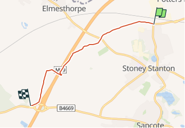
Tocht Te voet van 3,9 km beschikbaar op Engeland, Leicestershire, Blaby. Deze tocht wordt voorgesteld door SityTrail - itinéraires balisés pédestres.
Beschrijving
From Aston lane, Sharnford to the M69/A5070 junction, then north east across Hinckley Road on both sides of the motorway and to Huncote Road, Stoney Stanton
Plaatsbepaling
Land:
United Kingdom
Regio :
Engeland
Departement/Provincie :
Leicestershire
Gemeente :
Blaby
Locatie:
Unknown
Vertrek:(Dec)
Vertrek:(UTM)
616672 ; 5824403 (30U) N.
Opmerkingen
Wandeltochten in de omgeving
![Tocht Te voet Blaby - Bridleway V44 - Photo](https://media.geolcdn.com/t/375/260/ext.jpg?maxdim=2&url=https%3A%2F%2Fstatic1.geolcdn.com%2Fsiteimages%2Fupload%2Ffiles%2F1545311037marcheuse_200dpi.jpg)
![Te voet Te voet](https://static1.geolcdn.com/sitytour/trail-icons/100.png)
Bridleway V44
Te voet
Gemakkelijk
Blaby,
Engeland,
Leicestershire,
United Kingdom
![](/images/other/stat-length.png)
3,3 km | 3,5 km-effort
47min
![](https://static1.geolcdn.com/siteimages/upload/files/16400158638029165_repeat_loop_refresh_sync_direction_icon.png)
Neen