Tocht Stappen La Redorte - la redorte - Photo
 clo jp
clo jp

Gebruiker

© OpenStreetMap contributors
Lengte
Lengte
8,8 km
Max. hoogte
Max. hoogte
106 m
Positief hoogteverschil
102 m
Km-Effort
Km-Effort  
10,2 km
Min. hoogte
Min. hoogte
52 m
Negatief hoogteverschil
103 m
Boucle
Boucle
Neen
Datum van aanmaak :
2025-02-04 08:01:17.152
Laatste wijziging :
2025-02-04 13:06:03.393

(0 Bericht)

Stappen
Stappen
5h04
Moeilijkheid : Medium

Scan deze QR-code om de tocht te openen in de SityTrail-applicatie

Gratisgps-wandelapplicatie

Logo SityTrail SityTrail

IGN / Geografische instituten

SityTrail uit de App Store downloaden SityTrail uit Google Play downloaden

Logo SityTrail SityTrail World

De wereld gaat voor u open

SityTrail uit de App Store downloaden SityTrail uit Google Play downloaden SityTrail op Huawei AppGallery downloaden

Over ons

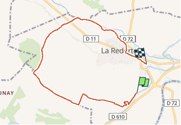
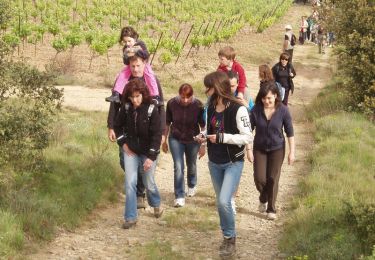
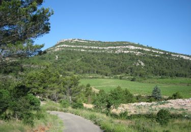
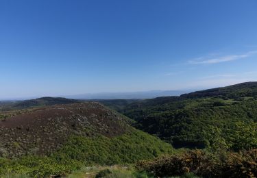
Tocht Stappen van 8,8 km beschikbaar op Occitanië, Aude, La Redorte. Deze tocht wordt voorgesteld door clo jp.
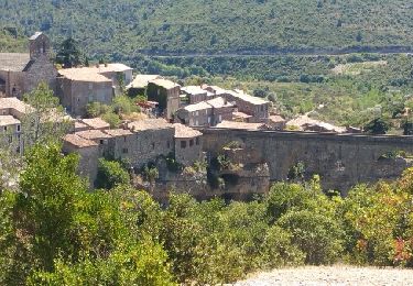
Beschrijving

la tour carrée

Hoogteprofiel

Plaatsbepaling

Land:
France
Regio :
Occitanië
Departement/Provincie :
Aude
Gemeente :
La Redorte
Locatie:
Unknown
Vertrek:(UTM)
472073 ; 4787712 (31T) N.

Wandeltochten in de omgeving

Tocht Fiets Azille - ferrals le bois minerve - Photo
Fiets
F.Rioland

Fiets

Heel gemakkelijk
(1)
Azille, Occitanië, Aude, France
57 km | 70 km-effort
4h 19min
Ja
Tocht Stappen Montbrun-des-Corbières - Montbrun - Photo
Stappen
belhache

Stappen

Heel gemakkelijk
(1)
Montbrun-des-Corbières, Occitanië, Aude, France
9,3 km | 11,6 km-effort
2h 21min
Ja
Tocht Fiets Azille - trois col en minervois - Photo
Fiets
F.Rioland

Fiets

Heel gemakkelijk
(1)
Azille, Occitanië, Aude, France
86 km | 108 km-effort
5h 36min
Ja
Tocht Stappen Montbrun-des-Corbières - MONTBRUN DES CORBIERES rocher du renard - Photo
Stappen
Licianus2

Stappen

Gemakkelijk
Montbrun-des-Corbières, Occitanië, Aude, France
7,4 km | 9,3 km-effort
1h 30min
Ja
Tocht Stappen Escales - ESCALES - La tour Romane - Photo
Stappen
Licianus2

Stappen

Heel gemakkelijk
(1)
Escales, Occitanië, Aude, France
4,2 km | 5,6 km-effort
1h 5min
Ja
Tocht Stappen Castelnau-d'Aude - En Corbières - Le Bosquet - Castelnau d'Aude - Photo
Stappen
tracegps

Stappen

Medium
Castelnau-d'Aude, Occitanië, Aude, France
4,8 km | 5,8 km-effort
2h 30min
Ja
Tocht Stappen Saint-Couat-d'Aude - Reco Officielle Marche RED'S 15.10.2022 - Photo
Stappen
jacques delaporte

Stappen

Zeer moeilijk
(1)
Saint-Couat-d'Aude, Occitanië, Aude, France
25 km | 34 km-effort
7h 44min
Ja
Tocht Wegfiets Azille - Salette croix de sou - Photo
Wegfiets
F.Rioland

Wegfiets

Moeilijk
Azille, Occitanië, Aude, France
72 km | 91 km-effort
5h 19min
Ja
Tocht Stappen Homps - Homps Olonzac - Photo
Stappen
marcheur75

Stappen

Medium
Homps, Occitanië, Aude, France
6 km | 6,3 km-effort
1h 26min
Ja


Sluiten
Mijn abonnementen