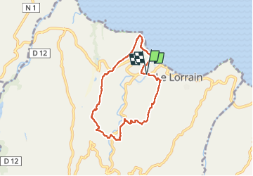
![](/images/other/stat-length.png)
![Tocht Stappen Le Lorrain - Boucle Lorrinoise via Morne Wawa - Photo](https://media.geolcdn.com/t/1900/400/2260d5fa-b236-443e-94b6-198d12135800.jpg&format=pjpeg&maxdim=2)
Boucle Lorrinoise via Morne Wawa
Lamartiniere
Gebruiker GUIDE
![Lengte](/images/other/stat-length.png)
![Max. hoogte](https://static1.geolcdn.com/siteimages/upload/files/1508320355ic_sort_altitude_max_24dp.png)
![Positief hoogteverschil](https://static1.geolcdn.com/siteimages/upload/files/1508320355ic_sort_den_pos_24dp.png)
![Km-Effort](/images/other/stat-length.png)
![Min. hoogte](https://static1.geolcdn.com/siteimages/upload/files/1508320355ic_sort_altitude_min_24dp.png)
![Negatief hoogteverschil](https://static1.geolcdn.com/siteimages/upload/files/1508320355ic_sort_den_neg_24dp.png)
![Boucle](https://static1.geolcdn.com/siteimages/upload/files/16400158638029165_repeat_loop_refresh_sync_direction_icon.png)
![Stappen](https://static1.geolcdn.com/sitytour/trail-icons/101.png)
2h35
Moeilijkheid : Medium
![Scan deze QR-code om de tocht te openen in de SityTrail-applicatie](https://capi.geolives.com/qq0zvz2zws4bq2lad0pu/sitytour/trails/4338927/qr.png?size=200)
Gratisgps-wandelapplicatie
Over ons
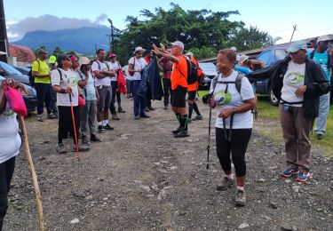
Tocht Stappen van 9,1 km beschikbaar op Martinique, Onbekend, Le Lorrain. Deze tocht wordt voorgesteld door Lamartiniere.
Beschrijving
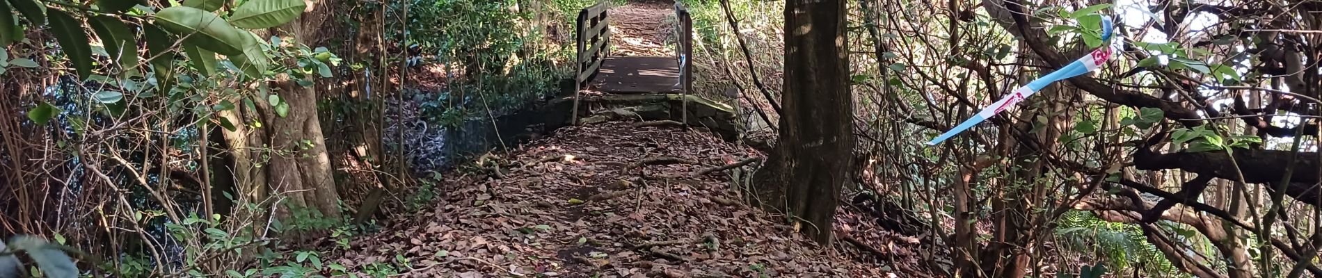
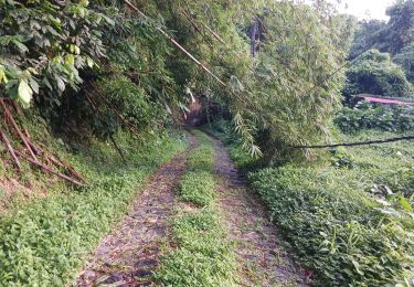
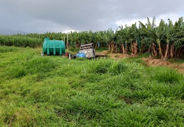
Randonnée au centre du Lorrain à travers les bananeraies et autres plantations. Morne Wawa en descente, rivière Grande Anse à traverser au gué, puis Bas-Céron, forêt de Mahogany, le dernier effort à Morne Landeau pour revenir sur Morne Céron et son panorama. Descente par Sem et Dorival. Cette randonnée sur parcelles privées nécessite des autorisations de passage.
Plaatsbepaling
Opmerkingen
Wandeltochten in de omgeving
![Tocht Stappen Le Lorrain - Boucle Morne Capot via La Pirogue - Photo](https://media.geolcdn.com/t/375/260/88d336cd-6544-44b1-ab6c-880c93dcc1a4.jpg&format=jpg&maxdim=2)
![Stappen Stappen](https://static1.geolcdn.com/sitytour/trail-icons/101.png)
Stappen
![](/images/other/stat-length.png)
![](https://static1.geolcdn.com/siteimages/upload/files/16400158638029165_repeat_loop_refresh_sync_direction_icon.png)
![Tocht Stappen Le Marigot - Boucle Le Mariigot - Charpentier - SLNA. - Photo](https://media.geolcdn.com/t/375/260/b4acbe47-87c5-4bec-aa83-83441bd5fc60.jpg&format=jpg&maxdim=2)
![Stappen Stappen](https://static1.geolcdn.com/sitytour/trail-icons/101.png)
Stappen
![](/images/other/stat-length.png)
![](https://static1.geolcdn.com/siteimages/upload/files/16400158638029165_repeat_loop_refresh_sync_direction_icon.png)
![Stappen Stappen](https://static1.geolcdn.com/sitytour/trail-icons/101.png)
Stappen
![](/images/other/stat-length.png)
![](https://static1.geolcdn.com/siteimages/upload/files/16400158638029165_repeat_loop_refresh_sync_direction_icon.png)
![Tocht Stappen Basse-Pointe - Exploitations agricoles en boucle N°1 - Photo](https://media.geolcdn.com/t/375/260/25d4e89e-0741-47b9-9c1b-39c4a8472812.jpg&format=jpg&maxdim=2)
![Stappen Stappen](https://static1.geolcdn.com/sitytour/trail-icons/101.png)
Stappen
![](/images/other/stat-length.png)
![](https://static1.geolcdn.com/siteimages/upload/files/16400158638029165_repeat_loop_refresh_sync_direction_icon.png)
![Tocht Stappen Le Lorrain - Mornes Capot / Lorrain Martinique - Photo](https://media.geolcdn.com/t/375/260/bf3e9288-2731-4804-b2e5-dccb9a2b816e.jpg&format=jpg&maxdim=2)
![Stappen Stappen](https://static1.geolcdn.com/sitytour/trail-icons/101.png)
Stappen
![](/images/other/stat-length.png)
![](https://static1.geolcdn.com/siteimages/upload/files/16400158638029165_repeat_loop_refresh_sync_direction_icon.png)
![Tocht Stappen Basse-Pointe - Boucle de chalvet, Pécoule vers Chalvet. - Photo](https://media.geolcdn.com/t/375/260/1e4cabaa-63c0-46f7-b111-2c87348cf0ee.jpg&format=jpg&maxdim=2)
![Stappen Stappen](https://static1.geolcdn.com/sitytour/trail-icons/101.png)
Stappen
![](/images/other/stat-length.png)
![](https://static1.geolcdn.com/siteimages/upload/files/16400158638029165_repeat_loop_refresh_sync_direction_icon.png)
![Tocht Stappen Le Marigot - Marigot vers le Lorrain - Photo](https://media.geolcdn.com/t/375/260/6a93875e-8aed-454e-924f-79cf5824df2f.jpg&format=jpg&maxdim=2)
![Stappen Stappen](https://static1.geolcdn.com/sitytour/trail-icons/101.png)
Stappen
![](/images/other/stat-length.png)
![](https://static1.geolcdn.com/siteimages/upload/files/16400158638029165_repeat_loop_refresh_sync_direction_icon.png)
![Tocht Stappen Le Lorrain - Boucle Seguineau 22 Mai - Photo](https://media.geolcdn.com/t/375/260/637e5e8f-3e66-4461-a851-15be19fa887e.jpg&format=jpg&maxdim=2)
![Stappen Stappen](https://static1.geolcdn.com/sitytour/trail-icons/101.png)
Stappen
![](/images/other/stat-length.png)
![](https://static1.geolcdn.com/siteimages/upload/files/16400158638029165_repeat_loop_refresh_sync_direction_icon.png)
![Tocht Stappen Le Lorrain - Morne Jacob au Panneau ONF - Photo](https://media.geolcdn.com/t/375/260/54159292-758e-4621-a73f-109fb913bb31.jpg&format=jpg&maxdim=2)
![Stappen Stappen](https://static1.geolcdn.com/sitytour/trail-icons/101.png)
Stappen
![](/images/other/stat-length.png)
![](https://static1.geolcdn.com/siteimages/upload/files/16400158638029165_repeat_loop_refresh_sync_direction_icon.png)