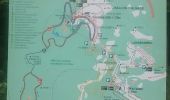

La Planche des Belles Filles

jeanclaude12
Gebruiker

Lengte
19,7 km

Max. hoogte
1145 m

Positief hoogteverschil
830 m

Km-Effort
30 km

Min. hoogte
816 m

Negatief hoogteverschil
682 m
Boucle
Neen
Datum van aanmaak :
2015-06-14 00:00:00.0
Laatste wijziging :
2015-06-14 00:00:00.0
4h46
Moeilijkheid : Medium

Gratisgps-wandelapplicatie
Over ons
Tocht Stappen van 19,7 km beschikbaar op Bourgondië-Franche-Comté, Haute-Saône, Plancher-les-Mines. Deze tocht wordt voorgesteld door jeanclaude12.
Beschrijving
Randonnée permettant de visiter les romantiques étangs du Ballon d'Alsace depuis la Planche des Belles Filles.
POI's
Plaatsbepaling
Land:
France
Regio :
Bourgondië-Franche-Comté
Departement/Provincie :
Haute-Saône
Gemeente :
Plancher-les-Mines
Locatie:
Unknown
Vertrek:(Dec)
Vertrek:(UTM)
333596 ; 5293724 (32T) N.
Opmerkingen
Wandeltochten in de omgeving
planche belles filles par auxelle haut


Stappen
Medium
(3)
Auxelles-Haut,
Bourgondië-Franche-Comté,
Territoire-de-Belfort,
France

14,6 km | 23 km-effort
4h 55min
Ja
Le Tremontkopf


Stappen
Medium
(1)
Lepuix,
Bourgondië-Franche-Comté,
Territoire-de-Belfort,
France

9,1 km | 17,3 km-effort
3h 0min
Ja
Le Ballon de Servance


Stappen
Moeilijk
(2)
Plancher-les-Mines,
Bourgondië-Franche-Comté,
Haute-Saône,
France

19,7 km | 30 km-effort
6h 0min
Ja

2025-01-04 Rando Polaire Dolleren Ballon Alsace Etape 3


Stappen
Zeer moeilijk
Plancher-les-Mines,
Bourgondië-Franche-Comté,
Haute-Saône,
France

18,6 km | 30 km-effort
6h 52min
Neen
2019-08-07 Balade Plancher des belles filles


Stappen
Heel gemakkelijk
Plancher-les-Mines,
Bourgondië-Franche-Comté,
Haute-Saône,
France

7,8 km | 11,9 km-effort
2h 12min
Ja
ballon alsace saut de la truite


Stappen
Heel gemakkelijk
(1)
Lepuix,
Bourgondië-Franche-Comté,
Territoire-de-Belfort,
France

9,2 km | 15,5 km-effort
3h 31min
Ja
Malvaux - Ballon d'Alsace - La Gentiane


Stappen
Zeer moeilijk
Lepuix,
Bourgondië-Franche-Comté,
Territoire-de-Belfort,
France

14,2 km | 24 km-effort
5h 23min
Ja
Malvaux - Ballon d'Alsace (15/12 au 15/7)


Stappen
Zeer moeilijk
Lepuix,
Bourgondië-Franche-Comté,
Territoire-de-Belfort,
France

14,8 km | 24 km-effort
5h 33min
Ja
Plancher les mines - sentier des mines - croix du choléra - Planche des Belle...


Stappen
Zeer moeilijk
Plancher-les-Mines,
Bourgondië-Franche-Comté,
Haute-Saône,
France

14,3 km | 25 km-effort
5h 38min
Ja


 SityTrail


