![](/images/other/stat-length.png)
![Tocht Stappen Chazelles - La balade de Chazelles (charente) et ses petits villages - Photo](https://media.geolcdn.com/t/1900/400/ext.pjpeg?maxdim=2&url=https%3A%2F%2Fstatic1.geolcdn.com%2Fsiteimages%2Fupload%2Ffiles%2F1553511878bg_sport_marche.png)
La balade de Chazelles (charente) et ses petits villages
alainjoseph6
Gebruiker
![Lengte](/images/other/stat-length.png)
Lengte
8,4 km
![Max. hoogte](https://static1.geolcdn.com/siteimages/upload/files/1508320355ic_sort_altitude_max_24dp.png)
Max. hoogte
137 m
![Positief hoogteverschil](https://static1.geolcdn.com/siteimages/upload/files/1508320355ic_sort_den_pos_24dp.png)
Positief hoogteverschil
98 m
![Km-Effort](/images/other/stat-length.png)
Km-Effort
9,7 km
![Min. hoogte](https://static1.geolcdn.com/siteimages/upload/files/1508320355ic_sort_altitude_min_24dp.png)
Min. hoogte
88 m
![Negatief hoogteverschil](https://static1.geolcdn.com/siteimages/upload/files/1508320355ic_sort_den_neg_24dp.png)
Negatief hoogteverschil
100 m
![Boucle](https://static1.geolcdn.com/siteimages/upload/files/16400158638029165_repeat_loop_refresh_sync_direction_icon.png)
Boucle
Ja
Datum van aanmaak :
2025-02-01 13:46:44.308
Laatste wijziging :
2025-02-02 09:48:12.176
![Stappen](https://static1.geolcdn.com/sitytour/trail-icons/101.png)
2h11
Moeilijkheid : Medium
![Scan deze QR-code om de tocht te openen in de SityTrail-applicatie](https://capi.geolives.com/qq0zvz2zws4bq2lad0pu/sitytour/trails/4336569/qr.png?size=200)
Gratisgps-wandelapplicatie
Over ons
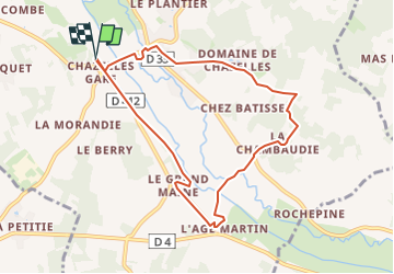
Tocht Stappen van 8,4 km beschikbaar op Nieuw-Aquitanië, Charente, Chazelles. Deze tocht wordt voorgesteld door alainjoseph6.
Beschrijving
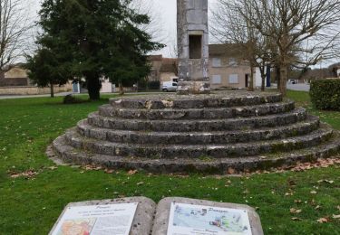
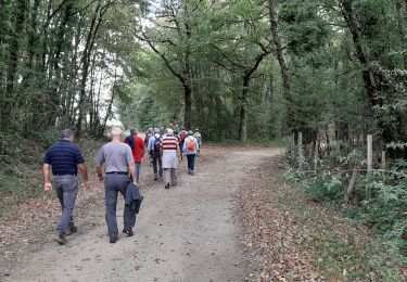
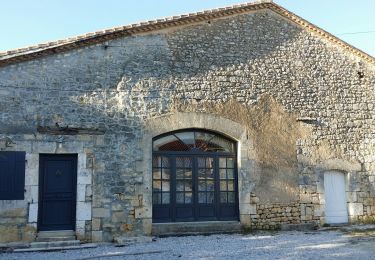
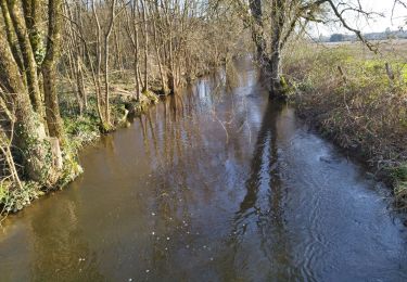
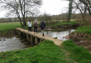
Une balade facile au départ du parking de l'ancienne gare, en empruntant la voie verte, le village du grand maine et sa nouvelle fromagerie, l'âge martin et la visite du bourg de Chazelles son nouveau restaurant avec retour au parking de l'ancienne gare.
Plaatsbepaling
Land:
France
Regio :
Nieuw-Aquitanië
Departement/Provincie :
Charente
Gemeente :
Chazelles
Locatie:
Unknown
Vertrek:(Dec)
Vertrek:(UTM)
294136 ; 5058088 (31T) N.
Opmerkingen
Wandeltochten in de omgeving
![Tocht Stappen Pranzac - Pranzac et ses petits villages. - Photo](https://media.geolcdn.com/t/375/260/3a77c9e3-0523-4318-8510-a2c1a4b859f3.jpg&format=jpg&maxdim=2)
![Stappen Stappen](https://static1.geolcdn.com/sitytour/trail-icons/101.png)
Pranzac et ses petits villages.
Stappen
Medium
Pranzac,
Nieuw-Aquitanië,
Charente,
France
![](/images/other/stat-length.png)
7,8 km | 9 km-effort
2h 26min
![](https://static1.geolcdn.com/siteimages/upload/files/16400158638029165_repeat_loop_refresh_sync_direction_icon.png)
Ja
![Tocht Stappen Chazelles - Les Grottes du Quéroy -gros terme et Combe - Photo](https://media.geolcdn.com/t/375/260/a902d7b3-47f7-4cd6-b06e-56e13f719b7b.jpg&format=jpg&maxdim=2)
![Stappen Stappen](https://static1.geolcdn.com/sitytour/trail-icons/101.png)
Les Grottes du Quéroy -gros terme et Combe
Stappen
Medium
(1)
Chazelles,
Nieuw-Aquitanië,
Charente,
France
![](/images/other/stat-length.png)
8,2 km | 9,6 km-effort
2h 24min
![](https://static1.geolcdn.com/siteimages/upload/files/16400158638029165_repeat_loop_refresh_sync_direction_icon.png)
Ja
![Tocht Stappen Bunzac - BUNZAC 16110 ..départ de Puy cocu > combebrune > les Denis > le château des deffends - Photo](https://media.geolcdn.com/t/375/260/7d0ff8b1-963c-44bc-be90-151320ae11e3.jpg&format=jpg&maxdim=2)
![Stappen Stappen](https://static1.geolcdn.com/sitytour/trail-icons/101.png)
BUNZAC 16110 ..départ de Puy cocu > combebrune > les Denis > le château des d...
Stappen
Gemakkelijk
Bunzac,
Nieuw-Aquitanië,
Charente,
France
![](/images/other/stat-length.png)
9,3 km | 10,8 km-effort
3h 9min
![](https://static1.geolcdn.com/siteimages/upload/files/16400158638029165_repeat_loop_refresh_sync_direction_icon.png)
Ja
![Tocht Stappen Moulins-sur-Tardoire - La rando de Vilhoneur côté Nord - Photo](https://media.geolcdn.com/t/375/260/c9220340-558b-478c-9a23-ab29d5a7cbe3.jpg&format=jpg&maxdim=2)
![Stappen Stappen](https://static1.geolcdn.com/sitytour/trail-icons/101.png)
La rando de Vilhoneur côté Nord
Stappen
Gemakkelijk
Moulins-sur-Tardoire,
Nieuw-Aquitanië,
Charente,
France
![](/images/other/stat-length.png)
7,1 km | 8,1 km-effort
2h 12min
![](https://static1.geolcdn.com/siteimages/upload/files/16400158638029165_repeat_loop_refresh_sync_direction_icon.png)
Ja
![Tocht Stappen Chazelles - La randonnée autour de Chazelles - Photo](https://media.geolcdn.com/t/375/260/6a56e3fd-00be-447e-b74c-a7c93873ee51.jpg&format=jpg&maxdim=2)
![Stappen Stappen](https://static1.geolcdn.com/sitytour/trail-icons/101.png)
La randonnée autour de Chazelles
Stappen
Gemakkelijk
Chazelles,
Nieuw-Aquitanië,
Charente,
France
![](/images/other/stat-length.png)
9,6 km | 11,1 km-effort
2h 32min
![](https://static1.geolcdn.com/siteimages/upload/files/16400158638029165_repeat_loop_refresh_sync_direction_icon.png)
Ja
![Tocht Mountainbike Chazelles - Chazelles - Brégout - Photo](https://media.geolcdn.com/t/375/260/ext.jpg?maxdim=2&url=https%3A%2F%2Fstatic1.geolcdn.com%2Fsiteimages%2Fupload%2Ffiles%2F1524743154velo.jpg)
![Mountainbike Mountainbike](https://static1.geolcdn.com/sitytour/trail-icons/202.png)
Chazelles - Brégout
Mountainbike
Moeilijk
(1)
Chazelles,
Nieuw-Aquitanië,
Charente,
France
![](/images/other/stat-length.png)
46 km | 57 km-effort
4h 0min
![](https://static1.geolcdn.com/siteimages/upload/files/16400158638029165_repeat_loop_refresh_sync_direction_icon.png)
Neen
![Tocht Stappen Bunzac - Départ de puy cocu et les petits villages autour de Pranzac 16 110 - Photo](https://media.geolcdn.com/t/375/260/3a6a783b-5767-4811-845d-75faa28604c8.jpg&format=jpg&maxdim=2)
![Stappen Stappen](https://static1.geolcdn.com/sitytour/trail-icons/101.png)
Départ de puy cocu et les petits villages autour de Pranzac 16 110
Stappen
Medium
Bunzac,
Nieuw-Aquitanië,
Charente,
France
![](/images/other/stat-length.png)
8,9 km | 10,2 km-effort
2h 18min
![](https://static1.geolcdn.com/siteimages/upload/files/16400158638029165_repeat_loop_refresh_sync_direction_icon.png)
Ja
![Tocht Stappen Moulins-sur-Tardoire - Vilhonneur0504 - Photo](https://media.geolcdn.com/t/375/260/5373ed4e-d465-4437-8c4c-df16ce9bb694.jpg&format=jpg&maxdim=2)
![Stappen Stappen](https://static1.geolcdn.com/sitytour/trail-icons/101.png)
Vilhonneur0504
Stappen
Medium
Moulins-sur-Tardoire,
Nieuw-Aquitanië,
Charente,
France
![](/images/other/stat-length.png)
6 km | 6,8 km-effort
2h 31min
![](https://static1.geolcdn.com/siteimages/upload/files/16400158638029165_repeat_loop_refresh_sync_direction_icon.png)
Ja
![Tocht Stappen Chazelles - Les grottes du Queroy en passant par le pont Romain de Gros Terme - Photo](https://media.geolcdn.com/t/375/260/ext.jpg?maxdim=2&url=https%3A%2F%2Fservices.sitytrail.com%2FGeolivesWS%2FDownloadMedia.ashx%3FTrailID%3D716486%26Media%3Dfix__20170319104404.jpg)
![Stappen Stappen](https://static1.geolcdn.com/sitytour/trail-icons/101.png)
Les grottes du Queroy en passant par le pont Romain de Gros Terme
Stappen
Gemakkelijk
Chazelles,
Nieuw-Aquitanië,
Charente,
France
![](/images/other/stat-length.png)
9,8 km | 11,2 km-effort
2h 47min
![](https://static1.geolcdn.com/siteimages/upload/files/16400158638029165_repeat_loop_refresh_sync_direction_icon.png)
Ja