![](/images/other/stat-length.png)
![Tocht Andere activiteiten Marly - 216/Marly Cité/Chésalles/usine élect./R - Photo](https://media.geolcdn.com/t/1900/400/ext.pjpeg?maxdim=2&url=https%3A%2F%2Fstatic1.geolcdn.com%2Fsiteimages%2Fupload%2Ffiles%2F1545311037marcheuse_200dpi.jpg)
216/Marly Cité/Chésalles/usine élect./R
nordicmarly
Gebruiker
![Lengte](/images/other/stat-length.png)
![Max. hoogte](https://static1.geolcdn.com/siteimages/upload/files/1508320355ic_sort_altitude_max_24dp.png)
![Positief hoogteverschil](https://static1.geolcdn.com/siteimages/upload/files/1508320355ic_sort_den_pos_24dp.png)
![Km-Effort](/images/other/stat-length.png)
![Min. hoogte](https://static1.geolcdn.com/siteimages/upload/files/1508320355ic_sort_altitude_min_24dp.png)
![Negatief hoogteverschil](https://static1.geolcdn.com/siteimages/upload/files/1508320355ic_sort_den_neg_24dp.png)
![Boucle](https://static1.geolcdn.com/siteimages/upload/files/16400158638029165_repeat_loop_refresh_sync_direction_icon.png)
![Andere activiteiten](https://static1.geolcdn.com/sitytour/trail-icons/900.png)
--
Moeilijkheid : Onbekend
![Scan deze QR-code om de tocht te openen in de SityTrail-applicatie](https://capi.geolives.com/qq0zvz2zws4bq2lad0pu/sitytour/trails/43232/qr.png?size=200)
Gratisgps-wandelapplicatie
Over ons
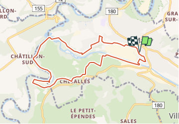
Tocht Andere activiteiten van 9,6 km beschikbaar op Fribourg/Freiburg, District de la Sarine, Marly. Deze tocht wordt voorgesteld door nordicmarly.
Beschrijving
MARLY CITE
EPINETTES
ST-ELOI
RTE DU MOULIN
CH. PASSERELLE
PASSERELLE BERGER
RIVE GERINE
RESERVOIR
LA VERNAIE
LE BUGNON
CHESALLES
RTE D''HAUTERIVE (CHEMIN)
USINE ELECTRIQUE
RIVE SARINE
PORT
MONTEE BOIS DU DEVIN
PISTE FINLANDAISE
BEL AIR
COSETTES
ILFORD
ANCIENNE PAPETERIE
EPINETTES
MARLY CITE
Plaatsbepaling
Opmerkingen
Wandeltochten in de omgeving
![Tocht Te voet Villars-sur-Glâne - Tour des trois rivières - Photo](https://media.geolcdn.com/t/375/260/50fb974f-7178-4c1e-8fa3-33696ba9387d.jpeg&format=jpg&maxdim=2)
![Te voet Te voet](https://static1.geolcdn.com/sitytour/trail-icons/100.png)
Te voet
![](/images/other/stat-length.png)
![](https://static1.geolcdn.com/siteimages/upload/files/16400158638029165_repeat_loop_refresh_sync_direction_icon.png)
![Tocht Te voet Hauterive (FR) - Circuit Hauterive - Photo](https://media.geolcdn.com/t/375/260/0d2a055c-cfc9-4111-95d9-78b65bbb9d7b.jpeg&format=jpg&maxdim=2)
![Te voet Te voet](https://static1.geolcdn.com/sitytour/trail-icons/100.png)
Te voet
![](/images/other/stat-length.png)
![](https://static1.geolcdn.com/siteimages/upload/files/16400158638029165_repeat_loop_refresh_sync_direction_icon.png)
![Tocht Te voet Hauterive (FR) - Hauterive - La Tuffière - Photo](https://media.geolcdn.com/t/375/260/0d2a055c-cfc9-4111-95d9-78b65bbb9d7b.jpeg&format=jpg&maxdim=2)
![Te voet Te voet](https://static1.geolcdn.com/sitytour/trail-icons/100.png)
Te voet
![](/images/other/stat-length.png)
![](https://static1.geolcdn.com/siteimages/upload/files/16400158638029165_repeat_loop_refresh_sync_direction_icon.png)
![Tocht Te voet Matran - Matran - Noréaz - Photo](https://media.geolcdn.com/t/375/260/7a2244db-87fb-4c17-aec0-e64a7984f7bf.jpeg&format=jpg&maxdim=2)
![Te voet Te voet](https://static1.geolcdn.com/sitytour/trail-icons/100.png)
Te voet
![](/images/other/stat-length.png)
![](https://static1.geolcdn.com/siteimages/upload/files/16400158638029165_repeat_loop_refresh_sync_direction_icon.png)
![Tocht Te voet Hauterive (FR) - Circuit de La Tuffière - Photo](https://media.geolcdn.com/t/375/260/0d2a055c-cfc9-4111-95d9-78b65bbb9d7b.jpeg&format=jpg&maxdim=2)
![Te voet Te voet](https://static1.geolcdn.com/sitytour/trail-icons/100.png)
Te voet
![](/images/other/stat-length.png)
![](https://static1.geolcdn.com/siteimages/upload/files/16400158638029165_repeat_loop_refresh_sync_direction_icon.png)
![Tocht Te voet Hauterive (FR) - Grangeneuve - La Tuffière - Photo](https://media.geolcdn.com/t/375/260/a63f5649-2efe-45fa-bfef-a4d56ef9f525.jpeg&format=jpg&maxdim=2)
![Te voet Te voet](https://static1.geolcdn.com/sitytour/trail-icons/100.png)
Te voet
![](/images/other/stat-length.png)
![](https://static1.geolcdn.com/siteimages/upload/files/16400158638029165_repeat_loop_refresh_sync_direction_icon.png)
![Tocht Te voet Fribourg - Freiburg - Bourguillon - Schürmatt - Photo](https://media.geolcdn.com/t/375/260/c072d18f-e4ff-49d2-980f-d857947059bb.jpeg&format=jpg&maxdim=2)
![Te voet Te voet](https://static1.geolcdn.com/sitytour/trail-icons/100.png)
Te voet
![](/images/other/stat-length.png)
![](https://static1.geolcdn.com/siteimages/upload/files/16400158638029165_repeat_loop_refresh_sync_direction_icon.png)
![Tocht Te voet Fribourg - Freiburg - Freiburg - Fribourg (Jura) - Photo](https://media.geolcdn.com/t/375/260/bd747e02-b2c4-4e8d-9274-ea5285c3be0a.jpeg&format=jpg&maxdim=2)
![Te voet Te voet](https://static1.geolcdn.com/sitytour/trail-icons/100.png)
Te voet
![](/images/other/stat-length.png)
![](https://static1.geolcdn.com/siteimages/upload/files/16400158638029165_repeat_loop_refresh_sync_direction_icon.png)
![Tocht Te voet Fribourg - Freiburg - Freiburg / Fribourg Balm / La Palme - Maggenberg - Photo](https://media.geolcdn.com/t/375/260/7a71c5bd-8e93-4c9f-9085-6acad23f2d78.jpeg&format=jpg&maxdim=2)
![Te voet Te voet](https://static1.geolcdn.com/sitytour/trail-icons/100.png)
Te voet
![](/images/other/stat-length.png)
![](https://static1.geolcdn.com/siteimages/upload/files/16400158638029165_repeat_loop_refresh_sync_direction_icon.png)