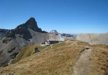
12,8 km | 18 km-effort
Wallis North 4 : Ardon - Gsteig
ovronne
Gebruiker
Lengte
33 km
Max. hoogte
2347 m
Positief hoogteverschil
2316 m
Km-Effort
61 km
Min. hoogte
482 m
Negatief hoogteverschil
1620 m
Boucle
Neen
Datum van aanmaak :
2014-12-10 00:00:00.0
Laatste wijziging :
2014-12-10 00:00:00.0
4h43
Moeilijkheid : Onbekend
Gratisgps-wandelapplicatie
Over ons
Tocht Mountainbike van 33 km beschikbaar op Valais/Wallis, Conthey, Ardon. Deze tocht wordt voorgesteld door ovronne.
Plaatsbepaling
Land:
Switzerland
Regio :
Valais/Wallis
Departement/Provincie :
Conthey
Gemeente :
Ardon
Locatie:
Unknown
Vertrek:(Dec)
Vertrek:(UTM)
365381 ; 5118941 (32T) N.
Opmerkingen
Wandeltochten in de omgeving
Chemin des berges du Rhône
Te voet
Gemakkelijk
Ardon,
Valais/Wallis,
Conthey,
Switzerland
4,4 km | 4,9 km-effort
1h 6min
Neen
Tour du Massif des Muverans
Stappen
Heel gemakkelijk
Sion,
Valais/Wallis,
Sion,
Switzerland
6,2 km | 14,1 km-effort
22h 11min
Neen
st_bg_conthey
Andere activiteiten
Heel gemakkelijk
Conthey,
Valais/Wallis,
Conthey,
Switzerland
22 km | 42 km-effort
9h 21min
Neen
Tour du MontFort - easy
Mountainbike
Heel gemakkelijk
Nendaz,
Valais/Wallis,
Conthey,
Switzerland
48 km | 84 km-effort
Onbekend
Ja
Sentier des pives
Stappen
Moeilijk
Nendaz,
Valais/Wallis,
Conthey,
Switzerland
10 km | 16,7 km-effort
3h 48min
Ja
saint
Stappen
Gemakkelijk
Chamoson,
Valais/Wallis,
Conthey,
Switzerland
36 km | 43 km-effort
6h 53min
Neen
Martigny -Sion iii
Fiets
Heel gemakkelijk
Saillon,
Valais/Wallis,
Martigny,
Switzerland
51 km | 58 km-effort
2h 21min
Ja
Ardon, Einzon
Stappen
Heel gemakkelijk
Ardon,
Valais/Wallis,
Conthey,
Switzerland
8,1 km | 21 km-effort
6h 30min
Ja