![](/images/other/stat-length.png)
![Tocht Stappen Montaignac-Saint-Hippolyte - Les chemins du Doustre - Photo](https://media.geolcdn.com/t/1900/400/ext.pjpeg?maxdim=2&url=https%3A%2F%2Fstatic1.geolcdn.com%2Fsiteimages%2Fupload%2Ffiles%2F1553511878bg_sport_marche.png)
Les chemins du Doustre
chanac les mines
Gebruiker
![Lengte](/images/other/stat-length.png)
Lengte
11,2 km
![Max. hoogte](https://static1.geolcdn.com/siteimages/upload/files/1508320355ic_sort_altitude_max_24dp.png)
Max. hoogte
619 m
![Positief hoogteverschil](https://static1.geolcdn.com/siteimages/upload/files/1508320355ic_sort_den_pos_24dp.png)
Positief hoogteverschil
266 m
![Km-Effort](/images/other/stat-length.png)
Km-Effort
14,8 km
![Min. hoogte](https://static1.geolcdn.com/siteimages/upload/files/1508320355ic_sort_altitude_min_24dp.png)
Min. hoogte
538 m
![Negatief hoogteverschil](https://static1.geolcdn.com/siteimages/upload/files/1508320355ic_sort_den_neg_24dp.png)
Negatief hoogteverschil
265 m
![Boucle](https://static1.geolcdn.com/siteimages/upload/files/16400158638029165_repeat_loop_refresh_sync_direction_icon.png)
Boucle
Ja
Datum van aanmaak :
2024-12-10 12:54:14.115
Laatste wijziging :
2024-12-11 08:31:12.219
![Stappen](https://static1.geolcdn.com/sitytour/trail-icons/101.png)
3h21
Moeilijkheid : Moeilijk
![Scan deze QR-code om de tocht te openen in de SityTrail-applicatie](https://capi.geolives.com/qq0zvz2zws4bq2lad0pu/sitytour/trails/4293174/qr.png?size=200)
Gratisgps-wandelapplicatie
Over ons
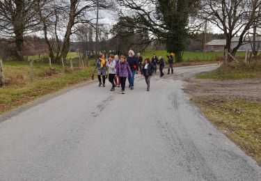
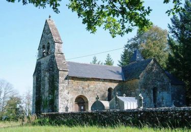
Tocht Stappen van 11,2 km beschikbaar op Nieuw-Aquitanië, Corrèze, Montaignac-Saint-Hippolyte. Deze tocht wordt voorgesteld door chanac les mines.
Beschrijving
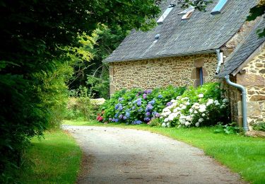
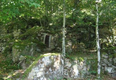
Ce circuit est magnifique ! il faut juste respecter les passages privés, vous découvrirez les rochers et les passerelles du Doustre
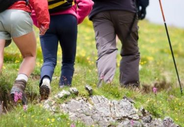
Plaatsbepaling
Land:
France
Regio :
Nieuw-Aquitanië
Departement/Provincie :
Corrèze
Gemeente :
Montaignac-Saint-Hippolyte
Locatie:
Unknown
Vertrek:(Dec)
Vertrek:(UTM)
422582 ; 5022871 (31T) N.
Opmerkingen
Wandeltochten in de omgeving
![Tocht Stappen Montaignac-Saint-Hippolyte - Les Etangs du Doustre - Photo](https://media.geolcdn.com/t/375/260/ext.jpg?maxdim=2&url=https%3A%2F%2Fservices.sitytrail.com%2FGeolivesWS%2FDownloadMedia.ashx%3FTrailID%3D109370%26Media%3D3686_1.jpg)
![Stappen Stappen](https://static1.geolcdn.com/sitytour/trail-icons/101.png)
Les Etangs du Doustre
Stappen
Moeilijk
(1)
Montaignac-Saint-Hippolyte,
Nieuw-Aquitanië,
Corrèze,
France
![](/images/other/stat-length.png)
16,4 km | 21 km-effort
4h 30min
![](https://static1.geolcdn.com/siteimages/upload/files/16400158638029165_repeat_loop_refresh_sync_direction_icon.png)
Ja
![Tocht Te voet Le Jardin - Sur les chemins de Marcouyeux - Photo](https://media.geolcdn.com/t/375/260/c880931d-8ea1-42ec-b107-88566e6b5caa.jpeg&format=jpg&maxdim=2)
![Te voet Te voet](https://static1.geolcdn.com/sitytour/trail-icons/100.png)
Sur les chemins de Marcouyeux
Te voet
Gemakkelijk
Le Jardin,
Nieuw-Aquitanië,
Corrèze,
France
![](/images/other/stat-length.png)
6,5 km | 8,1 km-effort
1h 50min
![](https://static1.geolcdn.com/siteimages/upload/files/16400158638029165_repeat_loop_refresh_sync_direction_icon.png)
Ja
![Tocht Te voet Le Jardin - Le Jardin Bourg - Photo](https://media.geolcdn.com/t/375/260/ext.jpg?maxdim=2&url=https%3A%2F%2Fstatic1.geolcdn.com%2Fsiteimages%2Fupload%2Ffiles%2F1545311037marcheuse_200dpi.jpg)
![Te voet Te voet](https://static1.geolcdn.com/sitytour/trail-icons/100.png)
Le Jardin Bourg
Te voet
Gemakkelijk
Le Jardin,
Nieuw-Aquitanië,
Corrèze,
France
![](/images/other/stat-length.png)
4,4 km | 5,5 km-effort
1h 15min
![](https://static1.geolcdn.com/siteimages/upload/files/16400158638029165_repeat_loop_refresh_sync_direction_icon.png)
Ja
![Tocht Te voet Rosiers-d'Égletons - Le Puy des Places - Photo](https://media.geolcdn.com/t/375/260/276f2976-67c7-4b61-81b4-6fa50409346e.jpg&format=jpg&maxdim=2)
![Te voet Te voet](https://static1.geolcdn.com/sitytour/trail-icons/100.png)
Le Puy des Places
Te voet
Gemakkelijk
Rosiers-d'Égletons,
Nieuw-Aquitanië,
Corrèze,
France
![](/images/other/stat-length.png)
13,2 km | 17,2 km-effort
3h 56min
![](https://static1.geolcdn.com/siteimages/upload/files/16400158638029165_repeat_loop_refresh_sync_direction_icon.png)
Ja
![Tocht Stappen Le Jardin - balade le jardin avec Viviane - Photo](https://media.geolcdn.com/t/375/260/47adab61-fed8-4182-9046-2018509384aa.jpg&format=jpg&maxdim=2)
![Stappen Stappen](https://static1.geolcdn.com/sitytour/trail-icons/101.png)
balade le jardin avec Viviane
Stappen
Heel gemakkelijk
Le Jardin,
Nieuw-Aquitanië,
Corrèze,
France
![](/images/other/stat-length.png)
4,3 km | 5,3 km-effort
1h 29min
![](https://static1.geolcdn.com/siteimages/upload/files/16400158638029165_repeat_loop_refresh_sync_direction_icon.png)
Ja
![Tocht Paard Le Jardin - Sur les chemins de Marcouyeux - Le Jardin - Pays d'Egletons - Photo](https://media.geolcdn.com/t/375/260/ext.jpg?maxdim=2&url=https%3A%2F%2Fservices.sitytrail.com%2FGeolivesWS%2FDownloadMedia.ashx%3FTrailID%3D112403%26Media%3D10527_1.jpg)
![Paard Paard](https://static1.geolcdn.com/sitytour/trail-icons/300.png)
Sur les chemins de Marcouyeux - Le Jardin - Pays d'Egletons
Paard
Medium
Le Jardin,
Nieuw-Aquitanië,
Corrèze,
France
![](/images/other/stat-length.png)
6,4 km | 8 km-effort
1h 10min
![](https://static1.geolcdn.com/siteimages/upload/files/16400158638029165_repeat_loop_refresh_sync_direction_icon.png)
Ja
![Tocht Mountainbike Le Jardin - Sur les chemins de Marcouyeux - Le Jardin - Pays d'Egletons - Photo](https://media.geolcdn.com/t/375/260/ext.jpg?maxdim=2&url=https%3A%2F%2Fservices.sitytrail.com%2FGeolivesWS%2FDownloadMedia.ashx%3FTrailID%3D112402%26Media%3D10527_1.jpg)
![Mountainbike Mountainbike](https://static1.geolcdn.com/sitytour/trail-icons/202.png)
Sur les chemins de Marcouyeux - Le Jardin - Pays d'Egletons
Mountainbike
Medium
Le Jardin,
Nieuw-Aquitanië,
Corrèze,
France
![](/images/other/stat-length.png)
6,4 km | 8 km-effort
34min
![](https://static1.geolcdn.com/siteimages/upload/files/16400158638029165_repeat_loop_refresh_sync_direction_icon.png)
Ja
![Tocht Stappen Le Jardin - Sur les chemins de Marcouyeux - Le Jardin - Pays d'Egletons - Photo](https://media.geolcdn.com/t/375/260/ext.jpg?maxdim=2&url=https%3A%2F%2Fservices.sitytrail.com%2FGeolivesWS%2FDownloadMedia.ashx%3FTrailID%3D112401%26Media%3D10527_1.jpg)
![Stappen Stappen](https://static1.geolcdn.com/sitytour/trail-icons/101.png)
Sur les chemins de Marcouyeux - Le Jardin - Pays d'Egletons
Stappen
Medium
Le Jardin,
Nieuw-Aquitanië,
Corrèze,
France
![](/images/other/stat-length.png)
6,4 km | 8 km-effort
2h 0min
![](https://static1.geolcdn.com/siteimages/upload/files/16400158638029165_repeat_loop_refresh_sync_direction_icon.png)
Ja
![Tocht Stappen Le Jardin - Le Jardin Bourg - Pays d'Égletons - Photo](https://media.geolcdn.com/t/375/260/ext.jpg?maxdim=2&url=https%3A%2F%2Fservices.sitytrail.com%2FGeolivesWS%2FDownloadMedia.ashx%3FTrailID%3D112315%26Media%3D10314_1.jpg)
![Stappen Stappen](https://static1.geolcdn.com/sitytour/trail-icons/101.png)
Le Jardin Bourg - Pays d'Égletons
Stappen
Gemakkelijk
Le Jardin,
Nieuw-Aquitanië,
Corrèze,
France
![](/images/other/stat-length.png)
4,2 km | 5,2 km-effort
1h 10min
![](https://static1.geolcdn.com/siteimages/upload/files/16400158638029165_repeat_loop_refresh_sync_direction_icon.png)
Ja