![](/images/other/stat-length.png)
![Tocht Stappen Gouvy - Cherain - Gouvy - Photo](https://media.geolcdn.com/t/1900/400/ext.pjpeg?maxdim=2&url=https%3A%2F%2Fstatic1.geolcdn.com%2Fsiteimages%2Fupload%2Ffiles%2F1553511878bg_sport_marche.png)
Cherain - Gouvy
pvancau
Gebruiker
![Lengte](/images/other/stat-length.png)
Lengte
8,9 km
![Max. hoogte](https://static1.geolcdn.com/siteimages/upload/files/1508320355ic_sort_altitude_max_24dp.png)
Max. hoogte
454 m
![Positief hoogteverschil](https://static1.geolcdn.com/siteimages/upload/files/1508320355ic_sort_den_pos_24dp.png)
Positief hoogteverschil
179 m
![Km-Effort](/images/other/stat-length.png)
Km-Effort
11,3 km
![Min. hoogte](https://static1.geolcdn.com/siteimages/upload/files/1508320355ic_sort_altitude_min_24dp.png)
Min. hoogte
391 m
![Negatief hoogteverschil](https://static1.geolcdn.com/siteimages/upload/files/1508320355ic_sort_den_neg_24dp.png)
Negatief hoogteverschil
180 m
![Boucle](https://static1.geolcdn.com/siteimages/upload/files/16400158638029165_repeat_loop_refresh_sync_direction_icon.png)
Boucle
Ja
Datum van aanmaak :
2015-06-02 00:00:00.0
Laatste wijziging :
2015-06-02 00:00:00.0
![Stappen](https://static1.geolcdn.com/sitytour/trail-icons/101.png)
2h23
Moeilijkheid : Gemakkelijk
![Scan deze QR-code om de tocht te openen in de SityTrail-applicatie](https://capi.geolives.com/qq0zvz2zws4bq2lad0pu/sitytour/trails/428366/qr.png?size=200)
Gratisgps-wandelapplicatie
Over ons
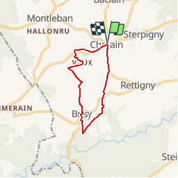
Tocht Stappen van 8,9 km beschikbaar op Wallonië, Luxemburg, Gouvy. Deze tocht wordt voorgesteld door pvancau.
Beschrijving
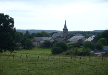
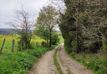
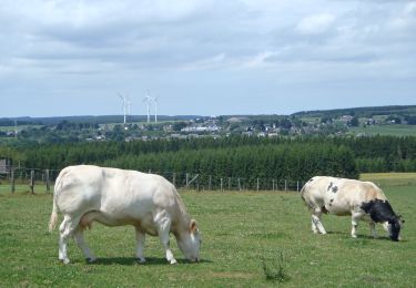
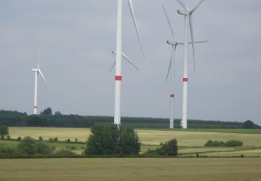
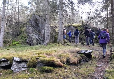
Promenade à travers prairies et bois. Découverte du village de Cherain et des hameaux de Brisy et Vaux avec leur bâti typiquement ardennais.
Départ de l'église de Cherain.
Plaatsbepaling
Land:
Belgium
Regio :
Wallonië
Departement/Provincie :
Luxemburg
Gemeente :
Gouvy
Locatie:
Cherain
Vertrek:(Dec)
Vertrek:(UTM)
704543 ; 5562655 (31U) N.
Opmerkingen
Wandeltochten in de omgeving
![Stappen Stappen](https://static1.geolcdn.com/sitytour/trail-icons/101.png)
RB-Lu-29_Courtil
Stappen
Heel gemakkelijk
(1)
Gouvy,
Wallonië,
Luxemburg,
Belgium
![](/images/other/stat-length.png)
22 km | 26 km-effort
5h 54min
![](https://static1.geolcdn.com/siteimages/upload/files/16400158638029165_repeat_loop_refresh_sync_direction_icon.png)
Ja
![Tocht Stappen Gouvy - 15 juli 2012 - Photo](https://media.geolcdn.com/t/375/260/ext.jpg?maxdim=2&url=https%3A%2F%2Fservices.sitytrail.com%2FGeolivesWS%2FDownloadMedia.ashx%3FTrailID%3D139158%26Media%3D20120715121313.jpg)
![Stappen Stappen](https://static1.geolcdn.com/sitytour/trail-icons/101.png)
15 juli 2012
Stappen
Heel gemakkelijk
(1)
Gouvy,
Wallonië,
Luxemburg,
Belgium
![](/images/other/stat-length.png)
5,1 km | 6,1 km-effort
1h 53min
![](https://static1.geolcdn.com/siteimages/upload/files/16400158638029165_repeat_loop_refresh_sync_direction_icon.png)
Ja
![Tocht Stappen Gouvy - Promenade vers la réserve naturelle](https://media.geolcdn.com/t/375/260/46168e03-2fed-43d1-bdbb-b065fc60f3b9.jpg&format=jpg&maxdim=2)
![Stappen Stappen](https://static1.geolcdn.com/sitytour/trail-icons/101.png)
Promenade vers la réserve naturelle "Chi Fontaine" - Gouvy
Stappen
Gemakkelijk
(5)
Gouvy,
Wallonië,
Luxemburg,
Belgium
![](/images/other/stat-length.png)
4,4 km | 5,3 km-effort
1h 11min
![](https://static1.geolcdn.com/siteimages/upload/files/16400158638029165_repeat_loop_refresh_sync_direction_icon.png)
Ja
![Tocht Stappen Gouvy - Au fil de l'eau - Gouvy - Photo](https://media.geolcdn.com/t/375/260/fd3fbf79-417f-4fef-bcc5-76d7dce912c8.jpg&format=jpg&maxdim=2)
![Stappen Stappen](https://static1.geolcdn.com/sitytour/trail-icons/101.png)
Au fil de l'eau - Gouvy
Stappen
Medium
(1)
Gouvy,
Wallonië,
Luxemburg,
Belgium
![](/images/other/stat-length.png)
7,3 km | 9,6 km-effort
2h 11min
![](https://static1.geolcdn.com/siteimages/upload/files/16400158638029165_repeat_loop_refresh_sync_direction_icon.png)
Ja
![Stappen Stappen](https://static1.geolcdn.com/sitytour/trail-icons/101.png)
RB-Lu-29_Courtil_variante
Stappen
Zeer moeilijk
(1)
Gouvy,
Wallonië,
Luxemburg,
Belgium
![](/images/other/stat-length.png)
28 km | 34 km-effort
7h 47min
![](https://static1.geolcdn.com/siteimages/upload/files/16400158638029165_repeat_loop_refresh_sync_direction_icon.png)
Ja
![Stappen Stappen](https://static1.geolcdn.com/sitytour/trail-icons/101.png)
RB-Lu-29_Courtil_via-racc
Stappen
Moeilijk
Gouvy,
Wallonië,
Luxemburg,
Belgium
![](/images/other/stat-length.png)
15,3 km | 18,8 km-effort
4h 16min
![](https://static1.geolcdn.com/siteimages/upload/files/16400158638029165_repeat_loop_refresh_sync_direction_icon.png)
Ja
![Tocht Stappen Gouvy - baclain - Photo](https://media.geolcdn.com/t/375/260/44b7fd52-e514-4c92-89ba-623cf2d25538.jpg&format=jpg&maxdim=2)
![Stappen Stappen](https://static1.geolcdn.com/sitytour/trail-icons/101.png)
![Tocht Te voet Gouvy - GrWandARd 33:Brisy bossen en weiden aan de Oost-Ourthe - Photo](https://media.geolcdn.com/t/375/260/4e1c6be1-5137-443f-a562-71a83efe2499.jpg&format=jpg&maxdim=2)
![Te voet Te voet](https://static1.geolcdn.com/sitytour/trail-icons/100.png)
GrWandARd 33:Brisy bossen en weiden aan de Oost-Ourthe
Te voet
Gemakkelijk
Gouvy,
Wallonië,
Luxemburg,
Belgium
![](/images/other/stat-length.png)
8,6 km | 10,5 km-effort
2h 23min
![](https://static1.geolcdn.com/siteimages/upload/files/16400158638029165_repeat_loop_refresh_sync_direction_icon.png)
Ja
![Tocht Stappen Gouvy - BE - Marche Bovigny 2017 Longue - Photo](https://media.geolcdn.com/t/375/260/ext.jpg?maxdim=2&url=https%3A%2F%2Fstatic1.geolcdn.com%2Fsiteimages%2Fupload%2Ffiles%2F1553511878bg_sport_marche.png)
![Stappen Stappen](https://static1.geolcdn.com/sitytour/trail-icons/101.png)
BE - Marche Bovigny 2017 Longue
Stappen
Gemakkelijk
(1)
Gouvy,
Wallonië,
Luxemburg,
Belgium
![](/images/other/stat-length.png)
7,7 km | 9,5 km-effort
2h 6min
![](https://static1.geolcdn.com/siteimages/upload/files/16400158638029165_repeat_loop_refresh_sync_direction_icon.png)
Ja