![](/images/other/stat-length.png)
![Tocht Iffendic - 2024-11-28_14h16m39_SityTrail - 4269401 - 2024x11x28-iffendic-reconnu - Photo](https://media.geolcdn.com/t/1900/400/ext.pjpeg?maxdim=2&url=https%3A%2F%2Fsecurestorage.geolives.com%2Fsitytour%2Ftrail-bg%2Fdefault.jpg)
2024-11-28_14h16m39_SityTrail - 4269401 - 2024x11x28-iffendic-reconnu
Ameligue
Gebruiker
![Lengte](/images/other/stat-length.png)
Lengte
8,9 km
![Max. hoogte](https://static1.geolcdn.com/siteimages/upload/files/1508320355ic_sort_altitude_max_24dp.png)
Max. hoogte
109 m
![Positief hoogteverschil](https://static1.geolcdn.com/siteimages/upload/files/1508320355ic_sort_den_pos_24dp.png)
Positief hoogteverschil
157 m
![Km-Effort](/images/other/stat-length.png)
Km-Effort
10,9 km
![Min. hoogte](https://static1.geolcdn.com/siteimages/upload/files/1508320355ic_sort_altitude_min_24dp.png)
Min. hoogte
39 m
![Negatief hoogteverschil](https://static1.geolcdn.com/siteimages/upload/files/1508320355ic_sort_den_neg_24dp.png)
Negatief hoogteverschil
133 m
![Boucle](https://static1.geolcdn.com/siteimages/upload/files/16400158638029165_repeat_loop_refresh_sync_direction_icon.png)
Boucle
Neen
Datum van aanmaak :
2024-11-28 13:16:39.415
Laatste wijziging :
2024-11-28 13:16:42.169
![Scan deze QR-code om de tocht te openen in de SityTrail-applicatie](https://capi.geolives.com/qq0zvz2zws4bq2lad0pu/sitytour/trails/4282745/qr.png?size=200)
Gratisgps-wandelapplicatie
Over ons
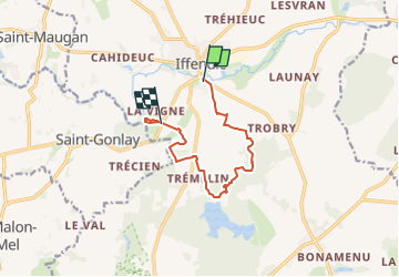
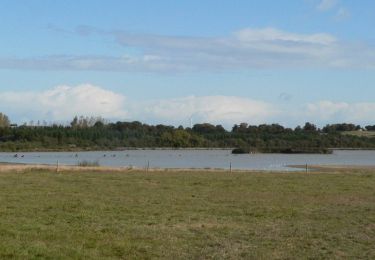
Tocht van 8,9 km beschikbaar op Bretagne, Ille-et-Vilaine, Iffendic. Deze tocht wordt voorgesteld door Ameligue.
Beschrijving
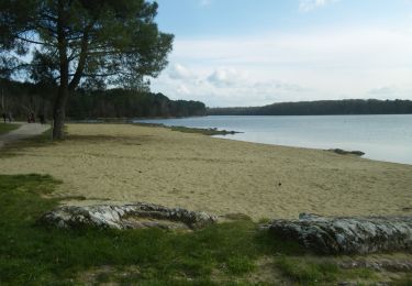
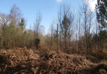
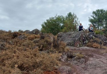
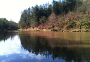
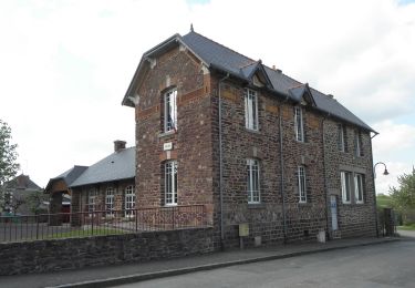
dénivelés importants, plusieurs traversées de ruisseaux sur des pierres, quelques passages sur des schistes qui pourraient être glissant en cas de pluie, mais pas ou peu de boue, paysages magnifiques et arrivée dans le parc du château de la Châsse.
Plaatsbepaling
Land:
France
Regio :
Bretagne
Departement/Provincie :
Ille-et-Vilaine
Gemeente :
Iffendic
Locatie:
Unknown
Vertrek:(Dec)
Vertrek:(UTM)
571963 ; 5330673 (30U) N.
Opmerkingen
Wandeltochten in de omgeving
![Tocht Te voet Iffendic - Lac et landiers de Trémelin - Photo](https://media.geolcdn.com/t/375/260/7ac840cd-e5f1-4d8d-95cf-07084d9e8f75.jpeg&format=jpg&maxdim=2)
![Te voet Te voet](https://static1.geolcdn.com/sitytour/trail-icons/100.png)
Lac et landiers de Trémelin
Te voet
Gemakkelijk
Iffendic,
Bretagne,
Ille-et-Vilaine,
France
![](/images/other/stat-length.png)
9,9 km | 11,4 km-effort
2h 34min
![](https://static1.geolcdn.com/siteimages/upload/files/16400158638029165_repeat_loop_refresh_sync_direction_icon.png)
Ja
![Tocht Te voet Iffendic - La Pierre Longue - Photo](https://media.geolcdn.com/t/375/260/8b094444-c6e7-42e6-b27a-c82fe025f95f.jpeg&format=jpg&maxdim=2)
![Te voet Te voet](https://static1.geolcdn.com/sitytour/trail-icons/100.png)
La Pierre Longue
Te voet
Gemakkelijk
Iffendic,
Bretagne,
Ille-et-Vilaine,
France
![](/images/other/stat-length.png)
8,3 km | 9,9 km-effort
2h 15min
![](https://static1.geolcdn.com/siteimages/upload/files/16400158638029165_repeat_loop_refresh_sync_direction_icon.png)
Ja
![Tocht Te voet Iffendic - Le Tour du Lac de Trémelin - Photo](https://media.geolcdn.com/t/375/260/b24516e3-87a2-4631-bc74-5cefab2c06d9.jpeg&format=jpg&maxdim=2)
![Te voet Te voet](https://static1.geolcdn.com/sitytour/trail-icons/100.png)
Le Tour du Lac de Trémelin
Te voet
Gemakkelijk
Iffendic,
Bretagne,
Ille-et-Vilaine,
France
![](/images/other/stat-length.png)
5 km | 5,5 km-effort
1h 15min
![](https://static1.geolcdn.com/siteimages/upload/files/16400158638029165_repeat_loop_refresh_sync_direction_icon.png)
Ja
![Tocht Stappen Iffendic - GR_37_CC_37_Iffendic_Plelan-le-Grand_20220821 - Photo](https://media.geolcdn.com/t/375/260/a461a4e2-f121-4384-a36b-7fa282322953.jpg&format=jpg&maxdim=2)
![Stappen Stappen](https://static1.geolcdn.com/sitytour/trail-icons/101.png)
GR_37_CC_37_Iffendic_Plelan-le-Grand_20220821
Stappen
Gemakkelijk
Iffendic,
Bretagne,
Ille-et-Vilaine,
France
![](/images/other/stat-length.png)
22 km | 25 km-effort
5h 25min
![](https://static1.geolcdn.com/siteimages/upload/files/16400158638029165_repeat_loop_refresh_sync_direction_icon.png)
Neen
![Tocht Te voet Saint-Gonlay - Circuit de Lorinou - Photo](https://media.geolcdn.com/t/375/260/6659771c-e661-47f3-8cb5-3a3f13080ca5.jpeg&format=jpg&maxdim=2)
![Te voet Te voet](https://static1.geolcdn.com/sitytour/trail-icons/100.png)
Circuit de Lorinou
Te voet
Gemakkelijk
Saint-Gonlay,
Bretagne,
Ille-et-Vilaine,
France
![](/images/other/stat-length.png)
9,2 km | 11 km-effort
2h 29min
![](https://static1.geolcdn.com/siteimages/upload/files/16400158638029165_repeat_loop_refresh_sync_direction_icon.png)
Ja
![Tocht Te voet Saint-Gonlay - Chemin des Moulins - Photo](https://media.geolcdn.com/t/375/260/bc01016c-afeb-4a6c-a5c1-892106093006.jpeg&format=jpg&maxdim=2)
![Te voet Te voet](https://static1.geolcdn.com/sitytour/trail-icons/100.png)
Chemin des Moulins
Te voet
Gemakkelijk
Saint-Gonlay,
Bretagne,
Ille-et-Vilaine,
France
![](/images/other/stat-length.png)
7,9 km | 9,1 km-effort
2h 3min
![](https://static1.geolcdn.com/siteimages/upload/files/16400158638029165_repeat_loop_refresh_sync_direction_icon.png)
Ja
![Tocht Te voet Iffendic - La Chambre-au-Loup - Photo](https://media.geolcdn.com/t/375/260/035739df-732e-4c49-94a4-b2bf0e9233ac.jpeg&format=jpg&maxdim=2)
![Te voet Te voet](https://static1.geolcdn.com/sitytour/trail-icons/100.png)
La Chambre-au-Loup
Te voet
Gemakkelijk
Iffendic,
Bretagne,
Ille-et-Vilaine,
France
![](/images/other/stat-length.png)
9,5 km | 11,1 km-effort
2h 30min
![](https://static1.geolcdn.com/siteimages/upload/files/16400158638029165_repeat_loop_refresh_sync_direction_icon.png)
Ja
![Tocht Stappen Iffendic - La balade des deux étangs entre Trémelin et Careil - Iffendic - Photo](https://media.geolcdn.com/t/375/260/ext.jpg?maxdim=2&url=https%3A%2F%2Fservices.sitytrail.com%2FGeolivesWS%2FDownloadMedia.ashx%3FTrailID%3D317843%26Media%3D17217_5.jpg)
![Stappen Stappen](https://static1.geolcdn.com/sitytour/trail-icons/101.png)
La balade des deux étangs entre Trémelin et Careil - Iffendic
Stappen
Medium
(1)
Iffendic,
Bretagne,
Ille-et-Vilaine,
France
![](/images/other/stat-length.png)
12,7 km | 14,3 km-effort
3h 30min
![](https://static1.geolcdn.com/siteimages/upload/files/16400158638029165_repeat_loop_refresh_sync_direction_icon.png)
Ja
![Tocht Stappen Iffendic - L'étang des landiers - Iffendic - Photo](https://media.geolcdn.com/t/375/260/ext.jpg?maxdim=2&url=https%3A%2F%2Fservices.sitytrail.com%2FGeolivesWS%2FDownloadMedia.ashx%3FTrailID%3D317719%26Media%3D17030_5.jpg)
![Stappen Stappen](https://static1.geolcdn.com/sitytour/trail-icons/101.png)
L'étang des landiers - Iffendic
Stappen
Medium
(1)
Iffendic,
Bretagne,
Ille-et-Vilaine,
France
![](/images/other/stat-length.png)
9,7 km | 11,1 km-effort
3h 0min
![](https://static1.geolcdn.com/siteimages/upload/files/16400158638029165_repeat_loop_refresh_sync_direction_icon.png)
Ja