![](/images/other/stat-length.png)
![Tocht Paardrijden Lemberg - suuntoapp-HorsebackRiding-2024-11-11T08-51-25Z - Photo](https://media.geolcdn.com/t/1900/400/ea9311dd-1d9e-48ba-a2e2-24731aca39a9.jpg&format=pjpeg&maxdim=2)
suuntoapp-HorsebackRiding-2024-11-11T08-51-25Z
holtzv
Gebruiker GUIDE
![Lengte](/images/other/stat-length.png)
Lengte
28 km
![Max. hoogte](https://static1.geolcdn.com/siteimages/upload/files/1508320355ic_sort_altitude_max_24dp.png)
Max. hoogte
432 m
![Positief hoogteverschil](https://static1.geolcdn.com/siteimages/upload/files/1508320355ic_sort_den_pos_24dp.png)
Positief hoogteverschil
632 m
![Km-Effort](/images/other/stat-length.png)
Km-Effort
36 km
![Min. hoogte](https://static1.geolcdn.com/siteimages/upload/files/1508320355ic_sort_altitude_min_24dp.png)
Min. hoogte
234 m
![Negatief hoogteverschil](https://static1.geolcdn.com/siteimages/upload/files/1508320355ic_sort_den_neg_24dp.png)
Negatief hoogteverschil
636 m
![Boucle](https://static1.geolcdn.com/siteimages/upload/files/16400158638029165_repeat_loop_refresh_sync_direction_icon.png)
Boucle
Ja
Datum van aanmaak :
2024-11-12 09:56:52.079
Laatste wijziging :
2024-11-12 10:01:05.329
![Paardrijden](https://static1.geolcdn.com/sitytour/trail-icons/301.png)
4h46
Moeilijkheid : Heel gemakkelijk
![Scan deze QR-code om de tocht te openen in de SityTrail-applicatie](https://capi.geolives.com/qq0zvz2zws4bq2lad0pu/sitytour/trails/4262784/qr.png?size=200)
Gratisgps-wandelapplicatie
Over ons
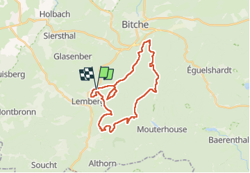
Tocht Paardrijden van 28 km beschikbaar op Grand Est, Moselle, Lemberg. Deze tocht wordt voorgesteld door holtzv.
Beschrijving
Week-end CVA à Soucht (57) : Jour 3 sur 3
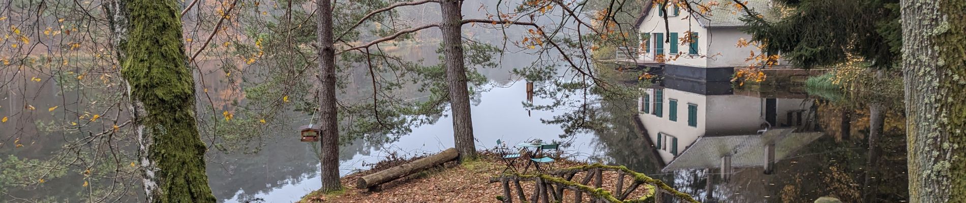
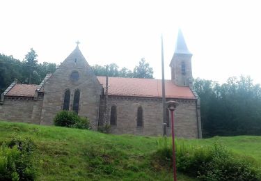
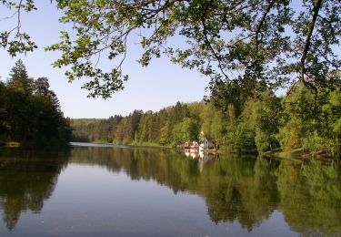
Journée au départ du stade de foot de Lemberg en passant par la grotte du Chorfelsen, les étangs de Hasselfurth et Entenbaechel et la cascade des Ondines.
Plaatsbepaling
Land:
France
Regio :
Grand Est
Departement/Provincie :
Moselle
Gemeente :
Lemberg
Locatie:
Unknown
Vertrek:(Dec)
Vertrek:(UTM)
382123 ; 5429623 (32U) N.
Opmerkingen
Wandeltochten in de omgeving
![Tocht Stappen Bitche - Etang de Hasselfurth et Hochkopf - Bitche - Photo](https://media.geolcdn.com/t/375/260/ext.jpg?maxdim=2&url=https%3A%2F%2Fservices.sitytrail.com%2FGeolivesWS%2FDownloadMedia.ashx%3FTrailID%3D317857%26Media%3D17240_6.jpg)
![Stappen Stappen](https://static1.geolcdn.com/sitytour/trail-icons/101.png)
Etang de Hasselfurth et Hochkopf - Bitche
Stappen
Medium
(1)
Bitche,
Grand Est,
Moselle,
France
![](/images/other/stat-length.png)
7,8 km | 10,1 km-effort
2h 0min
![](https://static1.geolcdn.com/siteimages/upload/files/16400158638029165_repeat_loop_refresh_sync_direction_icon.png)
Ja
![Tocht Stappen Saint-Louis-lès-Bitche - Saint-Louis-Lès-Bitche et le pays du verre et du cristal - Photo](https://media.geolcdn.com/t/375/260/ext.jpg?maxdim=2&url=https%3A%2F%2Fservices.sitytrail.com%2FGeolivesWS%2FDownloadMedia.ashx%3FTrailID%3D317570%26Media%3D16827_6.jpg)
![Stappen Stappen](https://static1.geolcdn.com/sitytour/trail-icons/101.png)
Saint-Louis-Lès-Bitche et le pays du verre et du cristal
Stappen
Medium
(2)
Saint-Louis-lès-Bitche,
Grand Est,
Moselle,
France
![](/images/other/stat-length.png)
13,1 km | 17,5 km-effort
3h 19min
![](https://static1.geolcdn.com/siteimages/upload/files/16400158638029165_repeat_loop_refresh_sync_direction_icon.png)
Ja
![Tocht Stappen Bitche - Circuit panoramique de Bitche - Photo](https://media.geolcdn.com/t/375/260/ext.jpg?maxdim=2&url=https%3A%2F%2Fservices.sitytrail.com%2FGeolivesWS%2FDownloadMedia.ashx%3FTrailID%3D118677%26Media%3D12842_6.jpg)
![Stappen Stappen](https://static1.geolcdn.com/sitytour/trail-icons/101.png)
Circuit panoramique de Bitche
Stappen
Medium
(2)
Bitche,
Grand Est,
Moselle,
France
![](/images/other/stat-length.png)
12,7 km | 16,7 km-effort
3h 25min
![](https://static1.geolcdn.com/siteimages/upload/files/16400158638029165_repeat_loop_refresh_sync_direction_icon.png)
Ja
![Tocht Stappen Bitche - Étang Hasselfurth 250112 - Photo](https://media.geolcdn.com/t/375/260/3662900e-8205-4856-9f76-ac80e91a6fa5.jpg&format=jpg&maxdim=2)
![Stappen Stappen](https://static1.geolcdn.com/sitytour/trail-icons/101.png)
Étang Hasselfurth 250112
Stappen
Medium
Bitche,
Grand Est,
Moselle,
France
![](/images/other/stat-length.png)
9,9 km | 13,1 km-effort
3h 0min
![](https://static1.geolcdn.com/siteimages/upload/files/16400158638029165_repeat_loop_refresh_sync_direction_icon.png)
Ja
![Tocht Te voet Meisenthal - Sur les traces des Verriers et des Sabotiers - circuit 2 - Photo](https://media.geolcdn.com/t/375/260/6caab5bb-203b-4360-b4ea-26455e163371.jpeg&format=jpg&maxdim=2)
![Te voet Te voet](https://static1.geolcdn.com/sitytour/trail-icons/100.png)
Sur les traces des Verriers et des Sabotiers - circuit 2
Te voet
Gemakkelijk
Meisenthal,
Grand Est,
Moselle,
France
![](/images/other/stat-length.png)
12,2 km | 16,7 km-effort
3h 47min
![](https://static1.geolcdn.com/siteimages/upload/files/16400158638029165_repeat_loop_refresh_sync_direction_icon.png)
Ja
![Tocht Te voet Goetzenbruck - Circuit des fontaines et lavoirs autour de Goetzenbruck - Photo](https://media.geolcdn.com/t/375/260/32d4f88d-fe9b-486d-8b31-2d18471e7ec7.jpeg&format=jpg&maxdim=2)
![Te voet Te voet](https://static1.geolcdn.com/sitytour/trail-icons/100.png)
Circuit des fontaines et lavoirs autour de Goetzenbruck
Te voet
Gemakkelijk
Goetzenbruck,
Grand Est,
Moselle,
France
![](/images/other/stat-length.png)
6,7 km | 9,1 km-effort
2h 4min
![](https://static1.geolcdn.com/siteimages/upload/files/16400158638029165_repeat_loop_refresh_sync_direction_icon.png)
Ja
![Tocht Te voet Mouterhouse - Yellow cross - Photo](https://media.geolcdn.com/t/375/260/aaa04aca-0f7b-4b8c-9cba-2f4a0cf60bff.jpeg&format=jpg&maxdim=2)
![Te voet Te voet](https://static1.geolcdn.com/sitytour/trail-icons/100.png)
Yellow cross
Te voet
Gemakkelijk
Mouterhouse,
Grand Est,
Moselle,
France
![](/images/other/stat-length.png)
9,9 km | 14,4 km-effort
3h 16min
![](https://static1.geolcdn.com/siteimages/upload/files/16400158638029165_repeat_loop_refresh_sync_direction_icon.png)
Neen
![Tocht Te voet Lemberg - Blue triangle - Photo](https://media.geolcdn.com/t/375/260/4728c46a-5534-4d4c-a2d5-aeb4236cb3e1.jpeg&format=jpg&maxdim=2)
![Te voet Te voet](https://static1.geolcdn.com/sitytour/trail-icons/100.png)
Blue triangle
Te voet
Gemakkelijk
Lemberg,
Grand Est,
Moselle,
France
![](/images/other/stat-length.png)
9 km | 10,9 km-effort
2h 29min
![](https://static1.geolcdn.com/siteimages/upload/files/16400158638029165_repeat_loop_refresh_sync_direction_icon.png)
Neen
![Tocht Te voet Lemberg - Blue ring - Photo](https://media.geolcdn.com/t/375/260/b1064c1c-fa8f-4421-8664-f1631d4d3040.jpeg&format=jpg&maxdim=2)
![Te voet Te voet](https://static1.geolcdn.com/sitytour/trail-icons/100.png)
Blue ring
Te voet
Gemakkelijk
Lemberg,
Grand Est,
Moselle,
France
![](/images/other/stat-length.png)
6,1 km | 7,9 km-effort
1h 48min
![](https://static1.geolcdn.com/siteimages/upload/files/16400158638029165_repeat_loop_refresh_sync_direction_icon.png)
Ja