![](/images/other/stat-length.png)
![Tocht Stappen Oupia - Oupia to Ségonne - Photo](https://media.geolcdn.com/t/1900/400/ext.pjpeg?maxdim=2&url=https%3A%2F%2Fservices.sitytrail.com%2FGeolivesWS%2FDownloadMedia.ashx%3FTrailID%3D424892%26Media%3D20150524125911.jpg)
Oupia to Ségonne
mootman
Gebruiker
![Lengte](/images/other/stat-length.png)
Lengte
13,7 km
![Max. hoogte](https://static1.geolcdn.com/siteimages/upload/files/1508320355ic_sort_altitude_max_24dp.png)
Max. hoogte
263 m
![Positief hoogteverschil](https://static1.geolcdn.com/siteimages/upload/files/1508320355ic_sort_den_pos_24dp.png)
Positief hoogteverschil
322 m
![Km-Effort](/images/other/stat-length.png)
Km-Effort
17,8 km
![Min. hoogte](https://static1.geolcdn.com/siteimages/upload/files/1508320355ic_sort_altitude_min_24dp.png)
Min. hoogte
75 m
![Negatief hoogteverschil](https://static1.geolcdn.com/siteimages/upload/files/1508320355ic_sort_den_neg_24dp.png)
Negatief hoogteverschil
265 m
![Boucle](https://static1.geolcdn.com/siteimages/upload/files/16400158638029165_repeat_loop_refresh_sync_direction_icon.png)
Boucle
Neen
Datum van aanmaak :
2015-05-24 00:00:00.0
Laatste wijziging :
2015-05-24 00:00:00.0
![Stappen](https://static1.geolcdn.com/sitytour/trail-icons/101.png)
2h15
Moeilijkheid : Gemakkelijk
![Scan deze QR-code om de tocht te openen in de SityTrail-applicatie](https://capi.geolives.com/qq0zvz2zws4bq2lad0pu/sitytour/trails/424892/qr.png?size=200)
Gratisgps-wandelapplicatie
Over ons
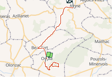
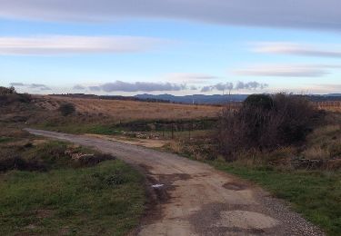
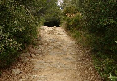
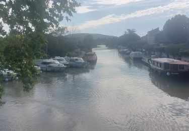
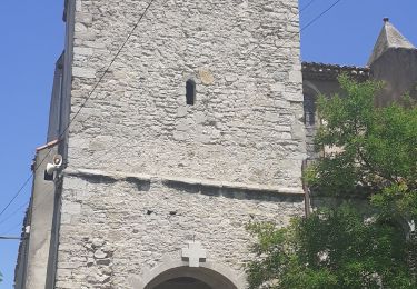
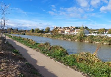
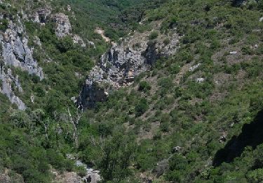
Tocht Stappen van 13,7 km beschikbaar op Occitanië, Hérault, Oupia. Deze tocht wordt voorgesteld door mootman.
Beschrijving
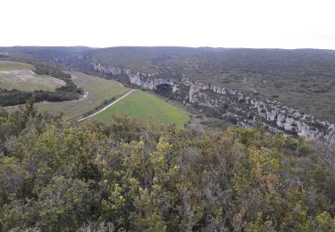
A gentle climb along well marked tracks and paths. Excellent views of the Minervois, Corbières, Massif de la Clappe and Montange Noire throughout.
Plaatsbepaling
Land:
France
Regio :
Occitanië
Departement/Provincie :
Hérault
Gemeente :
Oupia
Locatie:
Unknown
Vertrek:(Dec)
Vertrek:(UTM)
480942 ; 4792731 (31T) N.
Opmerkingen
Wandeltochten in de omgeving
![Tocht Stappen Cesseras - Grotte Aldène Cesseras - Photo](https://media.geolcdn.com/t/375/260/fbc77cc8-93f1-4b6b-b038-073024d6a586.jpg&format=jpg&maxdim=2)
![Stappen Stappen](https://static1.geolcdn.com/sitytour/trail-icons/101.png)
Grotte Aldène Cesseras
Stappen
Gemakkelijk
(3)
Cesseras,
Occitanië,
Hérault,
France
![](/images/other/stat-length.png)
12,6 km | 17,8 km-effort
3h 10min
![](https://static1.geolcdn.com/siteimages/upload/files/16400158638029165_repeat_loop_refresh_sync_direction_icon.png)
Ja
![Tocht Stappen Cesseras - 2023-04-08_21h30m21_Cesseras 10kms - Photo](https://media.geolcdn.com/t/375/260/63ef11e1-9828-4e19-8811-ad8eeda1adef.jpg&format=jpg&maxdim=2)
![Stappen Stappen](https://static1.geolcdn.com/sitytour/trail-icons/101.png)
2023-04-08_21h30m21_Cesseras 10kms
Stappen
Medium
(2)
Cesseras,
Occitanië,
Hérault,
France
![](/images/other/stat-length.png)
11,6 km | 16,3 km-effort
3h 42min
![](https://static1.geolcdn.com/siteimages/upload/files/16400158638029165_repeat_loop_refresh_sync_direction_icon.png)
Ja
![Tocht Stappen Aigne - Aigne - Saume Longue - Photo](https://media.geolcdn.com/t/375/260/ext.jpg?maxdim=2&url=https%3A%2F%2Fservices.sitytrail.com%2FGeolivesWS%2FDownloadMedia.ashx%3FTrailID%3D373254%26Media%3D20141229163850.jpg)
![Stappen Stappen](https://static1.geolcdn.com/sitytour/trail-icons/101.png)
Aigne - Saume Longue
Stappen
Heel gemakkelijk
(1)
Aigne,
Occitanië,
Hérault,
France
![](/images/other/stat-length.png)
4,8 km | 5,7 km-effort
1h 32min
![](https://static1.geolcdn.com/siteimages/upload/files/16400158638029165_repeat_loop_refresh_sync_direction_icon.png)
Ja
![Tocht Stappen Aigues-Vives - croix de St Félix boucle pech de agel - Photo](https://media.geolcdn.com/t/375/260/ext.jpg?maxdim=2&url=https%3A%2F%2Fservices.sitytrail.com%2FGeolivesWS%2FDownloadMedia.ashx%3FTrailID%3D550688%26Media%3Dfix__20160408124301.jpg)
![Stappen Stappen](https://static1.geolcdn.com/sitytour/trail-icons/101.png)
croix de St Félix boucle pech de agel
Stappen
Gemakkelijk
(1)
Aigues-Vives,
Occitanië,
Hérault,
France
![](/images/other/stat-length.png)
9 km | 12 km-effort
2h 47min
![](https://static1.geolcdn.com/siteimages/upload/files/16400158638029165_repeat_loop_refresh_sync_direction_icon.png)
Ja
![Tocht Stappen Tourouzelle - 11-Tourouzelle la Pinède de la Bade - 23/02/2014 - Photo](https://media.geolcdn.com/t/375/260/ext.jpg?maxdim=2&url=https%3A%2F%2Fservices.sitytrail.com%2FGeolivesWS%2FDownloadMedia.ashx%3FTrailID%3D252416%26Media%3Dfix__20140223114729.jpg)
![Stappen Stappen](https://static1.geolcdn.com/sitytour/trail-icons/101.png)
11-Tourouzelle la Pinède de la Bade - 23/02/2014
Stappen
Gemakkelijk
(2)
Tourouzelle,
Occitanië,
Aude,
France
![](/images/other/stat-length.png)
9,7 km | 11,9 km-effort
2h 29min
![](https://static1.geolcdn.com/siteimages/upload/files/16400158638029165_repeat_loop_refresh_sync_direction_icon.png)
Ja
![Tocht Stappen Homps - CC_Piemont_AD_04_Homps_St-Frichoux_20240614 - Photo](https://media.geolcdn.com/t/375/260/4725efec-6355-42bd-b509-ffcf2dd339b4.jpg&format=jpg&maxdim=2)
![Stappen Stappen](https://static1.geolcdn.com/sitytour/trail-icons/101.png)
CC_Piemont_AD_04_Homps_St-Frichoux_20240614
Stappen
Gemakkelijk
Homps,
Occitanië,
Aude,
France
![](/images/other/stat-length.png)
23 km | 26 km-effort
5h 56min
![](https://static1.geolcdn.com/siteimages/upload/files/16400158638029165_repeat_loop_refresh_sync_direction_icon.png)
Neen
![Tocht Stappen Azillanet - Azillanet Minerve - Photo](https://media.geolcdn.com/t/375/260/17a8c3f2-392a-4950-a09a-5c0f5e3f5c78.jpg&format=jpg&maxdim=2)
![Stappen Stappen](https://static1.geolcdn.com/sitytour/trail-icons/101.png)
Azillanet Minerve
Stappen
Moeilijk
Azillanet,
Occitanië,
Hérault,
France
![](/images/other/stat-length.png)
18 km | 25 km-effort
5h 30min
![](https://static1.geolcdn.com/siteimages/upload/files/16400158638029165_repeat_loop_refresh_sync_direction_icon.png)
Ja
![Tocht Stappen Roubia - Autour de Roubia - Photo](https://media.geolcdn.com/t/375/260/8fdc2bbb-69b7-4502-8cc8-ba67b30c173c.jpg&format=jpg&maxdim=2)
![Stappen Stappen](https://static1.geolcdn.com/sitytour/trail-icons/101.png)
Autour de Roubia
Stappen
Gemakkelijk
Roubia,
Occitanië,
Aude,
France
![](/images/other/stat-length.png)
14,9 km | 17,5 km-effort
4h 30min
![](https://static1.geolcdn.com/siteimages/upload/files/16400158638029165_repeat_loop_refresh_sync_direction_icon.png)
Ja
![Stappen Stappen](https://static1.geolcdn.com/sitytour/trail-icons/101.png)
Azillanet, Minerve, remontée du Brian et gorges de la Cesse
Stappen
Medium
Azillanet,
Occitanië,
Hérault,
France
![](/images/other/stat-length.png)
21 km | 29 km-effort
7h 0min
![](https://static1.geolcdn.com/siteimages/upload/files/16400158638029165_repeat_loop_refresh_sync_direction_icon.png)
Ja