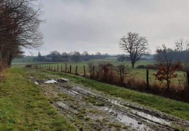
Sob 14 moulins/cephons St pierre de lamps SityTrail > Tochten > Outdoor > France > Centre-Val de Loire > Indre > Moulins-sur-Céphons SityTrail > Tochten > Outdoor > France > Centre-Val de Loire > Indre > Moulins-sur-Céphons Sob 14 moulins/cephons St pierre de lamps Glurps Gebruiker 3D © OpenStreetMap contributors Lengte 6 km Max. hoogte 175 m Positief hoogteverschil 33 m Km-Effort 6,6 km Min. hoogte 127 m Negatief hoogteverschil 68 m Boucle Neen Datum van aanmaak : 2024-09-23 06:50:42.0 Laatste wijziging : 2024-09-23 08:20:25.001 (0 Bericht) Gratisgps-wandelapplicatie SityTrail IGN / Geografische instituten SityTrail World De wereld gaat voor u open Over ons Tocht van 6 km beschikbaar op Centre-Val de Loire, Indre, Moulins-sur-Céphons. Deze tocht wordt voorgesteld door Glurps. Legenden | Meer details (PDF) Hoogteprofiel Legenden > 15% 15% - 10% 10% - 5% vlak 5% - 10% 10% - 15% 15% - 30% > 30% Plaatsbepaling Land: France Regio : Centre-Val de Loire Departement/Provincie : Indre Gemeente : Moulins-sur-Céphons Locatie: Unknown Vertrek:(Dec) 47.025312 / 1.528693 Vertrek:(UTM) 388197 ; 5209027 (31T) N. Opmerkingen Gelieve in te loggen om een commentaar of een beoordeling achter te laten Wandeltochten in de omgeving Fredrando64 Randonnée - boucle jaune - Géhée Te voet Gemakkelijk Gehée, Centre-Val de Loire, Indre, France 10,5 km | 12,1 km-effort 2h 45min Ja Fredrando64 Randonnée - boucle bleue - Géhée Te voet Gemakkelijk Gehée, Centre-Val de Loire, Indre, France 5,2 km | 6,2 km-effort 1h 30min Ja Gwen Bonneau boucle marchaisiere / la boutelaie / le marchais/plaineffe Paardrijden Gemakkelijk Langé, Centre-Val de Loire, Indre, France 7,2 km | 8 km-effort 1h 2min Neen