![](/images/other/stat-length.png)
![Tocht Stappen Presle - Le Chapotet - Photo](https://media.geolcdn.com/t/1900/400/ext.pjpeg?maxdim=2&url=https%3A%2F%2Fservices.sitytrail.com%2FGeolivesWS%2FDownloadMedia.ashx%3FTrailID%3D419016%26Media%3Dfix__20150510103449.jpg)
Le Chapotet
ddaniel
Gebruiker
![Lengte](/images/other/stat-length.png)
Lengte
12,6 km
![Max. hoogte](https://static1.geolcdn.com/siteimages/upload/files/1508320355ic_sort_altitude_max_24dp.png)
Max. hoogte
2073 m
![Positief hoogteverschil](https://static1.geolcdn.com/siteimages/upload/files/1508320355ic_sort_den_pos_24dp.png)
Positief hoogteverschil
827 m
![Km-Effort](/images/other/stat-length.png)
Km-Effort
24 km
![Min. hoogte](https://static1.geolcdn.com/siteimages/upload/files/1508320355ic_sort_altitude_min_24dp.png)
Min. hoogte
1317 m
![Negatief hoogteverschil](https://static1.geolcdn.com/siteimages/upload/files/1508320355ic_sort_den_neg_24dp.png)
Negatief hoogteverschil
835 m
![Boucle](https://static1.geolcdn.com/siteimages/upload/files/16400158638029165_repeat_loop_refresh_sync_direction_icon.png)
Boucle
Ja
Datum van aanmaak :
2015-05-10 00:00:00.0
Laatste wijziging :
2015-05-10 00:00:00.0
![Stappen](https://static1.geolcdn.com/sitytour/trail-icons/101.png)
5h59
Moeilijkheid : Gemakkelijk
![Scan deze QR-code om de tocht te openen in de SityTrail-applicatie](https://capi.geolives.com/qq0zvz2zws4bq2lad0pu/sitytour/trails/419016/qr.png?size=200)
Gratisgps-wandelapplicatie
Over ons
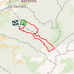
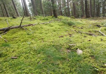
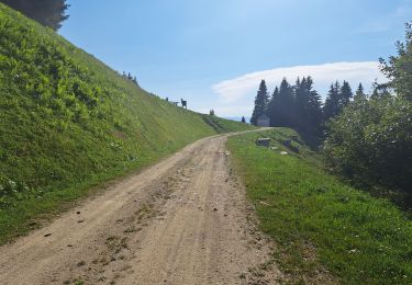
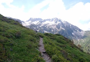
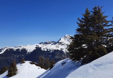
Tocht Stappen van 12,6 km beschikbaar op Auvergne-Rhône-Alpes, Savoie, Presle. Deze tocht wordt voorgesteld door ddaniel.
Beschrijving
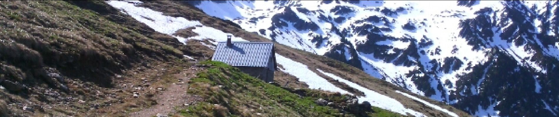
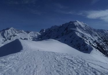
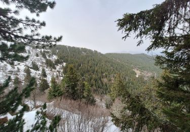
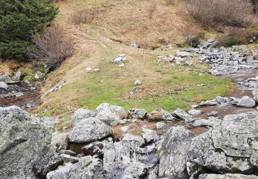
Depuis Prodin, le Chapotet par les refuges de la Grande montagne de Presle et des Plattières. Retour par le chalet de la Grande montagne du Verneil
Plaatsbepaling
Land:
France
Regio :
Auvergne-Rhône-Alpes
Departement/Provincie :
Savoie
Gemeente :
Presle
Locatie:
Unknown
Vertrek:(Dec)
Vertrek:(UTM)
278656 ; 5036226 (32T) N.
Opmerkingen
Wandeltochten in de omgeving
![Tocht Stappen Arvillard - Les Grands Moulins 2495m - Photo](https://media.geolcdn.com/t/375/260/ext.jpg?maxdim=2&url=https%3A%2F%2Fservices.sitytrail.com%2FGeolivesWS%2FDownloadMedia.ashx%3FTrailID%3D102590%26Media%3D3501_1.jpg)
![Stappen Stappen](https://static1.geolcdn.com/sitytour/trail-icons/101.png)
Les Grands Moulins 2495m
Stappen
Moeilijk
(1)
Arvillard,
Auvergne-Rhône-Alpes,
Savoie,
France
![](/images/other/stat-length.png)
9 km | 20 km-effort
5h 0min
![](https://static1.geolcdn.com/siteimages/upload/files/16400158638029165_repeat_loop_refresh_sync_direction_icon.png)
Ja
![Tocht Ski randonnée La Chapelle-du-Bard - Crête de la Plagne descente Nord - Photo](https://media.geolcdn.com/t/375/260/a18dcbf8-7d05-4d6a-95a3-6473edcc6b7f.jpg&format=jpg&maxdim=2)
![Ski randonnée Ski randonnée](https://static1.geolcdn.com/sitytour/trail-icons/503.png)
Crête de la Plagne descente Nord
Ski randonnée
Medium
La Chapelle-du-Bard,
Auvergne-Rhône-Alpes,
Isère,
France
![](/images/other/stat-length.png)
13 km | 30 km-effort
6h 24min
![](https://static1.geolcdn.com/siteimages/upload/files/16400158638029165_repeat_loop_refresh_sync_direction_icon.png)
Ja
![Tocht Mountainbike Valgelon-La Rochette - plan perrier + montmayeur - Photo](https://media.geolcdn.com/t/375/260/ext.jpg?maxdim=2&url=https%3A%2F%2Fstatic1.geolcdn.com%2Fsiteimages%2Fupload%2Ffiles%2F1524743154velo.jpg)
![Mountainbike Mountainbike](https://static1.geolcdn.com/sitytour/trail-icons/202.png)
plan perrier + montmayeur
Mountainbike
Medium
(1)
Valgelon-La Rochette,
Auvergne-Rhône-Alpes,
Savoie,
France
![](/images/other/stat-length.png)
25 km | 34 km-effort
2h 49min
![](https://static1.geolcdn.com/siteimages/upload/files/16400158638029165_repeat_loop_refresh_sync_direction_icon.png)
Ja
![Tocht Stappen Saint-Alban-d'Hurtières - Col Clampet, Le Grand Chat, Col d'alarmant - Photo](https://media.geolcdn.com/t/375/260/1d513b6f-1761-484e-9270-d816dd50c7b3.jpg&format=jpg&maxdim=2)
![Stappen Stappen](https://static1.geolcdn.com/sitytour/trail-icons/101.png)
Col Clampet, Le Grand Chat, Col d'alarmant
Stappen
Gemakkelijk
Saint-Alban-d'Hurtières,
Auvergne-Rhône-Alpes,
Savoie,
France
![](/images/other/stat-length.png)
8,4 km | 15,5 km-effort
3h 15min
![](https://static1.geolcdn.com/siteimages/upload/files/16400158638029165_repeat_loop_refresh_sync_direction_icon.png)
Ja
![Tocht Stappen Presle - tour du chapoté - Photo](https://media.geolcdn.com/t/375/260/60fd499a-f8ff-490d-892e-e5c9e4e4a7a6.jpg&format=jpg&maxdim=2)
![Stappen Stappen](https://static1.geolcdn.com/sitytour/trail-icons/101.png)
tour du chapoté
Stappen
Zeer moeilijk
Presle,
Auvergne-Rhône-Alpes,
Savoie,
France
![](/images/other/stat-length.png)
13,2 km | 24 km-effort
3h 50min
![](https://static1.geolcdn.com/siteimages/upload/files/16400158638029165_repeat_loop_refresh_sync_direction_icon.png)
Ja
![Tocht Stappen Presle - Le chapotet au départ de Prodin - Photo](https://media.geolcdn.com/t/375/260/4998ab41-5166-4f21-a80b-af21151571f7.jpg&format=jpg&maxdim=2)
![Stappen Stappen](https://static1.geolcdn.com/sitytour/trail-icons/101.png)
Le chapotet au départ de Prodin
Stappen
Medium
Presle,
Auvergne-Rhône-Alpes,
Savoie,
France
![](/images/other/stat-length.png)
12,1 km | 23 km-effort
5h 0min
![](https://static1.geolcdn.com/siteimages/upload/files/16400158638029165_repeat_loop_refresh_sync_direction_icon.png)
Ja
![Tocht Stappen Presle - 2023-06-15 Prodin -Col de la Perche en boucle - Photo](https://media.geolcdn.com/t/375/260/fea8337f-6305-49a4-963c-b11328735eeb.jpg&format=jpg&maxdim=2)
![Stappen Stappen](https://static1.geolcdn.com/sitytour/trail-icons/101.png)
2023-06-15 Prodin -Col de la Perche en boucle
Stappen
Medium
Presle,
Auvergne-Rhône-Alpes,
Savoie,
France
![](/images/other/stat-length.png)
12 km | 22 km-effort
4h 34min
![](https://static1.geolcdn.com/siteimages/upload/files/16400158638029165_repeat_loop_refresh_sync_direction_icon.png)
Ja
![Tocht Stappen La Chapelle-du-Bard - Col de l'Occiput en raquettes - Photo](https://media.geolcdn.com/t/375/260/097b251d-d4e3-4eff-83ad-ca4286267be3.jpg&format=jpg&maxdim=2)
![Stappen Stappen](https://static1.geolcdn.com/sitytour/trail-icons/101.png)
Col de l'Occiput en raquettes
Stappen
Moeilijk
La Chapelle-du-Bard,
Auvergne-Rhône-Alpes,
Isère,
France
![](/images/other/stat-length.png)
4,5 km | 9,2 km-effort
3h 36min
![](https://static1.geolcdn.com/siteimages/upload/files/16400158638029165_repeat_loop_refresh_sync_direction_icon.png)
Ja
![Tocht Stappen Presle - crete du Gargoton - Photo](https://media.geolcdn.com/t/375/260/da8655d9-7f77-42d9-9a84-6293f6cd1682.jpg&format=jpg&maxdim=2)
![Stappen Stappen](https://static1.geolcdn.com/sitytour/trail-icons/101.png)
crete du Gargoton
Stappen
Medium
Presle,
Auvergne-Rhône-Alpes,
Savoie,
France
![](/images/other/stat-length.png)
8,8 km | 20 km-effort
3h 26min
![](https://static1.geolcdn.com/siteimages/upload/files/16400158638029165_repeat_loop_refresh_sync_direction_icon.png)
Ja