![](/images/other/stat-length.png)
![Tocht Stappen Champigny-sur-Veude - Lémeré Fontaine de Jable - variante PR de Champigny-sur-Veude - 13.1km 160m 3h00 - 2024 08 25 - Photo](https://media.geolcdn.com/t/1900/400/186cdddc-e9ad-42c9-a57c-805aed4cbccf.jpg&format=pjpeg&maxdim=2)
Lémeré Fontaine de Jable - variante PR de Champigny-sur-Veude - 13.1km 160m 3h00 - 2024 08 25
Orcal37
Gebruiker GUIDE
![Lengte](/images/other/stat-length.png)
Lengte
13,1 km
![Max. hoogte](https://static1.geolcdn.com/siteimages/upload/files/1508320355ic_sort_altitude_max_24dp.png)
Max. hoogte
104 m
![Positief hoogteverschil](https://static1.geolcdn.com/siteimages/upload/files/1508320355ic_sort_den_pos_24dp.png)
Positief hoogteverschil
163 m
![Km-Effort](/images/other/stat-length.png)
Km-Effort
15,3 km
![Min. hoogte](https://static1.geolcdn.com/siteimages/upload/files/1508320355ic_sort_altitude_min_24dp.png)
Min. hoogte
42 m
![Negatief hoogteverschil](https://static1.geolcdn.com/siteimages/upload/files/1508320355ic_sort_den_neg_24dp.png)
Negatief hoogteverschil
162 m
![Boucle](https://static1.geolcdn.com/siteimages/upload/files/16400158638029165_repeat_loop_refresh_sync_direction_icon.png)
Boucle
Ja
Datum van aanmaak :
2024-08-25 12:39:26.202
Laatste wijziging :
2024-09-11 12:43:11.286
![Stappen](https://static1.geolcdn.com/sitytour/trail-icons/101.png)
3h00
Moeilijkheid : Gemakkelijk
![Scan deze QR-code om de tocht te openen in de SityTrail-applicatie](https://capi.geolives.com/qq0zvz2zws4bq2lad0pu/sitytour/trails/4168330/qr.png?size=200)
Gratisgps-wandelapplicatie
Over ons
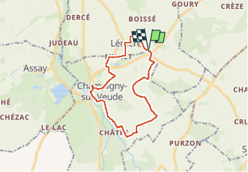
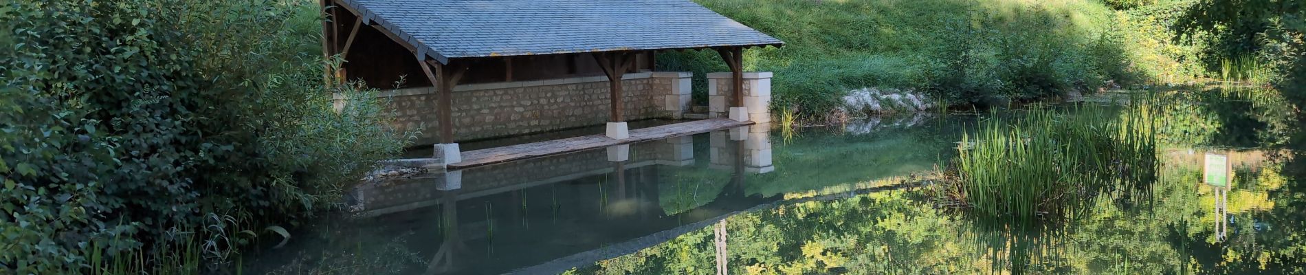
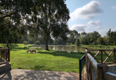
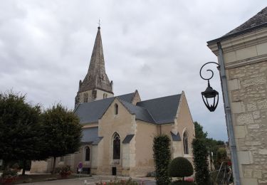
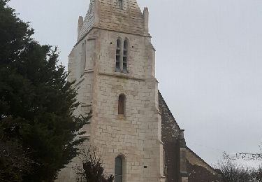
Tocht Stappen van 13,1 km beschikbaar op Centre-Val de Loire, Indre-et-Loire, Champigny-sur-Veude. Deze tocht wordt voorgesteld door Orcal37.
Beschrijving
Lémeré Fontaine de Jable - variante PR de Champigny-sur-Veude - Champigny-sur-Veude - Lémeré - 13.1km 160m 3h00 - 2024 08 25
Plaatsbepaling
Land:
France
Regio :
Centre-Val de Loire
Departement/Provincie :
Indre-et-Loire
Gemeente :
Champigny-sur-Veude
Locatie:
Unknown
Vertrek:(Dec)
Vertrek:(UTM)
298595 ; 5217468 (31T) N.
Opmerkingen
Wandeltochten in de omgeving
![Tocht Stappen Champigny-sur-Veude - Champigny-sur-Veude - Richelieu Chaveignes - 23.2km 180m 5h15 (50mn) - 2024 09 10 - Photo](https://media.geolcdn.com/t/375/260/4878e322-1065-4208-a275-c4a32103e2a7.jpg&format=jpg&maxdim=2)
![Stappen Stappen](https://static1.geolcdn.com/sitytour/trail-icons/101.png)
Champigny-sur-Veude - Richelieu Chaveignes - 23.2km 180m 5h15 (50mn) - 2024 0...
Stappen
Gemakkelijk
Champigny-sur-Veude,
Centre-Val de Loire,
Indre-et-Loire,
France
![](/images/other/stat-length.png)
23 km | 26 km-effort
5h 15min
![](https://static1.geolcdn.com/siteimages/upload/files/16400158638029165_repeat_loop_refresh_sync_direction_icon.png)
Ja
![Tocht Stappen Lémeré - Lémeré - le Coudray Château du Rivau - 15.6km 140m 3h20 (1h) - 2024 08 25 - Photo](https://media.geolcdn.com/t/375/260/58472c8d-5cf4-4979-93f7-93252efbc18f.jpg&format=jpg&maxdim=2)
![Stappen Stappen](https://static1.geolcdn.com/sitytour/trail-icons/101.png)
Lémeré - le Coudray Château du Rivau - 15.6km 140m 3h20 (1h) - 2024 08 25
Stappen
Gemakkelijk
Lémeré,
Centre-Val de Loire,
Indre-et-Loire,
France
![](/images/other/stat-length.png)
15,6 km | 17,5 km-effort
3h 20min
![](https://static1.geolcdn.com/siteimages/upload/files/16400158638029165_repeat_loop_refresh_sync_direction_icon.png)
Ja
![Tocht Stappen Lémeré - Lémeré le Coudray - Château du Rivau Lémeré - 11.2km 115m 2h25 - 2024 08 18 - Photo](https://media.geolcdn.com/t/375/260/c050ce35-1a2d-4387-b839-393ab8b4121d.jpg&format=jpg&maxdim=2)
![Stappen Stappen](https://static1.geolcdn.com/sitytour/trail-icons/101.png)
Lémeré le Coudray - Château du Rivau Lémeré - 11.2km 115m 2h25 - 2024 08 18
Stappen
Gemakkelijk
Lémeré,
Centre-Val de Loire,
Indre-et-Loire,
France
![](/images/other/stat-length.png)
11,2 km | 12,8 km-effort
2h 25min
![](https://static1.geolcdn.com/siteimages/upload/files/16400158638029165_repeat_loop_refresh_sync_direction_icon.png)
Ja
![Tocht Stappen Brizay - Brizay - la Neuptière Cléré Crèze PM - 11km 140m 2h15 - 2024 07 28 - Photo](https://media.geolcdn.com/t/375/260/68625c21-f666-455e-ae41-78fb9daee64e.jpg&format=jpg&maxdim=2)
![Stappen Stappen](https://static1.geolcdn.com/sitytour/trail-icons/101.png)
Brizay - la Neuptière Cléré Crèze PM - 11km 140m 2h15 - 2024 07 28
Stappen
Gemakkelijk
Brizay,
Centre-Val de Loire,
Indre-et-Loire,
France
![](/images/other/stat-length.png)
11 km | 12,9 km-effort
2h 15min
![](https://static1.geolcdn.com/siteimages/upload/files/16400158638029165_repeat_loop_refresh_sync_direction_icon.png)
Ja
![Tocht Stappen Lémeré - Lémeré - Photo](https://media.geolcdn.com/t/375/260/ext.jpg?maxdim=2&url=https%3A%2F%2Fservices.sitytrail.com%2FGeolivesWS%2FDownloadMedia.ashx%3FTrailID%3D883278%26Media%3Dfix__20171222164216.jpg)
![Stappen Stappen](https://static1.geolcdn.com/sitytour/trail-icons/101.png)
Lémeré
Stappen
Gemakkelijk
Lémeré,
Centre-Val de Loire,
Indre-et-Loire,
France
![](/images/other/stat-length.png)
11 km | 12,4 km-effort
2h 16min
![](https://static1.geolcdn.com/siteimages/upload/files/16400158638029165_repeat_loop_refresh_sync_direction_icon.png)
Ja
![Tocht Noords wandelen Champigny-sur-Veude - etang assay - Photo](https://media.geolcdn.com/t/375/260/ext.jpg?maxdim=2&url=https%3A%2F%2Fstatic1.geolcdn.com%2Fsiteimages%2Fupload%2Ffiles%2F1545311037marcheuse_200dpi.jpg)
![Noords wandelen Noords wandelen](https://static1.geolcdn.com/sitytour/trail-icons/102.png)
etang assay
Noords wandelen
Heel gemakkelijk
Champigny-sur-Veude,
Centre-Val de Loire,
Indre-et-Loire,
France
![](/images/other/stat-length.png)
6,9 km | 7,5 km-effort
1h 51min
![](https://static1.geolcdn.com/siteimages/upload/files/16400158638029165_repeat_loop_refresh_sync_direction_icon.png)
Ja