![](/images/other/stat-length.png)
![Tocht Stappen Moëlan-sur-Mer - SityTrail - GR34 Brigneau (port) à Riec sur Bélon 26 350m +348m - Photo](https://media.geolcdn.com/t/1900/400/ext.pjpeg?maxdim=2&url=https%3A%2F%2Fstatic1.geolcdn.com%2Fsiteimages%2Fupload%2Ffiles%2F1553511878bg_sport_marche.png)
SityTrail - GR34 Brigneau (port) à Riec sur Bélon 26 350m +348m
DanielROLLET
Gebruiker
![Lengte](/images/other/stat-length.png)
![Max. hoogte](https://static1.geolcdn.com/siteimages/upload/files/1508320355ic_sort_altitude_max_24dp.png)
![Positief hoogteverschil](https://static1.geolcdn.com/siteimages/upload/files/1508320355ic_sort_den_pos_24dp.png)
![Km-Effort](/images/other/stat-length.png)
![Min. hoogte](https://static1.geolcdn.com/siteimages/upload/files/1508320355ic_sort_altitude_min_24dp.png)
![Negatief hoogteverschil](https://static1.geolcdn.com/siteimages/upload/files/1508320355ic_sort_den_neg_24dp.png)
![Boucle](https://static1.geolcdn.com/siteimages/upload/files/16400158638029165_repeat_loop_refresh_sync_direction_icon.png)
![Stappen](https://static1.geolcdn.com/sitytour/trail-icons/101.png)
8h35
Moeilijkheid : Zeer moeilijk
![Scan deze QR-code om de tocht te openen in de SityTrail-applicatie](https://capi.geolives.com/qq0zvz2zws4bq2lad0pu/sitytour/trails/4155977/qr.png?size=200)
Gratisgps-wandelapplicatie
Over ons
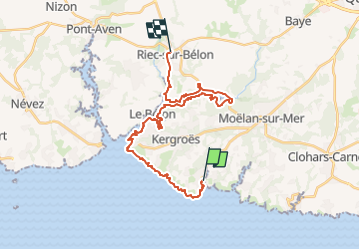
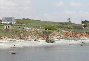
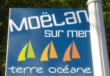
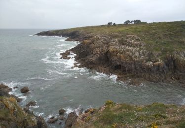
Tocht Stappen van 26 km beschikbaar op Bretagne, Finistère, Moëlan-sur-Mer. Deze tocht wordt voorgesteld door DanielROLLET.
Beschrijving
2024 08 07 - Beau temps très chaud
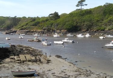
Départ 8h50 port de Brigneau/Arrivée 17h15 studio "Ile d'Art" à Riec-sur-Belon (durée 8h35)
Balisage GR34 modifié après la plage de Kerfany puis perdu sur la route jusqu'à Beg Rorz
Remontée rive gauche du Belon très fastidieuse, longueur quelques grimpettes, descente rive droite plus agréable
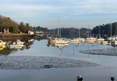
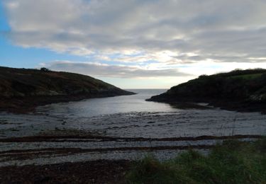
Pause : anse de Kiristinec.
Plaatsbepaling
Opmerkingen
Wandeltochten in de omgeving
![Tocht Stappen Moëlan-sur-Mer - Belon 16 km - Photo](https://media.geolcdn.com/t/375/260/8216e2e0-afdb-49ef-bc45-06fb5d915a7a.jpg&format=jpg&maxdim=2)
![Stappen Stappen](https://static1.geolcdn.com/sitytour/trail-icons/101.png)
Stappen
![](/images/other/stat-length.png)
![](https://static1.geolcdn.com/siteimages/upload/files/16400158638029165_repeat_loop_refresh_sync_direction_icon.png)
![Tocht Stappen Moëlan-sur-Mer - Merrien Doelan cote 11,5 km - Photo](https://media.geolcdn.com/t/375/260/599544b5-7665-42c5-9bba-b91c68249624.jpg&format=jpg&maxdim=2)
![Stappen Stappen](https://static1.geolcdn.com/sitytour/trail-icons/101.png)
Stappen
![](/images/other/stat-length.png)
![](https://static1.geolcdn.com/siteimages/upload/files/16400158638029165_repeat_loop_refresh_sync_direction_icon.png)
![Tocht Stappen Moëlan-sur-Mer - routoirs à lin de Pouldouran - Photo](https://media.geolcdn.com/t/375/260/3361eba2-e966-4e2b-bed4-315e6af4295a.jpg&format=jpg&maxdim=2)
![Stappen Stappen](https://static1.geolcdn.com/sitytour/trail-icons/101.png)
Stappen
![](/images/other/stat-length.png)
![](https://static1.geolcdn.com/siteimages/upload/files/16400158638029165_repeat_loop_refresh_sync_direction_icon.png)
![Tocht Te voet Moëlan-sur-Mer - FR-5 - Photo](https://media.geolcdn.com/t/375/260/7377c7e2-944d-4023-9c3d-895707207e3a.jpeg&format=jpg&maxdim=2)
![Te voet Te voet](https://static1.geolcdn.com/sitytour/trail-icons/100.png)
Te voet
![](/images/other/stat-length.png)
![](https://static1.geolcdn.com/siteimages/upload/files/16400158638029165_repeat_loop_refresh_sync_direction_icon.png)
![Tocht Stappen Moëlan-sur-Mer - MOELAN Sur MER - Photo](https://media.geolcdn.com/t/375/260/9f5d6a9f-89a4-4a35-9d4e-86b22f763fe6.jpg&format=jpg&maxdim=2)
![Stappen Stappen](https://static1.geolcdn.com/sitytour/trail-icons/101.png)
Stappen
![](/images/other/stat-length.png)
![](https://static1.geolcdn.com/siteimages/upload/files/16400158638029165_repeat_loop_refresh_sync_direction_icon.png)
![Tocht Stappen Moëlan-sur-Mer - MOËLAN sur MER - Photo](https://media.geolcdn.com/t/375/260/50c1b4de-5d6a-4ed2-b104-4b49e23459a5.jpg&format=jpg&maxdim=2)
![Stappen Stappen](https://static1.geolcdn.com/sitytour/trail-icons/101.png)
Stappen
![](/images/other/stat-length.png)
![](https://static1.geolcdn.com/siteimages/upload/files/16400158638029165_repeat_loop_refresh_sync_direction_icon.png)
![Tocht Stappen Moëlan-sur-Mer - Belon 5,6 km - Photo](https://media.geolcdn.com/t/375/260/8ab5e063-1a65-4f04-9262-32fd932aab57.jpg&format=jpg&maxdim=2)
![Stappen Stappen](https://static1.geolcdn.com/sitytour/trail-icons/101.png)
![Tocht Stappen Moëlan-sur-Mer - MOËLAN SUR MER - Photo](https://media.geolcdn.com/t/375/260/c89b66af-d30f-4599-933a-95fcfe3459c4.jpg&format=jpg&maxdim=2)
![Stappen Stappen](https://static1.geolcdn.com/sitytour/trail-icons/101.png)
Stappen
![](/images/other/stat-length.png)
![](https://static1.geolcdn.com/siteimages/upload/files/16400158638029165_repeat_loop_refresh_sync_direction_icon.png)
![Tocht Stappen Clohars-Carnoët - CLOHARS CARNOËT - Photo](https://media.geolcdn.com/t/375/260/47e82c60-5d8a-4e58-8e2f-70522285a529.jpg&format=jpg&maxdim=2)
![Stappen Stappen](https://static1.geolcdn.com/sitytour/trail-icons/101.png)
Stappen
![](/images/other/stat-length.png)
![](https://static1.geolcdn.com/siteimages/upload/files/16400158638029165_repeat_loop_refresh_sync_direction_icon.png)