![](/images/other/stat-length.png)
![Tocht Stappen Clohars-Carnoët - SityTrail - GR34 Le Pouldu à Brigneau 20 900m +193m - Photo](https://media.geolcdn.com/t/1900/400/ext.pjpeg?maxdim=2&url=https%3A%2F%2Fstatic1.geolcdn.com%2Fsiteimages%2Fupload%2Ffiles%2F1553511878bg_sport_marche.png)
SityTrail - GR34 Le Pouldu à Brigneau 20 900m +193m
DanielROLLET
Gebruiker
![Lengte](/images/other/stat-length.png)
Lengte
21 km
![Max. hoogte](https://static1.geolcdn.com/siteimages/upload/files/1508320355ic_sort_altitude_max_24dp.png)
Max. hoogte
28 m
![Positief hoogteverschil](https://static1.geolcdn.com/siteimages/upload/files/1508320355ic_sort_den_pos_24dp.png)
Positief hoogteverschil
193 m
![Km-Effort](/images/other/stat-length.png)
Km-Effort
23 km
![Min. hoogte](https://static1.geolcdn.com/siteimages/upload/files/1508320355ic_sort_altitude_min_24dp.png)
Min. hoogte
0 m
![Negatief hoogteverschil](https://static1.geolcdn.com/siteimages/upload/files/1508320355ic_sort_den_neg_24dp.png)
Negatief hoogteverschil
200 m
![Boucle](https://static1.geolcdn.com/siteimages/upload/files/16400158638029165_repeat_loop_refresh_sync_direction_icon.png)
Boucle
Neen
Datum van aanmaak :
2024-08-15 08:47:06.059
Laatste wijziging :
2024-08-15 09:06:59.23
![Stappen](https://static1.geolcdn.com/sitytour/trail-icons/101.png)
7h15
Moeilijkheid : Moeilijk
![Scan deze QR-code om de tocht te openen in de SityTrail-applicatie](https://capi.geolives.com/qq0zvz2zws4bq2lad0pu/sitytour/trails/4155949/qr.png?size=200)
Gratisgps-wandelapplicatie
Over ons
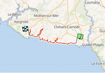
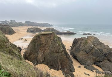
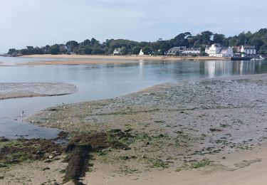
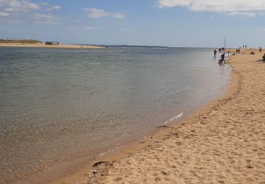
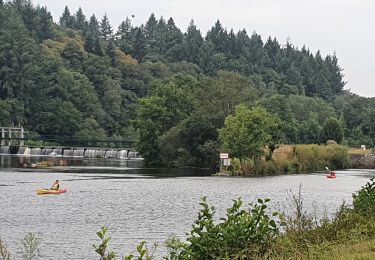
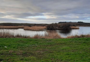
Tocht Stappen van 21 km beschikbaar op Bretagne, Finistère, Clohars-Carnoët. Deze tocht wordt voorgesteld door DanielROLLET.
Beschrijving
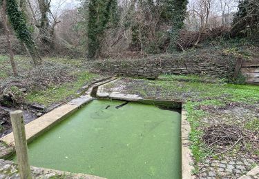
2024 08 06 - Pluie jusqu'à 11h30 (arrivée Merrien)
Départ 8h35 hôtel Naecou/Arrivée 15h50 port de Brigneau (durée 7h15) Pause à Merrien
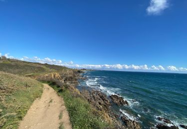
Parcours mémoriel...
Le mollet va mieux mais je boîte encore.
POI's
Plaatsbepaling
Land:
France
Regio :
Bretagne
Departement/Provincie :
Finistère
Gemeente :
Clohars-Carnoët
Locatie:
Unknown
Vertrek:(Dec)
Vertrek:(UTM)
457981 ; 5290845 (30T) N.
Opmerkingen
Wandeltochten in de omgeving
![Tocht Stappen Clohars-Carnoët - Le Pouldu - Photo](https://media.geolcdn.com/t/375/260/1a38db66-97d5-4b5b-9eac-2a7eff6538ed.jpg&format=jpg&maxdim=2)
![Stappen Stappen](https://static1.geolcdn.com/sitytour/trail-icons/101.png)
![Tocht Stappen Guidel - PR_56_Guidel_CA_03_Circuit3a_Autour-De-L-Etang-De-Lannenec_20240428 - Photo](https://media.geolcdn.com/t/375/260/6e0f082b-d9fc-4937-a2ef-b1992f251e56.jpg&format=jpg&maxdim=2)
![Stappen Stappen](https://static1.geolcdn.com/sitytour/trail-icons/101.png)
PR_56_Guidel_CA_03_Circuit3a_Autour-De-L-Etang-De-Lannenec_20240428
Stappen
Gemakkelijk
Guidel,
Bretagne,
Morbihan,
France
![](/images/other/stat-length.png)
10,2 km | 11,7 km-effort
2h 39min
![](https://static1.geolcdn.com/siteimages/upload/files/16400158638029165_repeat_loop_refresh_sync_direction_icon.png)
Neen
![Tocht Stappen Guidel - Guidel plage 7,6 km - Photo](https://media.geolcdn.com/t/375/260/ea313e26-3f1c-4186-89bc-ac39bff3fa8a.jpg&format=jpg&maxdim=2)
![Stappen Stappen](https://static1.geolcdn.com/sitytour/trail-icons/101.png)
Guidel plage 7,6 km
Stappen
Gemakkelijk
Guidel,
Bretagne,
Morbihan,
France
![](/images/other/stat-length.png)
7,6 km | 8,5 km-effort
2h 11min
![](https://static1.geolcdn.com/siteimages/upload/files/16400158638029165_repeat_loop_refresh_sync_direction_icon.png)
Ja
![Tocht Stappen Clohars-Carnoët - Pouldu port peintres 6,3 km - Photo](https://media.geolcdn.com/t/375/260/d878685e-3577-4835-a424-00b6066e1383.jpg&format=jpg&maxdim=2)
![Stappen Stappen](https://static1.geolcdn.com/sitytour/trail-icons/101.png)
Pouldu port peintres 6,3 km
Stappen
Gemakkelijk
Clohars-Carnoët,
Bretagne,
Finistère,
France
![](/images/other/stat-length.png)
6,3 km | 7,2 km-effort
2h 12min
![](https://static1.geolcdn.com/siteimages/upload/files/16400158638029165_repeat_loop_refresh_sync_direction_icon.png)
Ja
![Tocht Stappen Clohars-Carnoët - Pouldu Roche Percée et retour 9,5 km - Photo](https://media.geolcdn.com/t/375/260/9c185896-328f-4e1d-8063-56e555ea4d34.jpg&format=jpg&maxdim=2)
![Stappen Stappen](https://static1.geolcdn.com/sitytour/trail-icons/101.png)
Pouldu Roche Percée et retour 9,5 km
Stappen
Medium
Clohars-Carnoët,
Bretagne,
Finistère,
France
![](/images/other/stat-length.png)
9,5 km | 10,7 km-effort
2h 46min
![](https://static1.geolcdn.com/siteimages/upload/files/16400158638029165_repeat_loop_refresh_sync_direction_icon.png)
Ja
![Tocht Stappen Guidel - PR_56_Guidel_BA_02_Circuit3b_Entre-Loch-Et-Laita_20231004 - Photo](https://media.geolcdn.com/t/375/260/c4260127-a5b9-4007-9324-09ddf3ba24ca.jpg&format=jpg&maxdim=2)
![Stappen Stappen](https://static1.geolcdn.com/sitytour/trail-icons/101.png)
PR_56_Guidel_BA_02_Circuit3b_Entre-Loch-Et-Laita_20231004
Stappen
Gemakkelijk
Guidel,
Bretagne,
Morbihan,
France
![](/images/other/stat-length.png)
13,4 km | 15,7 km-effort
3h 34min
![](https://static1.geolcdn.com/siteimages/upload/files/16400158638029165_repeat_loop_refresh_sync_direction_icon.png)
Ja
![Tocht Stappen Guidel - laita - Photo](https://media.geolcdn.com/t/375/260/d2fc7529-c784-40ff-828a-4079bf6b08e9.jpg&format=jpg&maxdim=2)
![Stappen Stappen](https://static1.geolcdn.com/sitytour/trail-icons/101.png)
![Tocht Elektrische fiets Clohars-Carnoët - Moelans Pontivy par les berges du Blavet - Photo](https://media.geolcdn.com/t/375/260/02b1cea7-157d-417f-bb92-c1bdb0f96c6e.jpg&format=jpg&maxdim=2)
![Elektrische fiets Elektrische fiets](https://static1.geolcdn.com/sitytour/trail-icons/205.png)
Moelans Pontivy par les berges du Blavet
Elektrische fiets
Heel gemakkelijk
Clohars-Carnoët,
Bretagne,
Finistère,
France
![](/images/other/stat-length.png)
81 km | 94 km-effort
4h 43min
![](https://static1.geolcdn.com/siteimages/upload/files/16400158638029165_repeat_loop_refresh_sync_direction_icon.png)
Neen
![Tocht Stappen Guidel - PR_56_Guidel_AA_01_Circuit3b_Autour-Du-Loc'h_20220120 - Photo](https://media.geolcdn.com/t/375/260/d0aa8b77-81ab-4782-b792-dad3ac7c6e42.jpg&format=jpg&maxdim=2)
![Stappen Stappen](https://static1.geolcdn.com/sitytour/trail-icons/101.png)
PR_56_Guidel_AA_01_Circuit3b_Autour-Du-Loc'h_20220120
Stappen
Medium
Guidel,
Bretagne,
Morbihan,
France
![](/images/other/stat-length.png)
9,8 km | 11,2 km-effort
2h 16min
![](https://static1.geolcdn.com/siteimages/upload/files/16400158638029165_repeat_loop_refresh_sync_direction_icon.png)
Ja