![](/images/other/stat-length.png)
![Tocht Stappen Chamonix-Mont-Blanc - TMB Étape 8 : Tré-le-Champ à Les Houches par Col du Brévent via GR Principal - Photo](https://media.geolcdn.com/t/1900/400/ext.pjpeg?maxdim=2&url=https%3A%2F%2Fstatic1.geolcdn.com%2Fsiteimages%2Fupload%2Ffiles%2F1553511878bg_sport_marche.png)
TMB Étape 8 : Tré-le-Champ à Les Houches par Col du Brévent via GR Principal
Timothée ZARAGORI
Gebruiker
![Lengte](/images/other/stat-length.png)
![Max. hoogte](https://static1.geolcdn.com/siteimages/upload/files/1508320355ic_sort_altitude_max_24dp.png)
![Positief hoogteverschil](https://static1.geolcdn.com/siteimages/upload/files/1508320355ic_sort_den_pos_24dp.png)
![Km-Effort](/images/other/stat-length.png)
![Min. hoogte](https://static1.geolcdn.com/siteimages/upload/files/1508320355ic_sort_altitude_min_24dp.png)
![Negatief hoogteverschil](https://static1.geolcdn.com/siteimages/upload/files/1508320355ic_sort_den_neg_24dp.png)
![Boucle](https://static1.geolcdn.com/siteimages/upload/files/16400158638029165_repeat_loop_refresh_sync_direction_icon.png)
![Stappen](https://static1.geolcdn.com/sitytour/trail-icons/101.png)
10h35
Moeilijkheid : Zeer moeilijk
![Scan deze QR-code om de tocht te openen in de SityTrail-applicatie](https://capi.geolives.com/qq0zvz2zws4bq2lad0pu/sitytour/trails/4144772/qr.png?size=200)
Gratisgps-wandelapplicatie
Over ons
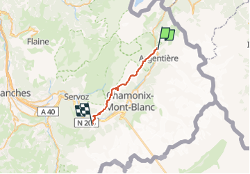
Tocht Stappen van 24 km beschikbaar op Auvergne-Rhône-Alpes, Haute-Savoie, Chamonix-Mont-Blanc. Deze tocht wordt voorgesteld door Timothée ZARAGORI.
Beschrijving
- 13,5 km : 1400 de D , 400 de D-, prévisionnel de 6H30
Tête aux vents
La Flégère
Col du Brévent
- 10 km: 200 de D , 1600 de D-, prévisionnel de 3H50
Refuge de Bellachat : ARRET pour déjeuner ? 3,5km - 1H30 depuis le col du Brévent.
➡️ Les Houches
Plaatsbepaling
Opmerkingen
Wandeltochten in de omgeving
![Tocht Stappen Vallorcine - J18 - R17 - Col des Montets - Cascade de Bérard - Photo](https://media.geolcdn.com/t/375/260/e29e3f44-880b-4f2b-954e-82a481673653.jpg&format=jpg&maxdim=2)
![Stappen Stappen](https://static1.geolcdn.com/sitytour/trail-icons/101.png)
Stappen
![](/images/other/stat-length.png)
![](https://static1.geolcdn.com/siteimages/upload/files/16400158638029165_repeat_loop_refresh_sync_direction_icon.png)
![Tocht Stappen Vallorcine - Le Buet - Vallorcine - Photo](https://media.geolcdn.com/t/375/260/ext.jpg?maxdim=2&url=https%3A%2F%2Fservices.sitytrail.com%2FGeolivesWS%2FDownloadMedia.ashx%3FTrailID%3D105027%26Media%3D8587_6.jpg)
![Stappen Stappen](https://static1.geolcdn.com/sitytour/trail-icons/101.png)
Stappen
![](/images/other/stat-length.png)
![](https://static1.geolcdn.com/siteimages/upload/files/16400158638029165_repeat_loop_refresh_sync_direction_icon.png)
![Tocht Stappen Chamonix-Mont-Blanc - Aiguillette des Posettes 2201m 6.7.22 - Photo](https://media.geolcdn.com/t/375/260/920b5cab-549c-4a76-961b-08991dae2f72.jpg&format=jpg&maxdim=2)
![Stappen Stappen](https://static1.geolcdn.com/sitytour/trail-icons/101.png)
Stappen
![](/images/other/stat-length.png)
![](https://static1.geolcdn.com/siteimages/upload/files/16400158638029165_repeat_loop_refresh_sync_direction_icon.png)
![Tocht Wintersport Vallorcine - vers Finhaut - Photo](https://media.geolcdn.com/t/375/260/ext.jpg?maxdim=2&url=https%3A%2F%2Fstatic1.geolcdn.com%2Fsiteimages%2Fupload%2Ffiles%2F1524743153ski.jpg)
![Wintersport Wintersport](https://static1.geolcdn.com/sitytour/trail-icons/500.png)
Wintersport
![](/images/other/stat-length.png)
![](https://static1.geolcdn.com/siteimages/upload/files/16400158638029165_repeat_loop_refresh_sync_direction_icon.png)
![Tocht Stappen Chamonix-Mont-Blanc - J19 - R18 - Le Chapeau - Photo](https://media.geolcdn.com/t/375/260/8e0b9563-30fc-4bc0-b4e5-7858f7df9b5b.jpg&format=jpg&maxdim=2)
![Stappen Stappen](https://static1.geolcdn.com/sitytour/trail-icons/101.png)
Stappen
![](/images/other/stat-length.png)
![](https://static1.geolcdn.com/siteimages/upload/files/16400158638029165_repeat_loop_refresh_sync_direction_icon.png)
![Tocht Stappen Vallorcine - J16 - R15 - Chemin des Diligences - Photo](https://media.geolcdn.com/t/375/260/3a598cc1-ce55-4b49-a436-a0cb45f4ed78.jpg&format=jpg&maxdim=2)
![Stappen Stappen](https://static1.geolcdn.com/sitytour/trail-icons/101.png)
Stappen
![](/images/other/stat-length.png)
![](https://static1.geolcdn.com/siteimages/upload/files/16400158638029165_repeat_loop_refresh_sync_direction_icon.png)
![Tocht Stappen Chamonix-Mont-Blanc - Argentiere - Photo](https://media.geolcdn.com/t/375/260/fad04a40-7ca4-42c3-847b-c84c30515115.jpg&format=jpg&maxdim=2)
![Stappen Stappen](https://static1.geolcdn.com/sitytour/trail-icons/101.png)
Stappen
![](/images/other/stat-length.png)
![](https://static1.geolcdn.com/siteimages/upload/files/16400158638029165_repeat_loop_refresh_sync_direction_icon.png)
![Tocht Stappen Chamonix-Mont-Blanc - Le tour des Aiguilles Rouges : J3 - Photo](https://media.geolcdn.com/t/375/260/5b0e7ef4-231b-4156-80e6-07aed6221899.jpg&format=jpg&maxdim=2)
![Stappen Stappen](https://static1.geolcdn.com/sitytour/trail-icons/101.png)
Stappen
![](/images/other/stat-length.png)
![](https://static1.geolcdn.com/siteimages/upload/files/16400158638029165_repeat_loop_refresh_sync_direction_icon.png)
![Tocht Stappen Vallorcine - Le tour des Aiguilles Rouges : J1 - Photo](https://media.geolcdn.com/t/375/260/fa753838-66a1-4d50-a490-aa852af9fab3.jpg&format=jpg&maxdim=2)
![Stappen Stappen](https://static1.geolcdn.com/sitytour/trail-icons/101.png)
Stappen
![](/images/other/stat-length.png)
![](https://static1.geolcdn.com/siteimages/upload/files/16400158638029165_repeat_loop_refresh_sync_direction_icon.png)