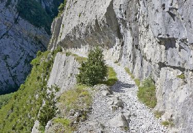
10,4 km | 19,6 km-effort
HRP - dag 9
timdewolf
Gebruiker
Lengte
10,7 km
Max. hoogte
2312 m
Positief hoogteverschil
773 m
Km-Effort
21 km
Min. hoogte
1638 m
Negatief hoogteverschil
830 m
Boucle
Neen
Datum van aanmaak :
2024-07-09 06:57:46.0
Laatste wijziging :
2024-08-01 04:06:35.621
3h33
Moeilijkheid : Moeilijk
Gratisgps-wandelapplicatie
Over ons
Tocht Stappen van 10,7 km beschikbaar op Aragón, Huesca, Jaca. Deze tocht wordt voorgesteld door timdewolf.
Plaatsbepaling
Land:
Spain
Regio :
Aragón
Departement/Provincie :
Huesca
Gemeente :
Jaca
Locatie:
Unknown
Vertrek:(Dec)
Vertrek:(UTM)
704111 ; 4744172 (30T) N.
Opmerkingen
Wandeltochten in de omgeving
Sentier de Peyranère au Refuge de Larry PNP
Te voet
Gemakkelijk
Urdos,
Nieuw-Aquitanië,
Pyrénées-Atlantiques,
France
4h 27min
Neen
Sentier du Plateau de la Gentiane PNP
Te voet
Gemakkelijk
Urdos,
Nieuw-Aquitanië,
Pyrénées-Atlantiques,
France
3,6 km | 7,3 km-effort
1h 39min
Neen
Sentier du Lac d'Estaëns PNP
Te voet
Gemakkelijk
Urdos,
Nieuw-Aquitanië,
Pyrénées-Atlantiques,
France
5,1 km | 10,1 km-effort
2h 17min
Neen
Col d'Ayous depuis Urdos
Stappen
Moeilijk
Urdos,
Nieuw-Aquitanië,
Pyrénées-Atlantiques,
France
14,6 km | 29 km-effort
6h 53min
Ja
Plateau de la gentiane
Stappen
Medium
Urdos,
Nieuw-Aquitanië,
Pyrénées-Atlantiques,
France
7,7 km | 13,2 km-effort
3h 18min
Ja
Astun au refuge d'Ayous
Stappen
Moeilijk
Jaca,
Aragón,
Huesca,
Spain
16,1 km | 29 km-effort
7h 29min
Ja
Lac d'Estaens et environs
Stappen
Moeilijk
Urdos,
Nieuw-Aquitanië,
Pyrénées-Atlantiques,
France
14,9 km | 26 km-effort
7h 42min
Ja
rando. en raquettes au col du Somport entre la vallée d'Aspe et l'Espagne
Stappen
Gemakkelijk
Urdos,
Nieuw-Aquitanië,
Pyrénées-Atlantiques,
France
3,4 km | 5,4 km-effort
2h 5min
Ja
Les lacs d'Ayous dans le Parc National des Pyrénées en 3 jours
Stappen
Moeilijk
Urdos,
Nieuw-Aquitanië,
Pyrénées-Atlantiques,
France
45 km | 81 km-effort
12h 0min
Neen