![](/images/other/stat-length.png)
![Tocht Stappen Thonon-les-Bains - Rando Thonon - Photo](https://media.geolcdn.com/t/1900/400/045d2246-16a3-4fb9-a5e7-5b0993d8eaf7.jpg&format=pjpeg&maxdim=2)
Rando Thonon
Fab-Oz
Gebruiker
![Lengte](/images/other/stat-length.png)
![Max. hoogte](https://static1.geolcdn.com/siteimages/upload/files/1508320355ic_sort_altitude_max_24dp.png)
![Positief hoogteverschil](https://static1.geolcdn.com/siteimages/upload/files/1508320355ic_sort_den_pos_24dp.png)
![Km-Effort](/images/other/stat-length.png)
![Min. hoogte](https://static1.geolcdn.com/siteimages/upload/files/1508320355ic_sort_altitude_min_24dp.png)
![Negatief hoogteverschil](https://static1.geolcdn.com/siteimages/upload/files/1508320355ic_sort_den_neg_24dp.png)
![Boucle](https://static1.geolcdn.com/siteimages/upload/files/16400158638029165_repeat_loop_refresh_sync_direction_icon.png)
![Stappen](https://static1.geolcdn.com/sitytour/trail-icons/101.png)
4h35
Moeilijkheid : Medium
![Scan deze QR-code om de tocht te openen in de SityTrail-applicatie](https://capi.geolives.com/qq0zvz2zws4bq2lad0pu/sitytour/trails/4134287/qr.png?size=200)
Gratisgps-wandelapplicatie
Over ons
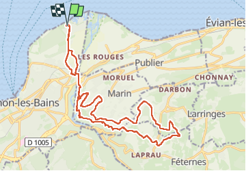
Tocht Stappen van 22 km beschikbaar op Auvergne-Rhône-Alpes, Haute-Savoie, Thonon-les-Bains. Deze tocht wordt voorgesteld door Fab-Oz.
Beschrijving
Rando sans grande difficulté, à part la distance 22km qu'on peut facilement réduire en partant du parking de Larry (-6km A/R)
Départ du Parc de la Châtaigneraie
Rejoindre le Pont de Dranse, puis le parking de Larry (point de départ intéressant)
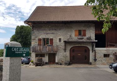
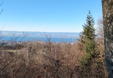
La montée se fait à travers les vignes les prés... par Fontanex (Marinel), Cutlaz, en suivant le GRP Littoral du Léman, jusqu'à Gresin et Champanges. On rejoint ensuite le Moulin de la Gerbaz, puis le ruisseau le Maravant avant de traverser le village de Thièze.
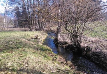
Le retour se fait au début le long du ruisseau (sans oublier de se tremper les pieds au Moulins du Maravant), dans les Bois de Fiogey, les Vignes de Pont, avant de rejoindre la Dranse.
Plaatsbepaling
Opmerkingen
Wandeltochten in de omgeving
![Tocht Mountainbike Publier - VTT Bois de Ville Carriere - Photo](https://media.geolcdn.com/t/375/260/ext.jpg?maxdim=2&url=https%3A%2F%2Fstatic1.geolcdn.com%2Fsiteimages%2Fupload%2Ffiles%2F1524743154velo.jpg)
![Mountainbike Mountainbike](https://static1.geolcdn.com/sitytour/trail-icons/202.png)
Mountainbike
![](/images/other/stat-length.png)
![](https://static1.geolcdn.com/siteimages/upload/files/16400158638029165_repeat_loop_refresh_sync_direction_icon.png)
![Tocht Te voet Thonon-les-Bains - GRP Littoral du Léman - Photo](https://media.geolcdn.com/t/375/260/08b05c77-4d18-4df6-9472-d5271b5e1471.jpeg&format=jpg&maxdim=2)
![Te voet Te voet](https://static1.geolcdn.com/sitytour/trail-icons/100.png)
Te voet
![](/images/other/stat-length.png)
![](https://static1.geolcdn.com/siteimages/upload/files/16400158638029165_repeat_loop_refresh_sync_direction_icon.png)
![Tocht Stappen Marin - Morel aux vignes - Photo](https://media.geolcdn.com/t/375/260/75d9e7d6-5d89-4a3a-adbd-58ad391eb8c0.jpg&format=jpg&maxdim=2)
![Stappen Stappen](https://static1.geolcdn.com/sitytour/trail-icons/101.png)
Stappen
![](/images/other/stat-length.png)
![](https://static1.geolcdn.com/siteimages/upload/files/16400158638029165_repeat_loop_refresh_sync_direction_icon.png)
![Tocht Motorfiets Thonon-les-Bains - GTA 2018 - ETAPE 2 - Photo](https://media.geolcdn.com/t/375/260/f293979c-6770-41e2-a588-185da9cd4036.jpg&format=jpg&maxdim=2)
![Motorfiets Motorfiets](https://static1.geolcdn.com/sitytour/trail-icons/402.png)
Motorfiets
![](/images/other/stat-length.png)
![](https://static1.geolcdn.com/siteimages/upload/files/16400158638029165_repeat_loop_refresh_sync_direction_icon.png)
![Tocht Fiets Thonon-les-Bains - col du feu - Photo](https://media.geolcdn.com/t/375/260/ext.jpg?maxdim=2&url=https%3A%2F%2Fservices.sitytrail.com%2FGeolivesWS%2FDownloadMedia.ashx%3FTrailID%3D220539%26Media%3Dfix__20130911131210.jpg)
![Fiets Fiets](https://static1.geolcdn.com/sitytour/trail-icons/200.png)
Fiets
![](/images/other/stat-length.png)
![](https://static1.geolcdn.com/siteimages/upload/files/16400158638029165_repeat_loop_refresh_sync_direction_icon.png)
![Tocht Stappen Thonon-les-Bains - La fontaine couverte - Photo](https://media.geolcdn.com/t/375/260/f0fc9f05-8614-49f0-819b-fd232b9ab161.jpg&format=jpg&maxdim=2)
![Stappen Stappen](https://static1.geolcdn.com/sitytour/trail-icons/101.png)
Stappen
![](/images/other/stat-length.png)
![](https://static1.geolcdn.com/siteimages/upload/files/16400158638029165_repeat_loop_refresh_sync_direction_icon.png)
![Tocht Fiets Thonon-les-Bains - Thonon Douvaine - Photo](https://media.geolcdn.com/t/375/260/ext.jpg?maxdim=2&url=https%3A%2F%2Fservices.sitytrail.com%2FGeolivesWS%2FDownloadMedia.ashx%3FTrailID%3D193687%26Media%3D20130523212254.jpg)
![Fiets Fiets](https://static1.geolcdn.com/sitytour/trail-icons/200.png)
Fiets
![](/images/other/stat-length.png)
![](https://static1.geolcdn.com/siteimages/upload/files/16400158638029165_repeat_loop_refresh_sync_direction_icon.png)
![Tocht Lopen Thonon-les-Bains - Footing Thonon - Photo](https://media.geolcdn.com/t/375/260/ext.jpg?maxdim=2&url=https%3A%2F%2Fstatic1.geolcdn.com%2Fsiteimages%2Fupload%2Ffiles%2F1524743154running.jpg)
![Lopen Lopen](https://static1.geolcdn.com/sitytour/trail-icons/103.png)
Lopen
![](/images/other/stat-length.png)
![](https://static1.geolcdn.com/siteimages/upload/files/16400158638029165_repeat_loop_refresh_sync_direction_icon.png)
![Tocht Noords wandelen Publier - marche Nordique D - Photo](https://media.geolcdn.com/t/375/260/ext.jpg?maxdim=2&url=https%3A%2F%2Fstatic1.geolcdn.com%2Fsiteimages%2Fupload%2Ffiles%2F1545311037marcheuse_200dpi.jpg)
![Noords wandelen Noords wandelen](https://static1.geolcdn.com/sitytour/trail-icons/102.png)
Noords wandelen
![](/images/other/stat-length.png)
![](https://static1.geolcdn.com/siteimages/upload/files/16400158638029165_repeat_loop_refresh_sync_direction_icon.png)