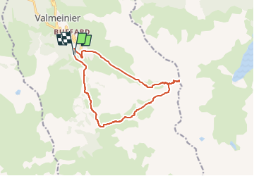
![](/images/other/stat-length.png)
![Tocht Stappen Valmeinier - 2024-07-17_18h03m17_2024-07-17_1716151883_GPX Download_ Boucle Croix des Déserts – Lac de la Roche Noire au départ de Valmeinier - Photo](https://media.geolcdn.com/t/1900/400/ext.pjpeg?maxdim=2&url=https%3A%2F%2Fstatic1.geolcdn.com%2Fsiteimages%2Fupload%2Ffiles%2F1553511878bg_sport_marche.png)
2024-07-17_18h03m17_2024-07-17_1716151883_GPX Download_ Boucle Croix des Déserts – Lac de la Roche Noire au départ de Valmeinier
Maryma
Gebruiker
![Lengte](/images/other/stat-length.png)
![Max. hoogte](https://static1.geolcdn.com/siteimages/upload/files/1508320355ic_sort_altitude_max_24dp.png)
![Positief hoogteverschil](https://static1.geolcdn.com/siteimages/upload/files/1508320355ic_sort_den_pos_24dp.png)
![Km-Effort](/images/other/stat-length.png)
![Min. hoogte](https://static1.geolcdn.com/siteimages/upload/files/1508320355ic_sort_altitude_min_24dp.png)
![Negatief hoogteverschil](https://static1.geolcdn.com/siteimages/upload/files/1508320355ic_sort_den_neg_24dp.png)
![Boucle](https://static1.geolcdn.com/siteimages/upload/files/16400158638029165_repeat_loop_refresh_sync_direction_icon.png)
![Stappen](https://static1.geolcdn.com/sitytour/trail-icons/101.png)
6h16
Moeilijkheid : Moeilijk
![Scan deze QR-code om de tocht te openen in de SityTrail-applicatie](https://capi.geolives.com/qq0zvz2zws4bq2lad0pu/sitytour/trails/4125382/qr.png?size=200)
Gratisgps-wandelapplicatie
Over ons
Tocht Stappen van 13,5 km beschikbaar op Auvergne-Rhône-Alpes, Savoie, Valmeinier. Deze tocht wordt voorgesteld door Maryma.
Beschrijving
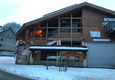
Départ à partir du parking des Déserts (Valmeinier 1800)
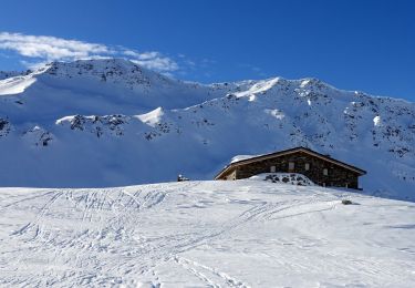
Un parcours qui se fait tranquillement ; une montée progressive, une descente sans difficulté.
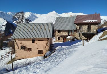
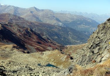
Traversée de hameaux tantôt habités, tantôt en ruines pour rejoindre le GRP du Tour du Mont Thabor. Présence de troupeaux. La roche noire donne la couleur au lac éponyme. Déjà là, un magnifique panorama, redoublé au col des Marches!
Le redescente le long du ruisseau du col des Marches est un bonheur des sens!
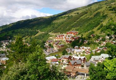
Traversée de la station Valmeinier 1800 pour retourner au parking des Déserts.
Plaatsbepaling
Opmerkingen
Wandeltochten in de omgeving
![Tocht Stappen Valloire - Tour de Valloire - Photo](https://media.geolcdn.com/t/375/260/ext.jpg?maxdim=2&url=https%3A%2F%2Fservices.sitytrail.com%2FGeolivesWS%2FDownloadMedia.ashx%3FTrailID%3D336767%26Media%3Dfix__20140813165712.jpg)
![Stappen Stappen](https://static1.geolcdn.com/sitytour/trail-icons/101.png)
Stappen
![](/images/other/stat-length.png)
![](https://static1.geolcdn.com/siteimages/upload/files/16400158638029165_repeat_loop_refresh_sync_direction_icon.png)
![Tocht Stappen Valloire - valloire à poingt ravier - Photo](https://media.geolcdn.com/t/375/260/ext.jpg?maxdim=2&url=https%3A%2F%2Fservices.sitytrail.com%2FGeolivesWS%2FDownloadMedia.ashx%3FTrailID%3D139009%26Media%3D20120714170941.jpeg)
![Stappen Stappen](https://static1.geolcdn.com/sitytour/trail-icons/101.png)
Stappen
![](/images/other/stat-length.png)
![](https://static1.geolcdn.com/siteimages/upload/files/16400158638029165_repeat_loop_refresh_sync_direction_icon.png)
![Tocht Stappen Saint-Michel-de-Maurienne - Le Thyl, pré Bérard - Photo](https://media.geolcdn.com/t/375/260/fc503a96-c499-4a4d-86da-0ca15e3c56c8.jpg&format=jpg&maxdim=2)
![Stappen Stappen](https://static1.geolcdn.com/sitytour/trail-icons/101.png)
Stappen
![](/images/other/stat-length.png)
![](https://static1.geolcdn.com/siteimages/upload/files/16400158638029165_repeat_loop_refresh_sync_direction_icon.png)
![Tocht Ski randonnée Valmeinier - la roche du lac, le col des marches et remonter en bas de l'arête de Petit Fourchon - Photo](https://media.geolcdn.com/t/375/260/2c1cd63c-1529-49ee-9858-ec4bc64019bc.jpg&format=jpg&maxdim=2)
![Ski randonnée Ski randonnée](https://static1.geolcdn.com/sitytour/trail-icons/503.png)
Ski randonnée
![](/images/other/stat-length.png)
![](https://static1.geolcdn.com/siteimages/upload/files/16400158638029165_repeat_loop_refresh_sync_direction_icon.png)
![Tocht Stappen Valmeinier - Valmeinier 1800 Lac Vert - Photo](https://media.geolcdn.com/t/375/260/ext.jpg?maxdim=2&url=https%3A%2F%2Fstatic1.geolcdn.com%2Fsiteimages%2Fupload%2Ffiles%2F1553511878bg_sport_marche.png)
![Stappen Stappen](https://static1.geolcdn.com/sitytour/trail-icons/101.png)
Stappen
![](/images/other/stat-length.png)
![](https://static1.geolcdn.com/siteimages/upload/files/16400158638029165_repeat_loop_refresh_sync_direction_icon.png)
![Tocht Sneeuwschoenen Valloire - Maurienne Valloire le panomarique - Photo](https://media.geolcdn.com/t/375/260/7e18c8dc-1201-44a9-9b7d-7b79e7067d64.jpg&format=jpg&maxdim=2)
![Sneeuwschoenen Sneeuwschoenen](https://static1.geolcdn.com/sitytour/trail-icons/504.png)
Sneeuwschoenen
![](/images/other/stat-length.png)
![](https://static1.geolcdn.com/siteimages/upload/files/16400158638029165_repeat_loop_refresh_sync_direction_icon.png)
![Tocht Stappen Valloire - Valloire - Photo](https://media.geolcdn.com/t/375/260/d0d671da-538a-4fe1-a4de-eca0138f6132.jpg&format=jpg&maxdim=2)
![Stappen Stappen](https://static1.geolcdn.com/sitytour/trail-icons/101.png)
Stappen
![](/images/other/stat-length.png)
![](https://static1.geolcdn.com/siteimages/upload/files/16400158638029165_repeat_loop_refresh_sync_direction_icon.png)
![Sneeuwschoenen Sneeuwschoenen](https://static1.geolcdn.com/sitytour/trail-icons/504.png)
Sneeuwschoenen
![](/images/other/stat-length.png)
![](https://static1.geolcdn.com/siteimages/upload/files/16400158638029165_repeat_loop_refresh_sync_direction_icon.png)
![Stappen Stappen](https://static1.geolcdn.com/sitytour/trail-icons/101.png)
Stappen
![](/images/other/stat-length.png)
![](https://static1.geolcdn.com/siteimages/upload/files/16400158638029165_repeat_loop_refresh_sync_direction_icon.png)