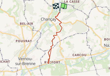
Tocht  Chançay - Rando 3 - Photo
© OpenStreetMap contributors
Lengte
Lengte
12,4 km
Max. hoogte
Max. hoogte
109 m
Positief hoogteverschil
151 m
Km-Effort
Km-Effort  
14,4 km
Min. hoogte
Min. hoogte
50 m
Negatief hoogteverschil
155 m
Boucle
Boucle
Ja
Datum van aanmaak :
2024-07-06 16:55:33.0
Laatste wijziging :
2024-07-06 20:02:06.45

(0 Bericht)


Scan deze QR-code om de tocht te openen in de SityTrail-applicatie

Gratisgps-wandelapplicatie

Logo SityTrail SityTrail

IGN / Geografische instituten

SityTrail uit de App Store downloaden SityTrail uit Google Play downloaden

Logo SityTrail SityTrail World

De wereld gaat voor u open

SityTrail uit de App Store downloaden SityTrail uit Google Play downloaden SityTrail op Huawei AppGallery downloaden

Over ons

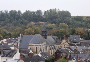
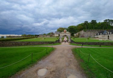
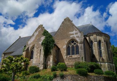
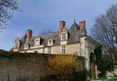
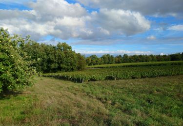
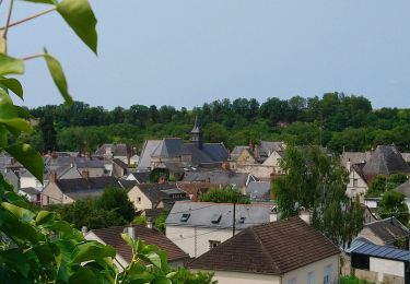
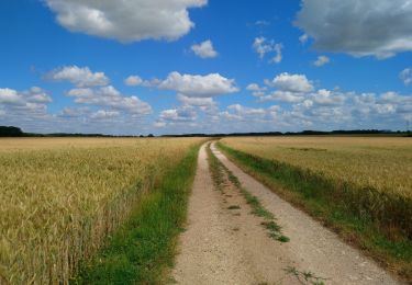
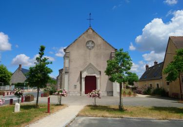
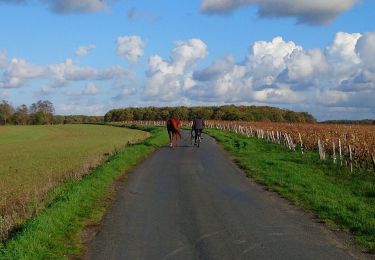
Tocht van 12,4 km beschikbaar op Centre-Val de Loire, Indre-et-Loire, Chançay. Deze tocht wordt voorgesteld door Mathilde Trestard.

Hoogteprofiel

Plaatsbepaling

Land:
France
Regio :
Centre-Val de Loire
Departement/Provincie :
Indre-et-Loire
Gemeente :
Chançay
Locatie:
Unknown
Vertrek:(Dec)
Vertrek:(UTM)
340703 ; 5258111 (31T) N.

Wandeltochten in de omgeving

Tocht Stappen Reugny - Reugny - Zig zag Valmer - 18.5km 315m 4h05 - 2024 05 02 - Photo
Stappen
GUIDE
Orcal37

Stappen

Medium
Reugny, Centre-Val de Loire, Indre-et-Loire, France
18,5 km | 23 km-effort
4h 5min
Ja
Tocht Stappen Chançay - Chançay - Zig zag Reugny GR655ouest - 20.3km 380m 4h40 (40mn) - 2024 04 28 - Photo
Stappen
GUIDE
Orcal37

Stappen

Medium
Chançay, Centre-Val de Loire, Indre-et-Loire, France
20 km | 25 km-effort
4h 40min
Ja
Tocht Stappen Noizay - Noizay - Zig zag autour des Coteaux à l'est de Noizay - 21.3km 370m 5h00 (40mn) - 2024 03 20 - Photo
Stappen
GUIDE
Orcal37

Stappen

Medium
Noizay, Centre-Val de Loire, Indre-et-Loire, France
21 km | 26 km-effort
5h 0min
Ja
Tocht Stappen Chançay - Chançay - Vaux et le Bois de Chançay - 8.7km 150m 2h05 - 2023 09 19 - Photo
Stappen
GUIDE
Orcal37

Stappen

Gemakkelijk
Chançay, Centre-Val de Loire, Indre-et-Loire, France
8,7 km | 10,7 km-effort
2h 5min
Ja
Tocht Stappen Vernou-sur-Brenne - Vernou-sur-Brenne - Variante Sentier Vignes et Patrimoine - 10.9km 140m 2h30 (25mn) - 2023 06 28 - Photo
Stappen
GUIDE
Orcal37

Stappen

Gemakkelijk
Vernou-sur-Brenne, Centre-Val de Loire, Indre-et-Loire, France
10,9 km | 12,8 km-effort
2h 30min
Ja
Tocht Stappen Reugny - Reugny - Château de la Vallière - 13.2km 115m 3h00 - 2023 06 11 - Photo
Stappen
GUIDE
Orcal37

Stappen

Moeilijk
Reugny, Centre-Val de Loire, Indre-et-Loire, France
13,2 km | 14,7 km-effort
3h 21min
Ja
Tocht Stappen Montreuil-en-Touraine - Montreuil-en-Touraine - 11.7km 80m 2h55 (25mn) - 2023 06 11 - Photo
Stappen
GUIDE
Orcal37

Stappen

Gemakkelijk
Montreuil-en-Touraine, Centre-Val de Loire, Indre-et-Loire, France
11,7 km | 12,7 km-effort
2h 55min
Ja
Tocht Stappen Noizay - Noizay - Carcou Vernou via PRs Chançay - 24.7km 290m 5h20 (30mn) - 2022 11 19 - Photo
Stappen
GUIDE
Orcal37

Stappen

Gemakkelijk
Noizay, Centre-Val de Loire, Indre-et-Loire, France
25 km | 29 km-effort
5h 20min
Ja
Tocht Stappen Vernou-sur-Brenne - Vaugondy Vernou - Reugny - 24.9km 315m 5h30 (30mn) - 2022 11 13 - Photo
Stappen
GUIDE
Orcal37

Stappen

Medium
Vernou-sur-Brenne, Centre-Val de Loire, Indre-et-Loire, France
25 km | 29 km-effort
5h 30min
Ja


Sluiten
Mijn abonnementen