![](/images/other/stat-length.png)
![Tocht Stappen Bellême - de belleme a l'etang de la herse - Photo](https://media.geolcdn.com/t/1900/400/cf5fb921-4c5a-49a3-9ce7-3714cc541daf.jpg&format=pjpeg&maxdim=2)
de belleme a l'etang de la herse
darkpapa
Gebruiker
![Lengte](/images/other/stat-length.png)
Lengte
11 km
![Max. hoogte](https://static1.geolcdn.com/siteimages/upload/files/1508320355ic_sort_altitude_max_24dp.png)
Max. hoogte
257 m
![Positief hoogteverschil](https://static1.geolcdn.com/siteimages/upload/files/1508320355ic_sort_den_pos_24dp.png)
Positief hoogteverschil
219 m
![Km-Effort](/images/other/stat-length.png)
Km-Effort
13,9 km
![Min. hoogte](https://static1.geolcdn.com/siteimages/upload/files/1508320355ic_sort_altitude_min_24dp.png)
Min. hoogte
164 m
![Negatief hoogteverschil](https://static1.geolcdn.com/siteimages/upload/files/1508320355ic_sort_den_neg_24dp.png)
Negatief hoogteverschil
219 m
![Boucle](https://static1.geolcdn.com/siteimages/upload/files/16400158638029165_repeat_loop_refresh_sync_direction_icon.png)
Boucle
Ja
Datum van aanmaak :
2024-06-25 12:34:02.376
Laatste wijziging :
2025-01-23 09:30:28.996
![Stappen](https://static1.geolcdn.com/sitytour/trail-icons/101.png)
3h10
Moeilijkheid : Gemakkelijk
![Scan deze QR-code om de tocht te openen in de SityTrail-applicatie](https://capi.geolives.com/qq0zvz2zws4bq2lad0pu/sitytour/trails/4102758/qr.png?size=200)
Gratisgps-wandelapplicatie
Over ons
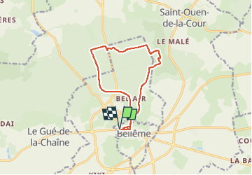
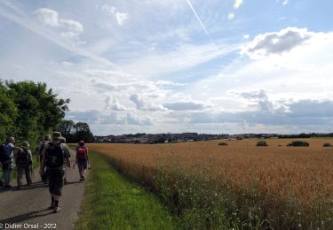
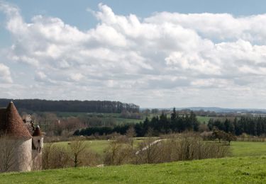
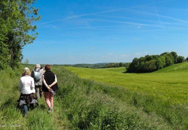
Tocht Stappen van 11 km beschikbaar op Normandië, Orne, Bellême. Deze tocht wordt voorgesteld door darkpapa.
Beschrijving
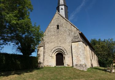
départ et retour place général Leclerc notre point de depart etant le restaurant la dinette gourmande
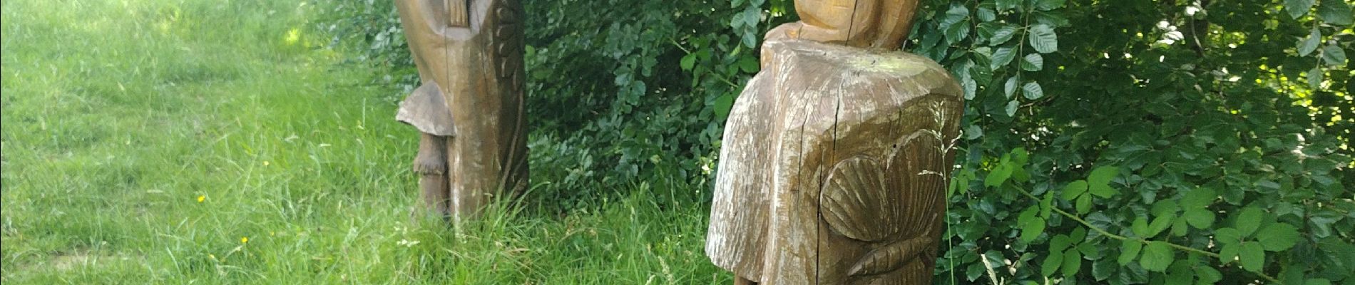
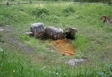
a voir au grès du parcours les sculptures bois
Plaatsbepaling
Land:
France
Regio :
Normandië
Departement/Provincie :
Orne
Gemeente :
Bellême
Locatie:
Unknown
Vertrek:(Dec)
Vertrek:(UTM)
319035 ; 5361072 (31U) N.
Opmerkingen
Wandeltochten in de omgeving
![Tocht Stappen Belforêt-en-Perche - Chêne séculaire - Bellême - Photo](https://media.geolcdn.com/t/375/260/ext.jpg?maxdim=2&url=https%3A%2F%2Fservices.sitytrail.com%2FGeolivesWS%2FDownloadMedia.ashx%3FTrailID%3D111658%26Media%3D7896_2.jpg)
![Stappen Stappen](https://static1.geolcdn.com/sitytour/trail-icons/101.png)
Chêne séculaire - Bellême
Stappen
Medium
(2)
Belforêt-en-Perche,
Normandië,
Orne,
France
![](/images/other/stat-length.png)
9,3 km | 11,8 km-effort
3h 30min
![](https://static1.geolcdn.com/siteimages/upload/files/16400158638029165_repeat_loop_refresh_sync_direction_icon.png)
Ja
![Tocht Mountainbike Bellême - La Bell'Rando 2005 - Photo](https://media.geolcdn.com/t/375/260/ext.jpg?maxdim=2&url=https%3A%2F%2Fservices.sitytrail.com%2FGeolivesWS%2FDownloadMedia.ashx%3FTrailID%3D101083%26Media%3D573_2.jpg)
![Mountainbike Mountainbike](https://static1.geolcdn.com/sitytour/trail-icons/202.png)
La Bell'Rando 2005
Mountainbike
Zeer moeilijk
(1)
Bellême,
Normandië,
Orne,
France
![](/images/other/stat-length.png)
50 km | 64 km-effort
3h 15min
![](https://static1.geolcdn.com/siteimages/upload/files/16400158638029165_repeat_loop_refresh_sync_direction_icon.png)
Ja
![Tocht Te voet Saint-Martin-du-Vieux-Bellême - Chêne séculaire - Photo](https://media.geolcdn.com/t/375/260/1e7dc81d-cfa6-49bd-86cc-f4a86c5edf07.jpeg&format=jpg&maxdim=2)
![Te voet Te voet](https://static1.geolcdn.com/sitytour/trail-icons/100.png)
Chêne séculaire
Te voet
Gemakkelijk
Saint-Martin-du-Vieux-Bellême,
Normandië,
Orne,
France
![](/images/other/stat-length.png)
9,2 km | 11,8 km-effort
2h 40min
![](https://static1.geolcdn.com/siteimages/upload/files/16400158638029165_repeat_loop_refresh_sync_direction_icon.png)
Neen
![Tocht Elektrische fiets Bellême - circuit des vallées bellemoises - Photo](https://media.geolcdn.com/t/375/260/8942d37a-44b6-4034-87b6-86b0b9a49d8c.jpg&format=jpg&maxdim=2)
![Elektrische fiets Elektrische fiets](https://static1.geolcdn.com/sitytour/trail-icons/205.png)
circuit des vallées bellemoises
Elektrische fiets
Gemakkelijk
Bellême,
Normandië,
Orne,
France
![](/images/other/stat-length.png)
44 km | 52 km-effort
4h 48min
![](https://static1.geolcdn.com/siteimages/upload/files/16400158638029165_repeat_loop_refresh_sync_direction_icon.png)
Ja
![Tocht Stappen Bellême - Bellême - Mortagne-au-Perche 23 km - Photo](https://media.geolcdn.com/t/375/260/648b0c04-c9f6-4954-a7eb-873b2f717454.jpg&format=jpg&maxdim=2)
![Stappen Stappen](https://static1.geolcdn.com/sitytour/trail-icons/101.png)
Bellême - Mortagne-au-Perche 23 km
Stappen
Zeer moeilijk
Bellême,
Normandië,
Orne,
France
![](/images/other/stat-length.png)
23 km | 27 km-effort
6h 17min
![](https://static1.geolcdn.com/siteimages/upload/files/16400158638029165_repeat_loop_refresh_sync_direction_icon.png)
Neen
![Tocht Stappen Bellême - Bellême - Nocé/Courboyer 17 km - Photo](https://media.geolcdn.com/t/375/260/0a669ee2-665f-435c-8b9c-5b0346d2e0a4.jpg&format=jpg&maxdim=2)
![Stappen Stappen](https://static1.geolcdn.com/sitytour/trail-icons/101.png)
Bellême - Nocé/Courboyer 17 km
Stappen
Gemakkelijk
Bellême,
Normandië,
Orne,
France
![](/images/other/stat-length.png)
16,6 km | 20 km-effort
3h 24min
![](https://static1.geolcdn.com/siteimages/upload/files/16400158638029165_repeat_loop_refresh_sync_direction_icon.png)
Neen
![Tocht Stappen Bellême - Traversées Percheronnes Bellême - Gémages 15,4 Km - Photo](https://media.geolcdn.com/t/375/260/23f7282d-ffa3-4b2e-a94a-5dc4af001232.jpg&format=jpg&maxdim=2)
![Stappen Stappen](https://static1.geolcdn.com/sitytour/trail-icons/101.png)
Traversées Percheronnes Bellême - Gémages 15,4 Km
Stappen
Medium
Bellême,
Normandië,
Orne,
France
![](/images/other/stat-length.png)
15,4 km | 17,6 km-effort
4h 2min
![](https://static1.geolcdn.com/siteimages/upload/files/16400158638029165_repeat_loop_refresh_sync_direction_icon.png)
Neen
![Tocht Stappen Bellême - Bellême - La Perrière 12 km - Photo](https://media.geolcdn.com/t/375/260/b423f935-0a19-479d-aaad-bc5a9bf55dc8.jpg&format=jpg&maxdim=2)
![Stappen Stappen](https://static1.geolcdn.com/sitytour/trail-icons/101.png)
Bellême - La Perrière 12 km
Stappen
Medium
Bellême,
Normandië,
Orne,
France
![](/images/other/stat-length.png)
12,1 km | 15,4 km-effort
3h 20min
![](https://static1.geolcdn.com/siteimages/upload/files/16400158638029165_repeat_loop_refresh_sync_direction_icon.png)
Neen
![Tocht Stappen Bellême - Bellême - Mauves-sur-Huisne 14 km - Photo](https://media.geolcdn.com/t/375/260/bd52a7c3-ac84-428f-b134-e425824892a0.jpg&format=jpg&maxdim=2)
![Stappen Stappen](https://static1.geolcdn.com/sitytour/trail-icons/101.png)
Bellême - Mauves-sur-Huisne 14 km
Stappen
Gemakkelijk
Bellême,
Normandië,
Orne,
France
![](/images/other/stat-length.png)
13,8 km | 16,5 km-effort
5h 40min
![](https://static1.geolcdn.com/siteimages/upload/files/16400158638029165_repeat_loop_refresh_sync_direction_icon.png)
Neen