![](/images/other/stat-length.png)
Sablières (07) - Le Chambon - Le Serre de l'Estelle et la Drobie
Drailloun
Gebruiker
![Lengte](/images/other/stat-length.png)
![Max. hoogte](https://static1.geolcdn.com/siteimages/upload/files/1508320355ic_sort_altitude_max_24dp.png)
![Positief hoogteverschil](https://static1.geolcdn.com/siteimages/upload/files/1508320355ic_sort_den_pos_24dp.png)
![Km-Effort](/images/other/stat-length.png)
![Min. hoogte](https://static1.geolcdn.com/siteimages/upload/files/1508320355ic_sort_altitude_min_24dp.png)
![Negatief hoogteverschil](https://static1.geolcdn.com/siteimages/upload/files/1508320355ic_sort_den_neg_24dp.png)
![Boucle](https://static1.geolcdn.com/siteimages/upload/files/16400158638029165_repeat_loop_refresh_sync_direction_icon.png)
![Stappen](https://static1.geolcdn.com/sitytour/trail-icons/101.png)
4h33
Moeilijkheid : Moeilijk
![Scan deze QR-code om de tocht te openen in de SityTrail-applicatie](https://capi.geolives.com/qq0zvz2zws4bq2lad0pu/sitytour/trails/408922/qr.png?size=200)
Gratisgps-wandelapplicatie
Over ons
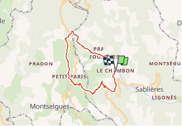
Tocht Stappen van 12,8 km beschikbaar op Auvergne-Rhône-Alpes, Ardèche, Sablières. Deze tocht wordt voorgesteld door Drailloun.
Beschrijving
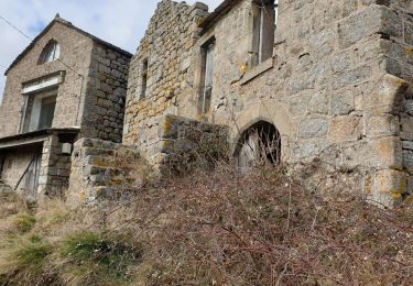
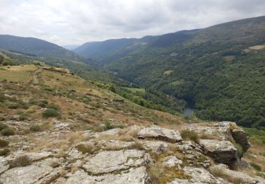
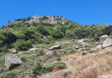
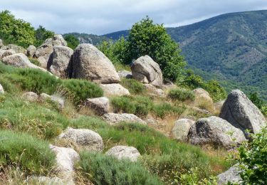
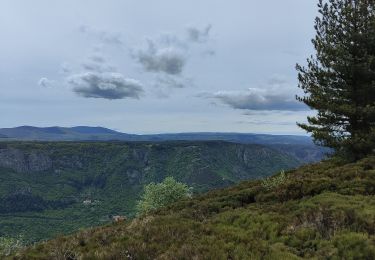
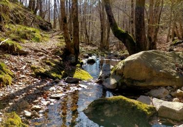
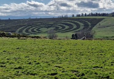
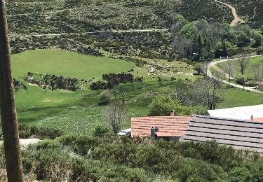
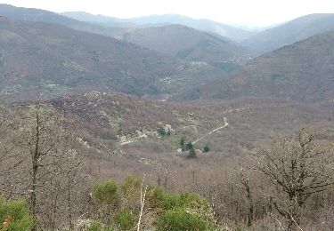
Départ du Chambon, au niveau du panneau du hameau (2 places de voitures au bord de la route). Remonter légèrement la route pour prendre à gauche une petite calade (balisage sur le muret). Passer au dessus de Vialaret. Le Martouret - Monter vers les crêtes par un ancien chemin muletier jusqu'à la Borie de Bousquet - La Fouette - Traverser la D4 - On va suivre le GR4 par le Serre de l'Estelle jusqu'à La Narce - On longe la Drobie par un sentier rocheux par endroits - Fourches - On contourne le camping pour revenir au Chambon. Possibilité de parking au camping de la Drobie (nous ne l'avons pas utilisé)
Plaatsbepaling
Opmerkingen
Wandeltochten in de omgeving
![Tocht Stappen Montselgues - Montselgues - Les chaos par les crètes - Photo](https://media.geolcdn.com/t/375/260/0482280d-355b-4aac-a4d8-303673dcfa53.jpg&format=jpg&maxdim=2)
![Stappen Stappen](https://static1.geolcdn.com/sitytour/trail-icons/101.png)
Stappen
![](/images/other/stat-length.png)
![](https://static1.geolcdn.com/siteimages/upload/files/16400158638029165_repeat_loop_refresh_sync_direction_icon.png)
![Tocht Stappen Montselgues - Etape2 Cévenne ardéchoise 17km - Photo](https://media.geolcdn.com/t/375/260/969831b8-bbd1-4f86-b20a-8870f6dd33b2.jpg&format=jpg&maxdim=2)
![Stappen Stappen](https://static1.geolcdn.com/sitytour/trail-icons/101.png)
Stappen
![](/images/other/stat-length.png)
![](https://static1.geolcdn.com/siteimages/upload/files/16400158638029165_repeat_loop_refresh_sync_direction_icon.png)
![Tocht Stappen Sablières - Pont Du Mas - Boules de Gargantua 14km - Photo](https://media.geolcdn.com/t/375/260/5cb15b8f-2fd3-4c0f-8366-db0eb66204b6.jpg&format=jpg&maxdim=2)
![Stappen Stappen](https://static1.geolcdn.com/sitytour/trail-icons/101.png)
Stappen
![](/images/other/stat-length.png)
![](https://static1.geolcdn.com/siteimages/upload/files/16400158638029165_repeat_loop_refresh_sync_direction_icon.png)
![Tocht Stappen Sablières - Pont du Mas - Boules de Gargantua - Photo](https://media.geolcdn.com/t/375/260/69b54ccf-6786-4aa1-9bd6-872344d5a4d9.jpg&format=jpg&maxdim=2)
![Stappen Stappen](https://static1.geolcdn.com/sitytour/trail-icons/101.png)
Stappen
![](/images/other/stat-length.png)
![](https://static1.geolcdn.com/siteimages/upload/files/16400158638029165_repeat_loop_refresh_sync_direction_icon.png)
![Tocht Stappen Montselgues - plateau m'ont selgue - Photo](https://media.geolcdn.com/t/375/260/131f287d-c4a6-4584-abf8-cdb69cc9b0a5.jpg&format=jpg&maxdim=2)
![Stappen Stappen](https://static1.geolcdn.com/sitytour/trail-icons/101.png)
Stappen
![](/images/other/stat-length.png)
![](https://static1.geolcdn.com/siteimages/upload/files/16400158638029165_repeat_loop_refresh_sync_direction_icon.png)
![Tocht Stappen Montselgues - 07-TMA - Montselgues-Loubaresse-St-Laurent-les-B - Photo](https://media.geolcdn.com/t/375/260/7c5a2d3c-7305-4552-bc39-d29471d5cd3b.jpg&format=jpg&maxdim=2)
![Stappen Stappen](https://static1.geolcdn.com/sitytour/trail-icons/101.png)
Stappen
![](/images/other/stat-length.png)
![](https://static1.geolcdn.com/siteimages/upload/files/16400158638029165_repeat_loop_refresh_sync_direction_icon.png)
![Tocht Stappen Montselgues - 20240415sail - Photo](https://media.geolcdn.com/t/375/260/504fb192-5dc2-4ffb-8841-3b85986e654c.jpg&format=jpg&maxdim=2)
![Stappen Stappen](https://static1.geolcdn.com/sitytour/trail-icons/101.png)
Stappen
![](/images/other/stat-length.png)
![](https://static1.geolcdn.com/siteimages/upload/files/16400158638029165_repeat_loop_refresh_sync_direction_icon.png)
![Tocht Stappen Montselgues - Montselgues 25 mai 2017 - Photo](https://media.geolcdn.com/t/375/260/ext.jpg?maxdim=2&url=https%3A%2F%2Fservices.sitytrail.com%2FGeolivesWS%2FDownloadMedia.ashx%3FTrailID%3D753378%26Media%3D20170515134919.jpg)
![Stappen Stappen](https://static1.geolcdn.com/sitytour/trail-icons/101.png)
Stappen
![](/images/other/stat-length.png)
![](https://static1.geolcdn.com/siteimages/upload/files/16400158638029165_repeat_loop_refresh_sync_direction_icon.png)
![Tocht Stappen Sablières - tce Boules de Gargantua 27-03-17 - Photo](https://media.geolcdn.com/t/375/260/ext.jpg?maxdim=2&url=https%3A%2F%2Fservices.sitytrail.com%2FGeolivesWS%2FDownloadMedia.ashx%3FTrailID%3D721870%26Media%3Dfix__20170327123501.jpg)
![Stappen Stappen](https://static1.geolcdn.com/sitytour/trail-icons/101.png)
Stappen
![](/images/other/stat-length.png)
![](https://static1.geolcdn.com/siteimages/upload/files/16400158638029165_repeat_loop_refresh_sync_direction_icon.png)