![](/images/other/stat-length.png)
![Tocht Stappen Semblançay - Semblançay - Circuit les Etangs - Photo](https://media.geolcdn.com/t/1900/400/f8a0420d-6268-4ce6-9de6-9ad2d70c7497.jpg&format=pjpeg&maxdim=2)
Semblançay - Circuit les Etangs
guydu41
Gebruiker
![Lengte](/images/other/stat-length.png)
Lengte
19,7 km
![Max. hoogte](https://static1.geolcdn.com/siteimages/upload/files/1508320355ic_sort_altitude_max_24dp.png)
Max. hoogte
135 m
![Positief hoogteverschil](https://static1.geolcdn.com/siteimages/upload/files/1508320355ic_sort_den_pos_24dp.png)
Positief hoogteverschil
149 m
![Km-Effort](/images/other/stat-length.png)
Km-Effort
22 km
![Min. hoogte](https://static1.geolcdn.com/siteimages/upload/files/1508320355ic_sort_altitude_min_24dp.png)
Min. hoogte
100 m
![Negatief hoogteverschil](https://static1.geolcdn.com/siteimages/upload/files/1508320355ic_sort_den_neg_24dp.png)
Negatief hoogteverschil
149 m
![Boucle](https://static1.geolcdn.com/siteimages/upload/files/16400158638029165_repeat_loop_refresh_sync_direction_icon.png)
Boucle
Ja
Datum van aanmaak :
2024-06-12 07:34:06.366
Laatste wijziging :
2024-06-12 18:35:14.491
![Stappen](https://static1.geolcdn.com/sitytour/trail-icons/101.png)
4h55
Moeilijkheid : Medium
![Scan deze QR-code om de tocht te openen in de SityTrail-applicatie](https://capi.geolives.com/qq0zvz2zws4bq2lad0pu/sitytour/trails/4088282/qr.png?size=200)
Gratisgps-wandelapplicatie
Over ons
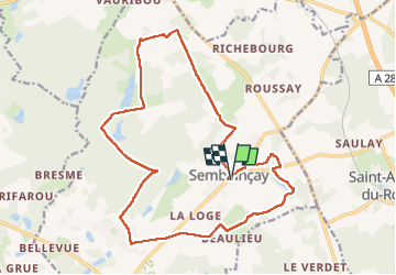
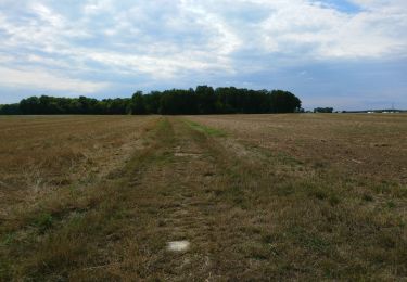
Tocht Stappen van 19,7 km beschikbaar op Centre-Val de Loire, Indre-et-Loire, Semblançay. Deze tocht wordt voorgesteld door guydu41.
Beschrijving
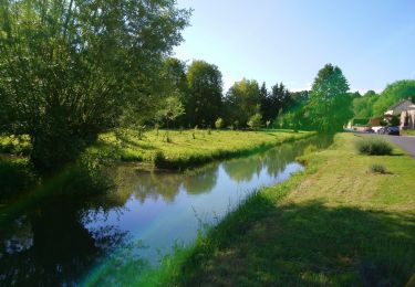
Randonnée au départ du parking Rue Jeanne de Russé à Semblançay 37360.
Ce circuit PR est balisé jaune.
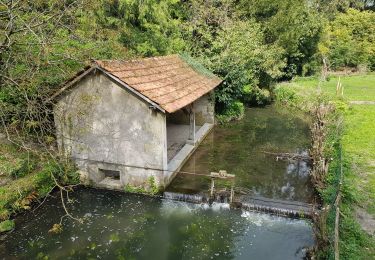
La fin du parcours quitte le PR pour voir quelques cavités dans une paroi rocheuse.
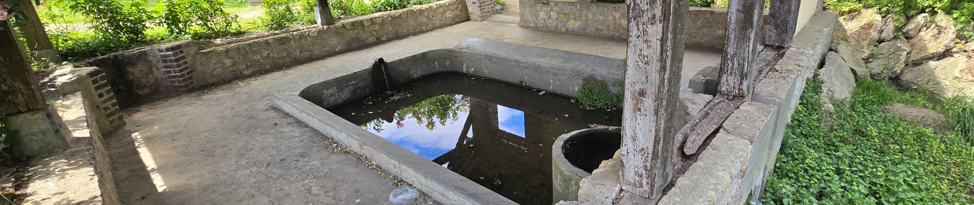
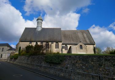
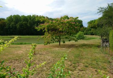
Plaatsbepaling
Land:
France
Regio :
Centre-Val de Loire
Departement/Provincie :
Indre-et-Loire
Gemeente :
Semblançay
Locatie:
Unknown
Vertrek:(Dec)
Vertrek:(UTM)
317684 ; 5263335 (31T) N.
Opmerkingen
Wandeltochten in de omgeving
![Tocht Stappen Saint-Antoine-du-Rocher - Saint-Antoine-du-Rocher - Rouziers-de-Touraine - 21.4km 165m 4h55 - 2022 04 03 - Photo](https://media.geolcdn.com/t/375/260/8b36e295-8247-4873-9751-f344e6172f47.jpg&format=jpg&maxdim=2)
![Stappen Stappen](https://static1.geolcdn.com/sitytour/trail-icons/101.png)
Saint-Antoine-du-Rocher - Rouziers-de-Touraine - 21.4km 165m 4h55 - 2022 04 03
Stappen
Gemakkelijk
Saint-Antoine-du-Rocher,
Centre-Val de Loire,
Indre-et-Loire,
France
![](/images/other/stat-length.png)
21 km | 24 km-effort
4h 55min
![](https://static1.geolcdn.com/siteimages/upload/files/16400158638029165_repeat_loop_refresh_sync_direction_icon.png)
Ja
![Tocht Stappen Charentilly - Charentilly - PR la Choisillette avec variante - 9km 100m 1h50 - 2020 11 28 - Photo](https://media.geolcdn.com/t/375/260/c1b744c0-bc06-4fe5-a4fc-24f9728adfe5.jpg&format=jpg&maxdim=2)
![Stappen Stappen](https://static1.geolcdn.com/sitytour/trail-icons/101.png)
Charentilly - PR la Choisillette avec variante - 9km 100m 1h50 - 2020 11 28
Stappen
Gemakkelijk
Charentilly,
Centre-Val de Loire,
Indre-et-Loire,
France
![](/images/other/stat-length.png)
9 km | 10,4 km-effort
1h 50min
![](https://static1.geolcdn.com/siteimages/upload/files/16400158638029165_repeat_loop_refresh_sync_direction_icon.png)
Ja
![Tocht Stappen Charentilly - Charentilly - Circuit 2 avec variante - 14.8km 135m 3h05 - 2020 08 15 - Photo](https://media.geolcdn.com/t/375/260/3d2c51a1-3af7-44d8-bc0c-6a33566d6f6e.jpg&format=jpg&maxdim=2)
![Stappen Stappen](https://static1.geolcdn.com/sitytour/trail-icons/101.png)
Charentilly - Circuit 2 avec variante - 14.8km 135m 3h05 - 2020 08 15
Stappen
Gemakkelijk
Charentilly,
Centre-Val de Loire,
Indre-et-Loire,
France
![](/images/other/stat-length.png)
14,8 km | 16,6 km-effort
3h 5min
![](https://static1.geolcdn.com/siteimages/upload/files/16400158638029165_repeat_loop_refresh_sync_direction_icon.png)
Ja
![Tocht Stappen Saint-Antoine-du-Rocher - Saint-Antoine-du-Rocher - circuit 2 - 9.2km 95m 2h05 - 2019 06 18 - Photo](https://media.geolcdn.com/t/375/260/04077eac-cbda-460d-bd61-597d1f82138d.jpg&format=jpg&maxdim=2)
![Stappen Stappen](https://static1.geolcdn.com/sitytour/trail-icons/101.png)
Saint-Antoine-du-Rocher - circuit 2 - 9.2km 95m 2h05 - 2019 06 18
Stappen
Heel gemakkelijk
Saint-Antoine-du-Rocher,
Centre-Val de Loire,
Indre-et-Loire,
France
![](/images/other/stat-length.png)
9,2 km | 10,5 km-effort
2h 5min
![](https://static1.geolcdn.com/siteimages/upload/files/16400158638029165_repeat_loop_refresh_sync_direction_icon.png)
Ja
![Tocht Stappen Semblançay - Semblancay - 19km 4h10 40mn - 2016 05 05 - Photo](https://media.geolcdn.com/t/375/260/aaec9c58-50fc-4965-b415-03cf161ec346.jpg&format=jpg&maxdim=2)
![Stappen Stappen](https://static1.geolcdn.com/sitytour/trail-icons/101.png)
Semblancay - 19km 4h10 40mn - 2016 05 05
Stappen
Gemakkelijk
Semblançay,
Centre-Val de Loire,
Indre-et-Loire,
France
![](/images/other/stat-length.png)
19,1 km | 21 km-effort
4h 40min
![](https://static1.geolcdn.com/siteimages/upload/files/16400158638029165_repeat_loop_refresh_sync_direction_icon.png)
Ja
![Tocht Stappen Charentilly - 29.04.21-10km-Charentilly - Photo](https://media.geolcdn.com/t/375/260/44d8eebe-e409-4304-a661-f8639518002a.jpg&format=jpg&maxdim=2)
![Stappen Stappen](https://static1.geolcdn.com/sitytour/trail-icons/101.png)
29.04.21-10km-Charentilly
Stappen
Medium
Charentilly,
Centre-Val de Loire,
Indre-et-Loire,
France
![](/images/other/stat-length.png)
13,8 km | 15,6 km-effort
2h 28min
![](https://static1.geolcdn.com/siteimages/upload/files/16400158638029165_repeat_loop_refresh_sync_direction_icon.png)
Neen
![Tocht Stappen Semblançay - Semblançay -13.40km - 11 Avril 2019 - Photo](https://media.geolcdn.com/t/375/260/7fcb576c-1848-403a-98d1-d730ca9c0e31.jpg&format=jpg&maxdim=2)
![Stappen Stappen](https://static1.geolcdn.com/sitytour/trail-icons/101.png)
Semblançay -13.40km - 11 Avril 2019
Stappen
Medium
Semblançay,
Centre-Val de Loire,
Indre-et-Loire,
France
![](/images/other/stat-length.png)
13,4 km | 14,9 km-effort
3h 14min
![](https://static1.geolcdn.com/siteimages/upload/files/16400158638029165_repeat_loop_refresh_sync_direction_icon.png)
Ja
![Tocht Stappen Charentilly - Charentilly le 13-09-2012 - Photo](https://media.geolcdn.com/t/375/260/ext.jpg?maxdim=2&url=https%3A%2F%2Fservices.sitytrail.com%2FGeolivesWS%2FDownloadMedia.ashx%3FTrailID%3D153350%26Media%3D20120913115056.jpeg)
![Stappen Stappen](https://static1.geolcdn.com/sitytour/trail-icons/101.png)
Charentilly le 13-09-2012
Stappen
Medium
Charentilly,
Centre-Val de Loire,
Indre-et-Loire,
France
![](/images/other/stat-length.png)
14,2 km | 16,1 km-effort
3h 35min
![](https://static1.geolcdn.com/siteimages/upload/files/16400158638029165_repeat_loop_refresh_sync_direction_icon.png)
Ja
![Tocht Elektrische fiets Saint-Antoine-du-Rocher - 23.06.2024.47km-Saint Antoine du Rocher au bord de Loire à Saint Antoine du Rocher - Photo](https://media.geolcdn.com/t/375/260/ext.jpg?maxdim=2&url=https%3A%2F%2Fstatic1.geolcdn.com%2Fsiteimages%2Fupload%2Ffiles%2F1524743154velo.jpg)
![Elektrische fiets Elektrische fiets](https://static1.geolcdn.com/sitytour/trail-icons/205.png)
23.06.2024.47km-Saint Antoine du Rocher au bord de Loire à Saint Antoine du R...
Elektrische fiets
Medium
Saint-Antoine-du-Rocher,
Centre-Val de Loire,
Indre-et-Loire,
France
![](/images/other/stat-length.png)
47 km | 53 km-effort
2h 34min
![](https://static1.geolcdn.com/siteimages/upload/files/16400158638029165_repeat_loop_refresh_sync_direction_icon.png)
Ja