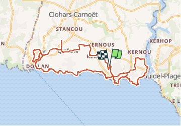
![](/images/other/stat-length.png)
![Tocht Stappen Clohars-Carnoët - Séjour 2024 GR 34 Le Pouldu camping Boucle Doelan - Photo](https://media.geolcdn.com/t/1900/400/ext.pjpeg?maxdim=2&url=https%3A%2F%2Fstatic1.geolcdn.com%2Fsiteimages%2Fupload%2Ffiles%2F1553511878bg_sport_marche.png)
Séjour 2024 GR 34 Le Pouldu camping Boucle Doelan
chessyca
Gebruiker GUIDE
![Lengte](/images/other/stat-length.png)
Lengte
24 km
![Max. hoogte](https://static1.geolcdn.com/siteimages/upload/files/1508320355ic_sort_altitude_max_24dp.png)
Max. hoogte
51 m
![Positief hoogteverschil](https://static1.geolcdn.com/siteimages/upload/files/1508320355ic_sort_den_pos_24dp.png)
Positief hoogteverschil
254 m
![Km-Effort](/images/other/stat-length.png)
Km-Effort
27 km
![Min. hoogte](https://static1.geolcdn.com/siteimages/upload/files/1508320355ic_sort_altitude_min_24dp.png)
Min. hoogte
0 m
![Negatief hoogteverschil](https://static1.geolcdn.com/siteimages/upload/files/1508320355ic_sort_den_neg_24dp.png)
Negatief hoogteverschil
254 m
![Boucle](https://static1.geolcdn.com/siteimages/upload/files/16400158638029165_repeat_loop_refresh_sync_direction_icon.png)
Boucle
Ja
Datum van aanmaak :
2024-06-07 06:24:11.34
Laatste wijziging :
2024-06-09 15:39:32.915
![Stappen](https://static1.geolcdn.com/sitytour/trail-icons/101.png)
6h11
Moeilijkheid : Heel gemakkelijk
![Scan deze QR-code om de tocht te openen in de SityTrail-applicatie](https://capi.geolives.com/qq0zvz2zws4bq2lad0pu/sitytour/trails/4082931/qr.png?size=200)
Gratisgps-wandelapplicatie
Over ons
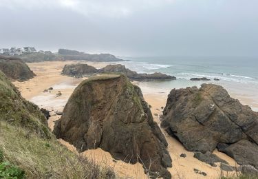
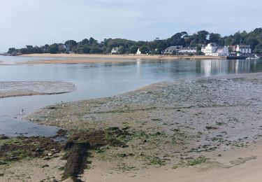
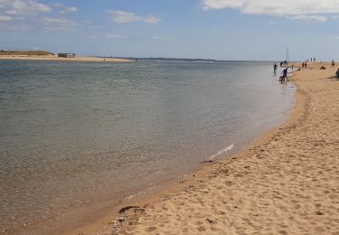
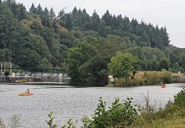
Tocht Stappen van 24 km beschikbaar op Bretagne, Finistère, Clohars-Carnoët. Deze tocht wordt voorgesteld door chessyca.
Beschrijving
Départ du camping du kérou et boucle sur le 34
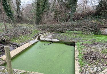
Attention dans la partie terre, de nombreux passages en propriété privée nécessitent un accord des propriétaires.
Les cartes ffr sont à mettre à jour
Plaatsbepaling
Land:
France
Regio :
Bretagne
Departement/Provincie :
Finistère
Gemeente :
Clohars-Carnoët
Locatie:
Unknown
Vertrek:(Dec)
Vertrek:(UTM)
458225 ; 5291111 (30T) N.
Opmerkingen
Wandeltochten in de omgeving
![Tocht Stappen Clohars-Carnoët - Le Pouldu - Photo](https://media.geolcdn.com/t/375/260/1a38db66-97d5-4b5b-9eac-2a7eff6538ed.jpg&format=jpg&maxdim=2)
![Stappen Stappen](https://static1.geolcdn.com/sitytour/trail-icons/101.png)
![Tocht Stappen Guidel - PR_56_Guidel_CA_03_Circuit3a_Autour-De-L-Etang-De-Lannenec_20240428 - Photo](https://media.geolcdn.com/t/375/260/6e0f082b-d9fc-4937-a2ef-b1992f251e56.jpg&format=jpg&maxdim=2)
![Stappen Stappen](https://static1.geolcdn.com/sitytour/trail-icons/101.png)
PR_56_Guidel_CA_03_Circuit3a_Autour-De-L-Etang-De-Lannenec_20240428
Stappen
Gemakkelijk
Guidel,
Bretagne,
Morbihan,
France
![](/images/other/stat-length.png)
10,2 km | 11,7 km-effort
2h 39min
![](https://static1.geolcdn.com/siteimages/upload/files/16400158638029165_repeat_loop_refresh_sync_direction_icon.png)
Neen
![Tocht Stappen Guidel - Guidel plage 7,6 km - Photo](https://media.geolcdn.com/t/375/260/ea313e26-3f1c-4186-89bc-ac39bff3fa8a.jpg&format=jpg&maxdim=2)
![Stappen Stappen](https://static1.geolcdn.com/sitytour/trail-icons/101.png)
Guidel plage 7,6 km
Stappen
Gemakkelijk
Guidel,
Bretagne,
Morbihan,
France
![](/images/other/stat-length.png)
7,6 km | 8,5 km-effort
2h 11min
![](https://static1.geolcdn.com/siteimages/upload/files/16400158638029165_repeat_loop_refresh_sync_direction_icon.png)
Ja
![Tocht Stappen Clohars-Carnoët - Pouldu port peintres 6,3 km - Photo](https://media.geolcdn.com/t/375/260/d878685e-3577-4835-a424-00b6066e1383.jpg&format=jpg&maxdim=2)
![Stappen Stappen](https://static1.geolcdn.com/sitytour/trail-icons/101.png)
Pouldu port peintres 6,3 km
Stappen
Gemakkelijk
Clohars-Carnoët,
Bretagne,
Finistère,
France
![](/images/other/stat-length.png)
6,3 km | 7,2 km-effort
2h 12min
![](https://static1.geolcdn.com/siteimages/upload/files/16400158638029165_repeat_loop_refresh_sync_direction_icon.png)
Ja
![Tocht Stappen Clohars-Carnoët - Pouldu Roche Percée et retour 9,5 km - Photo](https://media.geolcdn.com/t/375/260/9c185896-328f-4e1d-8063-56e555ea4d34.jpg&format=jpg&maxdim=2)
![Stappen Stappen](https://static1.geolcdn.com/sitytour/trail-icons/101.png)
Pouldu Roche Percée et retour 9,5 km
Stappen
Medium
Clohars-Carnoët,
Bretagne,
Finistère,
France
![](/images/other/stat-length.png)
9,5 km | 10,7 km-effort
2h 46min
![](https://static1.geolcdn.com/siteimages/upload/files/16400158638029165_repeat_loop_refresh_sync_direction_icon.png)
Ja
![Tocht Stappen Guidel - PR_56_Guidel_BA_02_Circuit3b_Entre-Loch-Et-Laita_20231004 - Photo](https://media.geolcdn.com/t/375/260/c4260127-a5b9-4007-9324-09ddf3ba24ca.jpg&format=jpg&maxdim=2)
![Stappen Stappen](https://static1.geolcdn.com/sitytour/trail-icons/101.png)
PR_56_Guidel_BA_02_Circuit3b_Entre-Loch-Et-Laita_20231004
Stappen
Gemakkelijk
Guidel,
Bretagne,
Morbihan,
France
![](/images/other/stat-length.png)
13,4 km | 15,7 km-effort
3h 34min
![](https://static1.geolcdn.com/siteimages/upload/files/16400158638029165_repeat_loop_refresh_sync_direction_icon.png)
Ja
![Tocht Stappen Guidel - laita - Photo](https://media.geolcdn.com/t/375/260/d2fc7529-c784-40ff-828a-4079bf6b08e9.jpg&format=jpg&maxdim=2)
![Stappen Stappen](https://static1.geolcdn.com/sitytour/trail-icons/101.png)
![Tocht Elektrische fiets Clohars-Carnoët - Moelans Pontivy par les berges du Blavet - Photo](https://media.geolcdn.com/t/375/260/02b1cea7-157d-417f-bb92-c1bdb0f96c6e.jpg&format=jpg&maxdim=2)
![Elektrische fiets Elektrische fiets](https://static1.geolcdn.com/sitytour/trail-icons/205.png)
Moelans Pontivy par les berges du Blavet
Elektrische fiets
Heel gemakkelijk
Clohars-Carnoët,
Bretagne,
Finistère,
France
![](/images/other/stat-length.png)
81 km | 94 km-effort
4h 43min
![](https://static1.geolcdn.com/siteimages/upload/files/16400158638029165_repeat_loop_refresh_sync_direction_icon.png)
Neen
![Tocht Stappen Guidel - PR_56_Guidel_AA_01_Circuit3b_Autour-Du-Loc'h_20220120 - Photo](https://media.geolcdn.com/t/375/260/d0aa8b77-81ab-4782-b792-dad3ac7c6e42.jpg&format=jpg&maxdim=2)
![Stappen Stappen](https://static1.geolcdn.com/sitytour/trail-icons/101.png)
PR_56_Guidel_AA_01_Circuit3b_Autour-Du-Loc'h_20220120
Stappen
Medium
Guidel,
Bretagne,
Morbihan,
France
![](/images/other/stat-length.png)
9,8 km | 11,2 km-effort
2h 16min
![](https://static1.geolcdn.com/siteimages/upload/files/16400158638029165_repeat_loop_refresh_sync_direction_icon.png)
Ja