


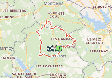

9,4 km | 11,2 km-effort

Marcher en groupe en veillant au respect de chacun et à la bonne humeur.


Gratisgps-wandelapplicatie
 SityTrail
IGN / Geografische instituten
SityTrail World
De wereld gaat voor u open
Tocht Stappen van 12 km beschikbaar op Bourgondië-Franche-Comté, Saône-et-Loire, Les Bizots. Deze tocht wordt voorgesteld door PASSION RANDO.
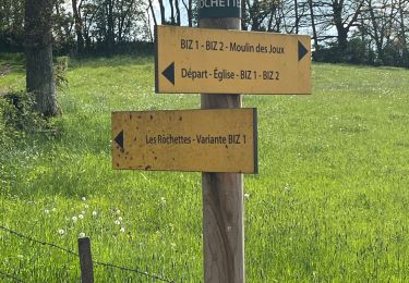
circuit balisé jaune de la CUCM réf : BI72
Stappen

Stappen

sport
Stappen
Stappen

Wegfiets
Stappen
Stappen

Motorfiets