Tocht Stappen Saints-Geosmes - Boucle 18 km incluant Cohons et la source de la Marne - Photo

Boucle 18 km incluant Cohons et la source de la Marne

 chessyca
chessyca

Gebruiker GUIDE

© OpenStreetMap contributors
Lengte
Lengte
18,3 km
Max. hoogte
Max. hoogte
475 m
Positief hoogteverschil
309 m
Km-Effort
Km-Effort  
22 km
Min. hoogte
Min. hoogte
358 m
Negatief hoogteverschil
311 m
Boucle
Boucle
Ja
Datum van aanmaak :
2024-05-17 06:34:54.133
Laatste wijziging :
2024-05-20 08:17:55.827

(0 Bericht)

Stappen
Stappen
3h54
Moeilijkheid : Medium

Scan deze QR-code om de tocht te openen in de SityTrail-applicatie

Gratisgps-wandelapplicatie

Logo SityTrail SityTrail

IGN / Geografische instituten

SityTrail uit de App Store downloaden SityTrail uit Google Play downloaden

Logo SityTrail SityTrail World

De wereld gaat voor u open

SityTrail uit de App Store downloaden SityTrail uit Google Play downloaden SityTrail op Huawei AppGallery downloaden

Over ons

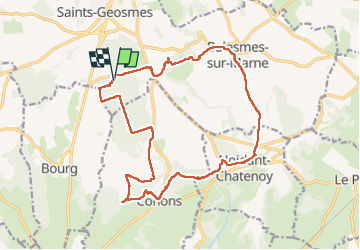
Tocht Stappen van 18,3 km beschikbaar op Grand Est, Haute-Marne, Saints-Geosmes. Deze tocht wordt voorgesteld door chessyca.

Beschrijving

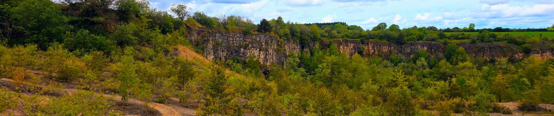
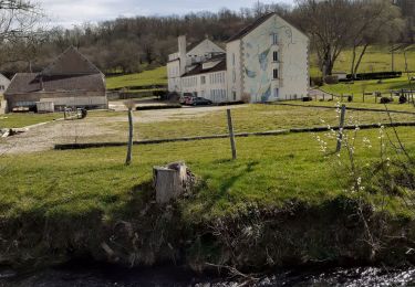
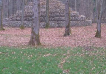
Dernière matinée du séjour en Haute Marne

Hoogteprofiel

Foto's

Plaatsbepaling

Land:
France
Regio :
Grand Est
Departement/Provincie :
Haute-Marne
Gemeente :
Saints-Geosmes
Locatie:
Saints-Geosmes
Vertrek:(Dec)
Vertrek:(UTM)
674493 ; 5298296 (31T) N.

Wandeltochten in de omgeving

Tocht Fiets Langres - Boucle 1 autour de la Voie Verte - Langres - Photo
Fiets
tracegps

Fiets

Medium
(1)
Langres, Grand Est, Haute-Marne, France
23 km | 28 km-effort
1h 15min
Ja
Tocht Stappen Villegusien-le-Lac - Heuilley-cotton - Cohons - Longeau - Photo
Stappen
indianalou

Stappen

Medium
(1)
Villegusien-le-Lac, Grand Est, Haute-Marne, France
17 km | 20 km-effort
4h 0min
Ja
Tocht Fiets Langres - Tour des 4 lacs - Langres - Photo
Fiets
tracegps

Fiets

Moeilijk
Langres, Grand Est, Haute-Marne, France
75 km | 88 km-effort
6h 15min
Ja
Tocht Fiets Langres - Entre Plateau de Langres et Montagne - Photo
Fiets
tracegps

Fiets

Moeilijk
Langres, Grand Est, Haute-Marne, France
115 km | 138 km-effort
4h 0min
Ja
Tocht Noords wandelen Perrancey-les-Vieux-Moulins - domaine de Montauban  - Photo
Noords wandelen
avier

Noords wandelen

Heel gemakkelijk
Perrancey-les-Vieux-Moulins, Grand Est, Haute-Marne, France
31 km | 35 km-effort
2h 25min
Neen
Tocht Stappen Noidant-Chatenoy - source de la marne - Photo
Stappen
richies77

Stappen

Medium
Noidant-Chatenoy, Grand Est, Haute-Marne, France
16 km | 19,8 km-effort
4h 18min
Ja
Tocht Fiets Brennes - Boucle 3 autour de la Voie Verte - Brennes - Photo
Fiets
tracegps

Fiets

Medium
Brennes, Grand Est, Haute-Marne, France
19,6 km | 23 km-effort
1h 30min
Ja
Tocht Fiets Saints-Geosmes - Boucle 2 autour de la Voie Verte - Saints - Geosmes - Photo
Fiets
tracegps

Fiets

Medium
Saints-Geosmes, Grand Est, Haute-Marne, France
17,7 km | 19,9 km-effort
1h 45min
Ja
Tocht Stappen Langres - Sentier Vosges-Pyrénées - de Langres à Noidant le Rocheux - Photo
Stappen
tracegps

Stappen

Moeilijk
Langres, Grand Est, Haute-Marne, France
14,3 km | 18,1 km-effort
3h 30min
Neen


Sluiten
Mijn abonnementen