
13/5/24

Alain28/01
Gebruiker

Lengte
24 km

Max. hoogte
1544 m

Positief hoogteverschil
637 m

Km-Effort
32 km

Min. hoogte
1114 m

Negatief hoogteverschil
636 m
Boucle
Ja
Datum van aanmaak :
2024-05-13 07:22:58.502
Laatste wijziging :
2024-05-14 11:26:00.634
5h09
Moeilijkheid : Zeer moeilijk

Gratisgps-wandelapplicatie
Over ons
Tocht Stappen van 24 km beschikbaar op Occitanië, Lozère, Monts-de-Randon. Deze tocht wordt voorgesteld door Alain28/01.
Beschrijving
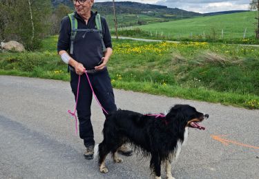
Belle journée à travers, pissenlits, genets en fleurs et forêts d'épicéas.
Notre compagnon du jour Owen nous a suivi sur tout le parcours.
Plaatsbepaling
Land:
France
Regio :
Occitanië
Departement/Provincie :
Lozère
Gemeente :
Monts-de-Randon
Locatie:
Rieutort-de-Randon
Vertrek:(Dec)
Vertrek:(UTM)
538020 ; 4942371 (31T) N.
Opmerkingen
Wandeltochten in de omgeving

Rando du 13/05/2024..Rieutor de Randon..Truc de Fortuneo..Lac de Charpal


Stappen
Moeilijk
Monts-de-Randon,
Occitanië,
Lozère,
France

23 km | 32 km-effort
5h 8min
Ja

Margeride


sport
Heel gemakkelijk
Monts-de-Randon,
Occitanië,
Lozère,
France

24 km | 32 km-effort
Onbekend
Ja

parcours vers lachamp


Mountainbike
Moeilijk
Monts-de-Randon,
Occitanië,
Lozère,
France

65 km | 82 km-effort
4h 30min
Ja

Aumont 85km


Mountainbike
Medium
Monts-de-Randon,
Occitanië,
Lozère,
France

84 km | 108 km-effort
6h 0min
Ja

rieutord- aumont


Andere activiteiten
Heel gemakkelijk
Monts-de-Randon,
Occitanië,
Lozère,
France

22 km | 28 km-effort
Onbekend
Neen

192-Lac_de_Ganivet


Stappen
Heel gemakkelijk
Monts-de-Randon,
Occitanië,
Lozère,
France

10,7 km | 0 m-effort
Onbekend
Ja

coulagnettes1


Stappen
Gemakkelijk
Monts-de-Randon,
Occitanië,
Lozère,
France

10,6 km | 13,9 km-effort
3h 20min
Ja

Tour de Monts-de Randon par la Baraque des Bouviers.


Wegfiets
Zeer moeilijk
Monts-de-Randon,
Occitanië,
Lozère,
France

60 km | 76 km-effort
4h 34min
Ja

SityTrail - Fortunio et Charpal


Te voet
Medium
Monts-de-Randon,
Occitanië,
Lozère,
France

17 km | 24 km-effort
5h 28min
Ja


 SityTrail


